
File:Lower Egypt ancient nomes position map.jpg
Nae heier resolution available.
Lower_Egypt_ancient_nomes_position_map.jpg (564 × 249 pixels, file size: 28 KB, MIME type: image/jpeg)
Ootline
| Descreeption |
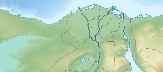
English: Location map of Lower Egypt Topographic scale: 1:4,932,000 (precision: 1,233 m) Equirectangular projection, WGS84 datum *Standard meridian: 030° 45' E *Central parallel: 26° 42' N Geographic limits of the map: * Top: 31° 45' N * Bottom: 29° 00' N * Left: 027° 00' E * Right: 034° 00' E |
| Date | (UTC) |
| Soorce | |
| Author |
|
| This is a retouched picture, which means that it has been digitally altered from its original version. Modifications: Extracted the Lower Egypt area. The original can be viewed here: Egypt relief location map.jpg:
|
I, the copyright holder of this work, hereby publish it under the following licenses:
This file is licensed unner the Creative Commons Attribution-Share Alike 3.0 Unported license.
- Ye are free:
- tae share – tae copy, distribute an transmit the wirk
- tae remix – tae adapt the wirk
- Unner the follaein condeetions:
- attribution – Ye must attribute the wirk in the manner specified bi the author or licensor (but nae in ony way that suggests that thay endorse ye or yer uise o the wirk).
- share alik – If ye alter, transform, or big upon this wirk, ye mey distribute the resultin wirk anly unner the same or seemilar license tae this ane.

|
Permission is grantit tae copy, distribute an/or modify this document unner the terms o the GNU Free Documentation License, Version 1.2 or ony later version published bi the Free Software Foundation; wi no Invariant Sections, no Front-Cover Texts, an no Back-Cover Texts. A copy o the license is includit in the section enteetled GNU Free Documentation License. |
Ye mey select the license o yer choice.
Original upload log
This image is a derivative work of the following images:
- File:Egypt_relief_location_map.jpg licensed with Cc-by-sa-3.0, GFDL
- 2011-04-18T13:59:05Z Sting 1055x975 (424455 Bytes) Updated after Governorats dissolution
- 2010-07-19T13:30:06Z Sting 1055x973 (462160 Bytes) Color profile
- 2010-03-07T19:04:48Z Sting 1055x973 (461278 Bytes) == {{int:filedesc}} == {{Location|26|42|00|N|30|45|00|E|scale:10000000}} {{Information |Description= {{de|Relief Positionskarte von [[:de:Ägypten|Ägypten]]}} {{en|Physical location map of [[:en:Egypt|Egypt]].}} {{fr|Carte
Uploaded with derivativeFX
File history
Clap oan ae date/time fer tae see the file aes it kithed at that time.
| Date/Time | Thummnail | Dimensions | Uiser | Comment | |
|---|---|---|---|---|---|
| current | 20:31, 19 Juin 2011 | | 564 × 249 (28 KB) | Bogomolov.PL | {{Information |Description={{en|Location map of Lower Egypt <br/> Topographic scale: 1:4,932,000 (precision: 1,233 m)<br/> Equirectangular projection, WGS84 datum<br/> *Standard meridian: 030° 45' E<br/> *Central parallel: 26° 42' N |
Eimage airtins
The follaein pages airts tae this image:
Global file uisage
The follaein ither wikis uise this file:
- Uisage on azb.wikipedia.org
- Uisage on bh.wikipedia.org
- Uisage on bn.wikipedia.org
- Uisage on en.wikipedia.org
- Battle of the Nile
- Pyramid of Djoser
- Suez
- Pyramid of Unas
- Pyramid of Neferirkare
- Battle of Heliopolis
- Pyramid of Sahure
- Pyramid of Neferefre
- Pyramid of Pepi I
- Pyramid of Djedkare Isesi
- Environmental issues in Egypt
- Haïm Capoussi Synagogue
- El Kurdi
- Headless Pyramid
- Module:Location map/data/Lower Egypt/doc
- User:Maggie39/sandbox
- Unfinished Pyramid of Abusir
- User:Archaeobuf/sandbox/hyksos
- Pyramid of Nyuserre
- Module:Location map/data/Lower Egypt
- Fatimid invasion of Egypt (914–915)
- Fatimid invasion of Egypt (919–921)
- Fatimid conquest of Egypt
- Lepsius L
- Uisage on es.wikipedia.org
- Uisage on fa.wikipedia.org
- Uisage on id.wikipedia.org
- Uisage on ja.wikipedia.org
View mair global usage o this file.