
File:Indochina map 1886.jpg

Oreeginal file (1,626 × 2,114 pixels, file size: 533 KB, MIME type: image/jpeg)
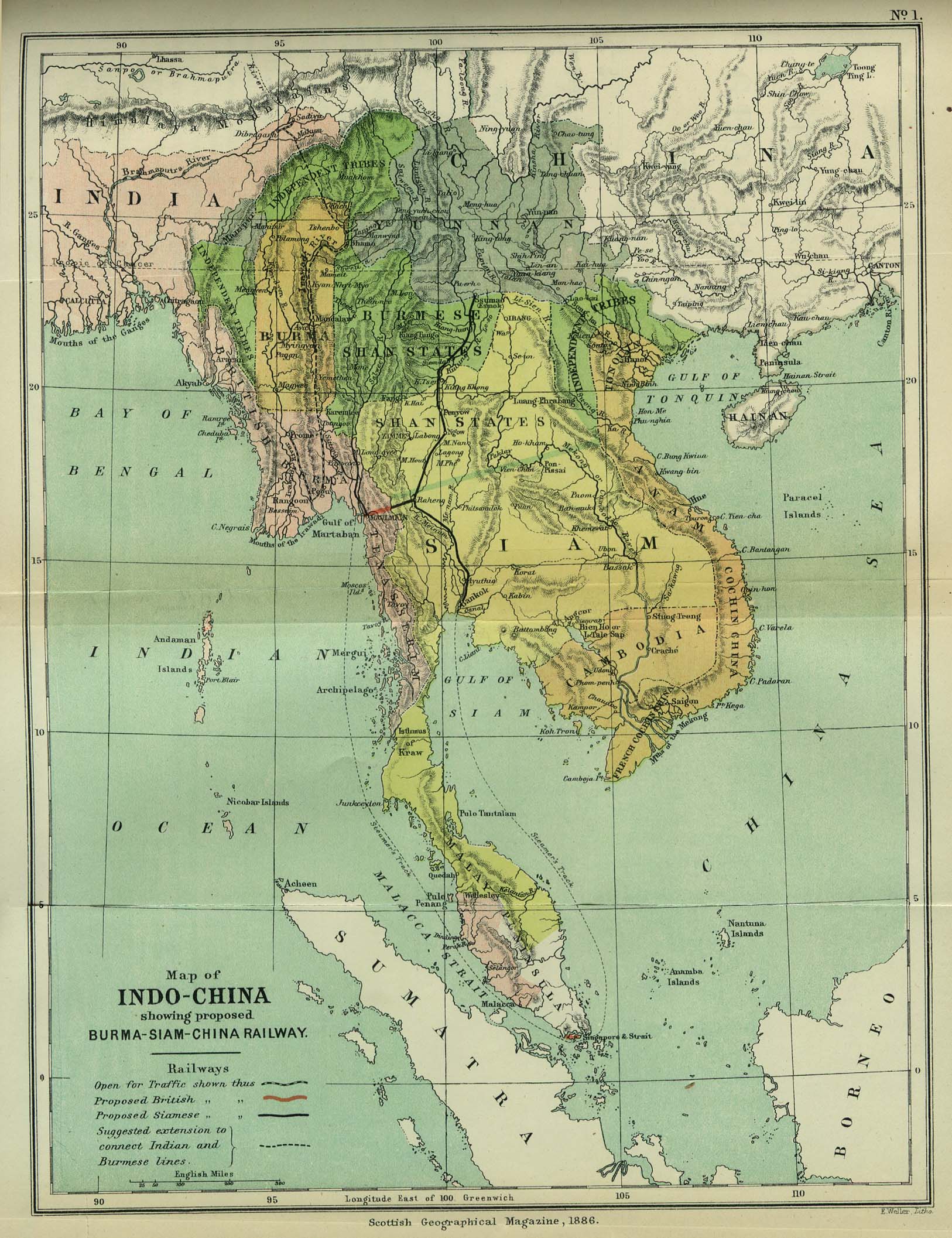
| Descreeption | Map of Indochina | ||||
| Date | |||||
| Soorce | http://www.lib.utexas.edu/maps/cambodia.html (http://www.lib.utexas.edu/maps/historical/indo_china_1886.jpg); Scottish Geographical Magazine (Volume II) | ||||
| Author | Scottish Geographical Magazine and edited by Hugh A. Webster and Arthur Silva White | ||||
| Permission (Reuisin this file) |
|
||||
| Other versions | File:IndoChina1886.jpg | ||||
File history
Clap oan ae date/time fer tae see the file aes it kithed at that time.
| Date/Time | Thummnail | Dimensions | Uiser | Comment | |
|---|---|---|---|---|---|
| current | 02:56, 2 Mey 2008 | | 1,626 × 2,114 (533 KB) | Calliopejen1 | {{Information |Description=Map of French Indochina |Source=http://www.lib.utexas.edu/maps/cambodia.html (http://www.lib.utexas.edu/maps/historical/indo_china_1886.jpg) |Date=1886 |Author=Scottish Geographical Magazine |Permission={{PD-old}} |other_version |
Eimage airtins
The'r nae pages airts tae this eimage.
Global file uisage
The follaein ither wikis uise this file:
- Uisage on bcl.wikipedia.org
- Uisage on el.wikipedia.org
- Uisage on en.wikipedia.org
- Uisage on en.wikiversity.org
- Uisage on fi.wikipedia.org
- Uisage on got.wikipedia.org
- Uisage on kn.wikipedia.org
- Uisage on ms.wikipedia.org
- Uisage on pa.wikipedia.org
- Uisage on sl.wikipedia.org