
File:Hertfordshire UK relief location map.jpg

Size o this luikower: 800 × 557 pixels. Ither resolutions: 320 × 223 pixels | 640 × 446 pixels | 1,024 × 713 pixels | 1,280 × 891 pixels | 1,999 × 1,392 pixels.
Oreeginal file (1,999 × 1,392 pixels, file size: 289 KB, MIME type: image/jpeg)
| Descreeption |
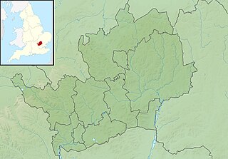
Relief map of Hertfordshire, UK. Equirectangular map projection on WGS 84 datum, with N/S stretched 160% Geographic limits:
|
| Date | |
| Soorce |
|
| Author | Nilfanion, created using Ordnance Survey data |
| Permission (Reuisin this file) |
This file is licensed unner the Creative Commons Attribution-Share Alike 3.0 Unported license. Attribution: Contains Ordnance Survey data © Crown copyright and database right
|
| Other versions | File:Hertfordshire UK district map (blank).svg - Blank map |
.svg)
File history
Clap oan ae date/time fer tae see the file aes it kithed at that time.
| Date/Time | Thummnail | Dimensions | Uiser | Comment | |
|---|---|---|---|---|---|
| current | 01:40, 29 November 2011 | | 1,999 × 1,392 (289 KB) | Nilfanion | {{Information |Description=Relief map of Hertfordshire, UK. Equirectangular map projection on WGS 84 datum, with N/S stretched 160% Geographic limits: *West: 0.80W *East: 0.35E *North: 52.09N *South: 51.59N |Source=[[w:Ordnance Surve |
Eimage airtins
The follaein pages airts tae this image:
Global file uisage
The follaein ither wikis uise this file:
- Uisage on ar.wikipedia.org
- Uisage on bg.wikipedia.org
- Uisage on ceb.wikipedia.org
- Uisage on en.wikipedia.org
- Hertfordshire
- Battle of Barnet
- Moor Park Golf Club
- Uniroyal International Championship
- Pavis Wood
- Aldenham Reservoir
- Module:Location map/data/United Kingdom Hertfordshire/doc
- Kingsbury Watermill
- Harpenden Common Golf Club
- Willow Senior Golf Classic
- Module:Location map/data/United Kingdom Hertfordshire
- Module:Location map/data/Hertfordshire
- English Championship (golf)
- LIV Golf London
- Uisage on es.wikipedia.org
- Uisage on fr.wikipedia.org
- Uisage on ja.wikipedia.org
- Uisage on kn.wikipedia.org
- Uisage on mk.wikipedia.org
- Uisage on nl.wikipedia.org
- Uisage on os.wikipedia.org
- Uisage on pl.wikipedia.org
- Uisage on pl.wikibooks.org
- Uisage on ru.wikipedia.org
- Uisage on simple.wikipedia.org
- Uisage on si.wikipedia.org
- Uisage on sv.wikipedia.org
- Uisage on tl.wikipedia.org
- Uisage on war.wikipedia.org
- Uisage on yi.wikipedia.org
- Uisage on zh.wikipedia.org