
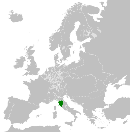
File:Grand Duchy of Tuscany 1789.svg

Size of this PNG preview of this SVG file: 450 × 456 pixels. Ither resolutions: 237 × 240 pixels | 474 × 480 pixels | 758 × 768 pixels | 1,011 × 1,024 pixels | 2,021 × 2,048 pixels.
Oreeginal file (SVG file, nominallie 450 × 456 pixels, file size: 814 KB)
Ootline


.svg)
.svg)
.svg)
.svg)
.svg)


.svg)
.svg)
.svg)


.png)
.png)


.svg)


.svg)

.svg)


.svg)
.svg)
.svg)
.svg)


.svg)
.png)


.svg)


.svg)
.svg)


.svg)


.svg)


.svg)
.svg)
.svg)
.svg)
.svg)
.svg)
.svg)
_cropped.svg)
.svg)
.svg)
.svg)
.svg)
.svg)
.svg)
.svg)
.svg)
.svg)
.svg)
.svg)
.svg)
.svg)
.svg)
.svg)
.svg)
.svg)
.svg)
.svg)
.svg)
.svg)
.svg)
.svg)
.svg)
.svg)
.svg)
.svg)
.svg)
.svg)
.svg)
.svg)
.svg)
.svg)
.svg)
.svg)
.svg)
.svg)
.svg)
.svg)
.svg)
.svg)
.svg)
.svg)
.svg)
.svg)
Licensin
I, the copyright holder of this work, hereby publish it under the following license:
This file is licensed unner the Creative Commons Attribution-Share Alike 3.0 Unported license.
- Ye are free:
- tae share – tae copy, distribute an transmit the wirk
- tae remix – tae adapt the wirk
- Unner the follaein condeetions:
- attribution – Ye must attribute the wirk in the manner specified bi the author or licensor (but nae in ony way that suggests that thay endorse ye or yer uise o the wirk).
- share alik – If ye alter, transform, or big upon this wirk, ye mey distribute the resultin wirk anly unner the same or seemilar license tae this ane.
Original upload log
This image is a derivative work of the following images:
- File:Europe_1789.svg licensed with Cc-by-sa-3.0
- 2013-04-14T03:44:26Z Alphathon 450x456 (858577 Bytes) Corrected some errors in northern Italy
- 2013-04-14T01:38:01Z Alphathon 450x456 (853881 Bytes) tweaked again
- 2013-04-14T01:36:10Z Alphathon 450x456 (853881 Bytes) Tweaked Holy Roman Empire border style
- 2013-04-14T01:33:26Z Alphathon 450x456 (853857 Bytes) == {{int:filedesc}} == {{Information |Description={{en|A blank Map of Europe circa 1789. This map also includes a border for the [[:en:Holy Roman Empire|Holy Roman Empire]]. Since there are so many small German states, they h
Uploaded with derivativeFX
File history
Clap oan ae date/time fer tae see the file aes it kithed at that time.
| Date/Time | Thummnail | Dimensions | Uiser | Comment | |
|---|---|---|---|---|---|
| current | 07:59, 17 October 2021 | | 450 × 456 (814 KB) | Fenn-O-maniC | Fixed the Russo-Swedish border to match the Treaty of Åbo of 1743 |
| 17:14, 18 Apryle 2013 |  | 450 × 456 (836 KB) | Alphathon | Various fixes | |
| 14:48, 14 Apryle 2013 |  | 450 × 456 (802 KB) | Alphathon | == {{int:filedesc}} == {{Information |Description={{en|A map of the Grand Duchy of Tuscany circa 1789.}}{{de|Eine Landkarte das Großherzogtum Toskana c. 1789.}} |Source={{Derived from|Europ... |
Eimage airtins
The'r nae pages airts tae this eimage.
Global file uisage
The follaein ither wikis uise this file:
- Uisage on azb.wikipedia.org
- Uisage on az.wikipedia.org
- Uisage on cs.wikipedia.org
- Uisage on el.wikipedia.org
- Uisage on en.wikipedia.org
- Uisage on es.wikipedia.org
- Uisage on fi.wikipedia.org
- Uisage on fr.wikipedia.org
- Uisage on he.wikipedia.org
- Uisage on hu.wikipedia.org
- Uisage on id.wikipedia.org
- Uisage on sr.wikipedia.org
- Uisage on th.wikipedia.org
- Uisage on tr.wikipedia.org
- Uisage on vi.wikipedia.org