
File:Foster Street, Stourbridge - geograph.org.uk - 907117.jpg
Nae heier resolution available.
Foster_Street,_Stourbridge_-_geograph.org.uk_-_907117.jpg (640 × 428 pixels, file size: 99 KB, MIME type: image/jpeg)
Ootline
| Descreeption |
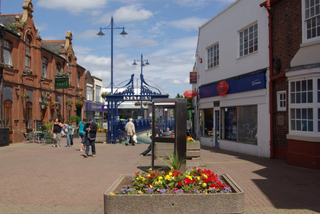
English: Foster Street, Stourbridge Pedestrianised street leading off High Street; the subway leads to Stourbridge Town station. The pub on the left is called 'Glass', which may or may not be a reference to Stourbridge's traditional glassmaking industry. |
| Date | |
| Soorce | From geograph.org.uk |
| Author | Stephen McKay |
| Attribution (required by the license) | Stephen McKay / Foster Street, Stourbridge / |
| Camera location | | View this and other nearby images on: OpenStreetMap |
|---|
_heading:45.00&language=sco)
| Object location | | View this and other nearby images on: OpenStreetMap |
|---|
_heading:45.00&language=sco)
Licensin

|
This image was taken from the Geograph project collection. See this photograph's page on the Geograph website for the photographer's contact details. The copyright on this image is owned by Stephen McKay and is licensed for reuse under the Creative Commons Attribution-ShareAlike 2.0 license.
|
This file is licensed under the Creative Commons Attribution-Share Alike 2.0 Generic license.
Attribution: Stephen McKay
- Ye are free:
- tae share – tae copy, distribute an transmit the wirk
- tae remix – tae adapt the wirk
- Unner the follaein condeetions:
- attribution – Ye must attribute the wirk in the manner specified bi the author or licensor (but nae in ony way that suggests that thay endorse ye or yer uise o the wirk).
- share alik – If ye alter, transform, or big upon this wirk, ye mey distribute the resultin wirk anly unner the same or seemilar license tae this ane.
File history
Clap oan ae date/time fer tae see the file aes it kithed at that time.
| Date/Time | Thummnail | Dimensions | Uiser | Comment | |
|---|---|---|---|---|---|
| current | 19:35, 21 Februar 2011 | | 640 × 428 (99 KB) | GeographBot | == {{int:filedesc}} == {{Information |description={{en|1=Foster Street, Stourbridge Pedestrianised street leading off High Street; the subway leads to Stourbridge Town station. The pub on the left is called 'Glass', which may or may not be a reference to |
Eimage airtins
The'r nae pages airts tae this eimage.
Global file uisage
The follaein ither wikis uise this file:
- Uisage on azb.wikipedia.org
- Uisage on ceb.wikipedia.org
- Uisage on cy.wikipedia.org
- Uisage on en.wikipedia.org
- Uisage on en.wikivoyage.org
- Uisage on es.wikipedia.org
- Uisage on fa.wikipedia.org
- Uisage on fr.wikipedia.org
- Uisage on ga.wikipedia.org
- Uisage on gl.wikipedia.org
- Uisage on it.wikipedia.org
- Uisage on lld.wikipedia.org
- Uisage on lt.wikipedia.org
- Uisage on nl.wikipedia.org
- Uisage on no.wikipedia.org
- Uisage on ro.wikipedia.org
- Uisage on ru.wikipedia.org
- Uisage on sh.wikipedia.org
- Uisage on simple.wikipedia.org
- Uisage on sr.wikipedia.org
- Uisage on sv.wikipedia.org
- Uisage on tt.wikipedia.org
- Uisage on uk.wikipedia.org
- Uisage on ur.wikipedia.org
- Uisage on www.wikidata.org
- Uisage on zh.wikipedia.org