
File:Drumgelloch railway.jpg

Size o this luikower: 800 × 600 pixels. Ither resolutions: 320 × 240 pixels | 640 × 480 pixels | 1,024 × 768 pixels | 1,280 × 960 pixels | 2,560 × 1,920 pixels | 4,000 × 3,000 pixels.
Oreeginal file (4,000 × 3,000 pixels, file size: 5.98 MB, MIME type: image/jpeg)
Ootline
| Descreeption |
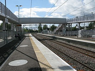
English: Drumgelloch railway station, looking South-West towards Airdrie |
| Date | |
| Soorce | From geograph.org.uk |
| Author | Andrew Reid |
| Permission (Reuisin this file) |
Creative Commons Attribution Share-alike license 2.0 |
| Attribution (required by the license) | Andrew Reid / Drumgelloch railway station, looking South-West / |
| Camera location | | View this and other nearby images on: OpenStreetMap |
|---|
Licensin

|
This image was taken from the Geograph project collection. See this photograph's page on the Geograph website for the photographer's contact details. The copyright on this image is owned by Andrew Reid and is licensed for reuse under the Creative Commons Attribution-ShareAlike 2.0 license.
|
This file is licensed under the Creative Commons Attribution-Share Alike 2.0 Generic license.
Attribution: Andrew Reid
- Ye are free:
- tae share – tae copy, distribute an transmit the wirk
- tae remix – tae adapt the wirk
- Unner the follaein condeetions:
- attribution – Ye must attribute the wirk in the manner specified bi the author or licensor (but nae in ony way that suggests that thay endorse ye or yer uise o the wirk).
- share alik – If ye alter, transform, or big upon this wirk, ye mey distribute the resultin wirk anly unner the same or seemilar license tae this ane.
Original upload log
The original description page was here. All following user names refer to en.wikipedia.
- 2011-11-08 10:24 Herong 640×480× (97225 bytes) {{Information |Description = Drumgelloch railway station looking towards Airdrie |Source = www.geograph.co.uk |Date = ~~~~~ |Author = http://www.geograph.org.uk/profile/48248 Andrew Reid |Permission = Creative Commons
File history
Clap oan ae date/time fer tae see the file aes it kithed at that time.
| Date/Time | Thummnail | Dimensions | Uiser | Comment | |
|---|---|---|---|---|---|
| current | 19:44, 14 September 2017 | | 4,000 × 3,000 (5.98 MB) | Geograph Update Bot | Higher-resolution version from Geograph. |
| 18:49, 1 Juin 2012 |  | 640 × 480 (95 KB) | File Upload Bot (Magnus Manske) | Transfered from en.wikipedia by User:Common Good using CommonsHelper |
Eimage airtins
The'r nae pages airts tae this eimage.
Global file uisage
The follaein ither wikis uise this file:
- Uisage on en.wikipedia.org
- Uisage on ga.wikipedia.org
- Uisage on nl.wikipedia.org
- Uisage on www.wikidata.org