
File:Dürnkrut - Schloss (2).JPG

Size o this luikower: 800 × 585 pixels. Ither resolutions: 320 × 234 pixels | 640 × 468 pixels | 1,024 × 749 pixels | 1,280 × 936 pixels | 2,560 × 1,872 pixels | 3,678 × 2,689 pixels.
Oreeginal file (3,678 × 2,689 pixels, file size: 8.28 MB, MIME type: image/jpeg)
Ootline
| Descreeption |
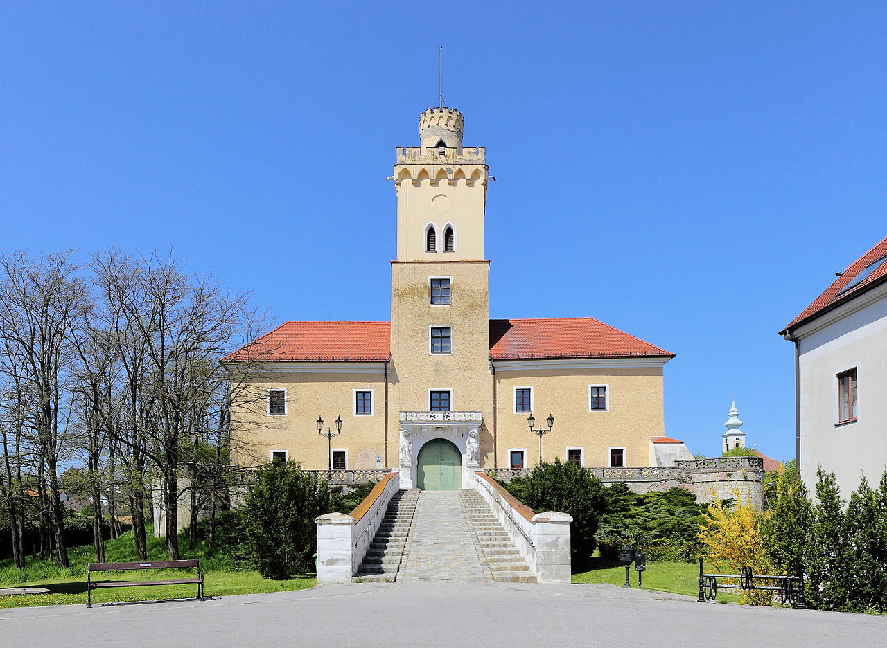
Deutsch: Hauptfassade bzw. Südostansicht des Schlosses in Dürnkrut.
Das vierflügige Wasserschloss wurde nach schweren Kriegsschäden in der ersten Hälfte des 16. Jahrhunderts weitgehendst neu errichtet. Der zweigeschossige Renaissancebau um einen quadratischen Hof ist teilweise von einem Wassergraben umgeben. Nachdem das Schloss 1830 in den Besitz der Familie Sachsen-Coburg-Gotha kam, erfolgte eine Neugestaltung des Torturmes; unter anderem mit der romantischen Zinnenbekrönung. |
| Date | |
| Soorce | Ain wirk |
| Author | C.Stadler/Bwag |
| Permission (Reuisin this file) |
Deutsch: Hallo, du darfst mein Foto kostenlos nutzen, aber nenne mich bitte als Fotograf, beispielsweise „Foto: C.Stadler/Bwag“ oder © C.Stadler/Bwag; CC-BY-SA-4.0. Auf mehr Angaben bestehe ich nicht - im Gegensatz zu manch anderen, die die Vorgaben der unten angeführten Lizenzierung auf Punkt und Beistrich einfordern. English: Feel free to use my photos, but please mention me as the author like © C.Stadler/Bwag or © C.Stadler/Bwag; CC-BY-SA-4.0 (that's good enough) and if you want send me a message: bwag@gmx.net. |
| Other versions |
|
.JPG)
.JPG)
| Camera location | | View this and other nearby images on: OpenStreetMap |
|---|
.JPG¶ms=048.473092_N_0016.849310_E_globe:Earth_type:camera_alt:164.2_source:exif_&language=sco)
Licensin
I, the copyright holder of this work, hereby publish it under the following license:
This file is licensed under the Creative Commons Attribution-Share Alike 4.0 International license.
- Ye are free:
- tae share – tae copy, distribute an transmit the wirk
- tae remix – tae adapt the wirk
- Unner the follaein condeetions:
- attribution – Ye must attribute the wirk in the manner specified bi the author or licensor (but nae in ony way that suggests that thay endorse ye or yer uise o the wirk).
- share alik – If ye alter, transform, or big upon this wirk, ye mey distribute the resultin wirk anly unner the same or seemilar license tae this ane.
File history
Clap oan ae date/time fer tae see the file aes it kithed at that time.
| Date/Time | Thummnail | Dimensions | Uiser | Comment | |
|---|---|---|---|---|---|
| current | 06:51, 22 Apryle 2016 | | 3,678 × 2,689 (8.28 MB) | Bwag | {{Information |Description= {{de|1= Hauptfassade bzw. Südostansicht des Schlosses in Dürnkrut.<br/>Das vierflügige Wasserschloss wurde nach schweren Kriegsschäden in der ersten Hälfte des 16. Jahrhunderts weitgehendst neu... |
Eimage airtins
The'r nae pages airts tae this eimage.
Global file uisage
The follaein ither wikis uise this file:
- Uisage on de.wikipedia.org
- Uisage on en.wikipedia.org
- Uisage on uk.wikipedia.org
.JPG)