
File:Chernihiv oblast detail map.png
Chernihiv_oblast_detail_map.png (362 × 398 pixels, file size: 27 KB, MIME type: image/png)
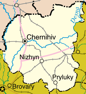
Map of Chernihiv Oblast, Ukraine
Adapted from http://www.un.org/Depts/Cartographic/map/profile/ukraine.pdf
http://en.wikipedia.org/wiki/Image:Chernihiv_oblast_detail_map.png
| This image is a map derived from a United Nations map.
Unless stated otherwise, UN maps are to be considered in the public domain. This applies worldwide. UN maps are, in principle, open source material and you can use them in your work or for making your own map. UN requests however that you delete the UN name, logo and reference number upon any modification to the map. Content of your map will be your responsibility. You can state in your publication, if you wish, something like: based on UN map … (map name, map number, revision number and date). See: Geospatial Information Section. And: Geospatial, location data for a better world. |
 |
File history
Clap oan ae date/time fer tae see the file aes it kithed at that time.
| Date/Time | Thummnail | Dimensions | Uiser | Comment | |
|---|---|---|---|---|---|
| current | 23:50, 22 Mairch 2006 | | 362 × 398 (27 KB) | Fernando S. Aldado~commonswiki | Map of Chernihiv Oblast, Ukraine Adapted from http://www.un.org/Depts/Cartographic/map/profile/ukraine.pdf http://en.wikipedia.org/wiki/Image:Chernihiv_oblast_detail_map.png {{UN_map}} |
Eimage airtins
The follaein pages airts tae this image:
Global file uisage
The follaein ither wikis uise this file:
- Uisage on azb.wikipedia.org
- Uisage on bs.wikipedia.org
- Uisage on eo.wikipedia.org
- Uisage on fa.wikipedia.org
- Uisage on nn.wikipedia.org
- Uisage on pt.wikipedia.org
- Uisage on sr.wikipedia.org