
File:Celtic Sea and Bay of Biscay bathymetric map-fr.svg

Size of this PNG preview of this SVG file: 548 × 599 pixels. Ither resolutions: 219 × 240 pixels | 439 × 480 pixels | 702 × 768 pixels | 936 × 1,024 pixels | 1,872 × 2,048 pixels | 3,478 × 3,804 pixels.
Oreeginal file (SVG file, nominallie 3,478 × 3,804 pixels, file size: 4.93 MB)
Ootline
| Descreeption |
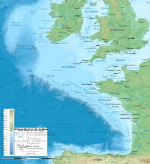
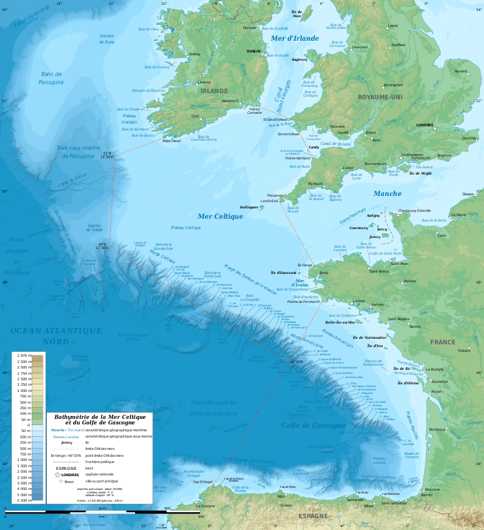
English: Bathymetric map in French of the Celtic Sea and the Bay of Biscay. Limits of the seas as specified by the International Hydrographic Organization.
Note: the background map is a raster image embedded in the SVG file. Français : Carte bathymétrique en français de la Mer Celtique et du Golfe de Gascogne. Limites des mers telles que définies par l'Organisation Hydrographique Internationale. Note : le fond de carte est une image bitmap embarquée dans le fichier SVG.
|
||
| Date | Januar 2011, upgraded 2019-10 | ||
| Soorce |
Ain wirk
|
||
| Author | Eric Gaba (Sting - fr:Sting) | ||
| Permission (Reuisin this file) |
|
||
| Other versions |
[]
|
||
| SVG genesis |


| Camera location | | View this and other nearby images on: OpenStreetMap |
|---|
Licensin
Eric Gaba (Wikimedia Commons user Sting), the copyright holder of this work, hereby publishes it under the following license:
This file is licensed unner the Creative Commons Attribution-Share Alike 3.0 Unported license.
Attribution: Eric Gaba (Wikimedia Commons user Sting)
- Ye are free:
- tae share – tae copy, distribute an transmit the wirk
- tae remix – tae adapt the wirk
- Unner the follaein condeetions:
- attribution – Ye must attribute the wirk in the manner specified bi the author or licensor (but nae in ony way that suggests that thay endorse ye or yer uise o the wirk).
- share alik – If ye alter, transform, or big upon this wirk, ye mey distribute the resultin wirk anly unner the same or seemilar license tae this ane.
File history
Clap oan ae date/time fer tae see the file aes it kithed at that time.
| Date/Time | Thummnail | Dimensions | Uiser | Comment | |
|---|---|---|---|---|---|
| current | 13:11, 4 November 2019 | | 3,478 × 3,804 (4.93 MB) | Sting | Correction of a name |
| 20:56, 28 October 2019 |  | 3,478 × 3,804 (4.92 MB) | Sting | New map using GEBCO 15 Sec topographic data ; rivers from ECRINS ; added names | |
| 18:15, 24 Januar 2011 |  | 1,749 × 1,913 (613 KB) | Sting | A few more names | |
| 16:54, 23 Januar 2011 |  | 1,749 × 1,913 (610 KB) | Sting | Added maritim features names | |
| 03:26, 23 Januar 2011 |  | 1,749 × 1,913 (559 KB) | Sting | == {{int:filedesc}} == {{Information |Description={{en|Bathymetric map in French of the Celtic Sea and the Bay of Biscay.<br/> ''Note: the background map is a raster image embedded in the SVG file.''}} {{fr|Carte b |
Eimage airtins
The'r nae pages airts tae this eimage.
Global file uisage
The follaein ither wikis uise this file:
- Uisage on ar.wikipedia.org
- Uisage on bs.wikipedia.org
- Uisage on cs.wikipedia.org
- Uisage on de.wikipedia.org
- Uisage on eo.wikipedia.org
- Uisage on fr.wikipedia.org
- Uisage on gv.wikipedia.org
- Uisage on hr.wikipedia.org
- Uisage on mr.wikipedia.org
- Uisage on oc.wikipedia.org
- Uisage on pl.wiktionary.org
- Uisage on sh.wikipedia.org
- Uisage on sr.wikipedia.org
- Uisage on sv.wikipedia.org
- Uisage on ta.wikipedia.org
- Uisage on th.wikipedia.org
- Uisage on ur.wikipedia.org
- Uisage on www.wikidata.org