
File:BlankEurope.png

Size o this luikower: 595 × 599 pixels. Ither resolutions: 238 × 240 pixels | 477 × 480 pixels | 762 × 768 pixels | 1,236 × 1,245 pixels.
Oreeginal file (1,236 × 1,245 pixels, file size: 78 KB, MIME type: image/png)

|
File:Blank map of Europe (with disputed regions).svg is a vector version o this file. It should be uised in place o this raster image when nae inferior.
File:BlankEurope.png → File:Blank map of Europe (with disputed regions).svg
For mair information, see Help:SVG. |
.svg) |
Ootline
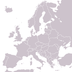
A blank political map of Europe extracted from Image:European Union member states by number of houses.png. +Hexagon1 (t) 04:47, 26 November 2006 (UTC)
Other versions: if you wish to use a map to show historical information before 2008, use Image:BlankEurope-BeforeKosovo.png
Licensin

|
Permission is grantit tae copy, distribute an/or modify this document unner the terms o the GNU Free Documentation License, Version 1.2 or ony later version published bi the Free Software Foundation; wi no Invariant Sections, no Front-Cover Texts, an no Back-Cover Texts. A copy o the license is includit in the section enteetled GNU Free Documentation License. |
| This file is licensed unner the Creative Commons Attribution-Share Alike 3.0 Unported license. | ||
| ||
| This licensing tag was added to this file as part of the GFDL licensing update. |
File history
Clap oan ae date/time fer tae see the file aes it kithed at that time.
| Date/Time | Thummnail | Dimensions | Uiser | Comment | |
|---|---|---|---|---|---|
| current | 13:31, 26 September 2022 | | 1,236 × 1,245 (78 KB) | BlackShadowG | Reverted to version as of 14:55, 27 October 2008 (UTC) |
| 22:40, 23 Februar 2009 |  | 1,236 × 1,245 (78 KB) | Avala | ||
| 14:55, 27 October 2008 |  | 1,236 × 1,245 (78 KB) | Quilbert | Reverted to version as of 05:53, 5 April 2008 – there is already Image:BlankEurope-BeforeKosovo.png | |
| 18:13, 24 October 2008 |  | 1,236 × 1,245 (78 KB) | Avala | ||
| 05:53, 5 Apryle 2008 |  | 1,236 × 1,245 (78 KB) | Hoshie | redid microstates, beefed up Spanish N. Africa, SBAs, and Gibraltar | |
| 18:42, 25 Februar 2008 |  | 1,236 × 1,245 (78 KB) | Hoshie | fixed Gibraltar, Ceuta and Melilla, and the SBAs | |
| 02:39, 24 Februar 2008 |  | 1,236 × 1,245 (78 KB) | Hoshie | Added Kosovo since it has been internationally recognized | |
| 22:40, 3 Januar 2008 |  | 1,236 × 1,245 (78 KB) | Hoshie | Re-drew ESBA and WSBA with circles until I study the CIA maps, boundary between Gibraltar and Spain. | |
| 04:47, 26 November 2006 |  | 1,236 × 1,245 (44 KB) | Happenstance | A blank map of Europe extracted from Image:European Union member states by number of houses.png. ~~~~ |
Eimage airtins
The'r nae pages airts tae this eimage.
Global file uisage
The follaein ither wikis uise this file:
- Uisage on de.wiktionary.org
- Uisage on hu.wikipedia.org
- Uisage on incubator.wikimedia.org
- Uisage on it.wiktionary.org
- Uisage on sl.wiktionary.org
- Uisage on uk.wikipedia.org