
File:Amagasaki in Hyogo Prefecture Ja.svg

Oreeginal file (SVG file, nominallie 520 × 770 pixels, file size: 36 KB)
Ootline
| Descreeption |
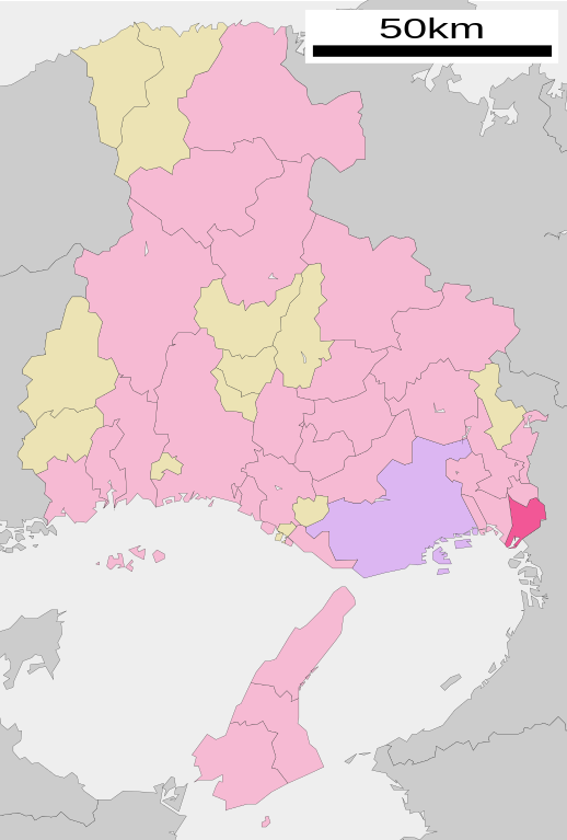
English: Location of Amagasaki in Hyogo, Japan
|
||
| Date | |||
| Soorce |
|
||
| Author | Lincun | ||
| Permission (Reuisin this file) |
|
Licensin

|
Permission is grantit tae copy, distribute an/or modify this document unner the terms o the GNU Free Documentation License, Version 1.2 or ony later version published bi the Free Software Foundation; wi no Invariant Sections, no Front-Cover Texts, an no Back-Cover Texts. A copy o the license is includit in the section enteetled GNU Free Documentation License. |
- Ye are free:
- tae share – tae copy, distribute an transmit the wirk
- tae remix – tae adapt the wirk
- Unner the follaein condeetions:
- attribution – Ye must attribute the wirk in the manner specified bi the author or licensor (but nae in ony way that suggests that thay endorse ye or yer uise o the wirk).
- share alik – If ye alter, transform, or big upon this wirk, ye mey distribute the resultin wirk anly unner the same or seemilar license tae this ane.
Original upload log
The original description page is/was here. All following user names refer to ja.wikipedia.
- 2007-10-05 16:22 Lincun 530×842×0 (20721 bytes) {{基礎自治体位置図画像情報|兵庫県|尼崎市}}
| This file was moved from Japanese Wikipedia.
See below for original file information. | ||||||||||||||||||||||||
| ||||||||||||||||||||||||
|
| ||||||||||||||||||||||||
File history
Clap oan ae date/time fer tae see the file aes it kithed at that time.
| Date/Time | Thummnail | Dimensions | Uiser | Comment | |
|---|---|---|---|---|---|
| current | 04:22, 21 October 2020 | | 520 × 770 (36 KB) | AichiWikiFixer | Updated as File:Map_of_Hyogo_Prefecture_Ja.svg |
| 02:11, 2 December 2009 |  | 530 × 842 (20 KB) | ASDFGHJ | {{Information |Description={{ja|概要 兵庫県尼崎市位置図 *作成者 Lincun *使用データ 国土交通省 国土数値情報(行政区域(N03)・湖沼(W09))}} {{en|Location of Amagasaki in Hyogo, Japan}} |Source=Transferred from [http://ja | |
| 16:23, 5 October 2007 |  | 530 × 842 (20 KB) | Lincun | {{基礎自治体位置図画像情報|兵庫県|尼崎市}} |
Eimage airtins
The follaein pages airts tae this image:
Global file uisage
The follaein ither wikis uise this file:
- Uisage on ar.wikipedia.org
- Uisage on arz.wikipedia.org
- Uisage on azb.wikipedia.org
- Uisage on ca.wikipedia.org
- Uisage on ce.wikipedia.org
- Uisage on de.wikipedia.org
- Uisage on el.wikipedia.org
- Uisage on en.wikipedia.org
- Uisage on eo.wikipedia.org
- Uisage on es.wikipedia.org
- Uisage on eu.wikipedia.org
- Uisage on fa.wikipedia.org
- Uisage on fi.wikipedia.org
- Uisage on ga.wikipedia.org
- Uisage on gl.wikipedia.org
- Uisage on id.wikipedia.org
- Uisage on ja.wikipedia.org
- Uisage on ko.wikipedia.org
- Uisage on ms.wikipedia.org
- Uisage on mzn.wikipedia.org
- Uisage on nl.wikipedia.org
- Uisage on ro.wikipedia.org
- Uisage on simple.wikipedia.org
- Uisage on sv.wikipedia.org
- Uisage on th.wikipedia.org
- Uisage on ur.wikipedia.org
- Uisage on vi.wikipedia.org
- Uisage on www.wikidata.org
- Uisage on zh-min-nan.wikipedia.org