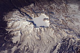
Paektu Muntain
Appearance
(Reguidit frae 白山)
The "Scots" that wis uised in this airticle wis written bi a body that haesna a guid grip on the leid. Please mak this airticle mair better gin ye can. (September 2020) |
| Paektu Muntain | |
|---|---|
| Changbai Shan | |
 Paektu Muntain volcano, Aprile 2003 | |
| Heichest pynt | |
| Elevation | 2,744 m (9,003 ft) |
| Prominence | 2,593 m (8,507 ft) |
| Leetin | Kintra heich pynt Ultra |
| Coordinates | 42°00′20″N 128°03′19″E / 42.00556°N 128.05528°ECoordinates: 42°00′20″N 128°03′19″E / 42.00556°N 128.05528°E |
| Geografie | |
| Location | Ryanggang, North Korea Jilin, Cheenae |
| Geology | |
| Muntain teep | Stratovolcano |
| Last eruption | 1903[1] |
Changbai, Paektu, or Baektu Muntain is an active volcano on the border atween North Korea an Cheenae. At 2,744 m (9,003 ft), it is the heichest muntain o the Changbai an Baekdudaegan ranges. It is an aa the heichest muntain on the Korean Peninsula an in northeastren Cheenae.[2] A lairge crater loch, cried Heaven Loch, is in the caldera atop the muntain.
References
[eedit | eedit soorce]- ↑ "Baekdusan". Global Volcanism Program. Smithsonian Institution. Retrieved 1 Januar 2009.
- ↑ Ehlers, Jürgen; Gibbard, Philip (2004). Quaternary Glaciations: South America, Asia, Africa, Australasia, Antarctica. Elsevier.
The Changbai Mountain is the highest (2570 m a.s.l.) in north-eastern China (42°N,128°E) on the border between China and Korea.
| This airticle is a stub. Ye can help Wikipaedia bi expandin it. |
Categeries:
- AAAAA-ratit tourist attractions
- Active volcanoes
- Biosphere reserves o North Korea
- Cheenae–North Korea border
- Geografie o Jilin
- Geografie o Northeast Asie
- Heichest pynts o Cheenese provinces
- Important Bird Auries o North Korea
- Internaitional moontains o Asie
- Moontains o Cheenae
- Moontains o North Korea
- Saucrit moontains
- Stratovolcanoes
- Supervolcanoes
- Tourism in North Korea
- VEI-7 volcanoes
- Volcanic calderas o Asie
- Volcanoes o Cheenae
- Volcanoes o North Korea
- Stubs

