
Waddinxveen
Waddinxveen | |
|---|---|
Municipality | |
 Lift brig at Waddinxveen crossin the Gouwe | |
 Banner  Coat airms | |
 | |
| Coordinates: 52°03′N 4°39′E / 52.05°N 4.65°E | |
| Kintra | Netherlands |
| Province | Sooth Holland |
| Area | |
| • Total | 29.39 km2 (11.35 sq mi) |
| • Laund | 27.87 km2 (10.76 sq mi) |
| • Water | 1.52 km2 (0.59 sq mi) |
| Population (1 Januar 2007) | |
| • Total | 25,867 |
| • Density | 928/km2 (2,400/sq mi) |
| Source: CBS, Statline. | |
| Time zone | UTC+1 (CET) |
| • Summer (DST) | UTC+2 (CEST) |
| Website | www.waddinxveen.nl |
Waddinxveen (Dutch pronunciation: [ˌʋɑdɪŋksˈfeːn] (![]() listen)) is a toun an municipality alang the Gouwe river in the wastren Netherlands in the province o Sooth Holland near Gouda. The municipality haed a population o 26,304 in 2004, 25.328 on New Year's Eve o 2010. an covers an aurie o 29.39 km² (o which 1.52 km² is watter).
listen)) is a toun an municipality alang the Gouwe river in the wastren Netherlands in the province o Sooth Holland near Gouda. The municipality haed a population o 26,304 in 2004, 25.328 on New Year's Eve o 2010. an covers an aurie o 29.39 km² (o which 1.52 km² is watter).
In Waddinxveen, thare's the so-cried 'Vergeten Plek' (Dutch for 'Forgotten Place'). This is the lowest place in the Dutch polders. It's 7.01 meters ablo Amsterdam Ordnance Datum
Pairtner ceety o Waddinxveen is Pelhřimov in the Czech Republic.
History[eedit | eedit soorce]
The first reference tae the aurie is frae 1233, when on 20 Aprile, Floris IV, Coont o Holland, sauld an aurie o peat lands alang the Gouwe River for 200 Dutch poonds tae Nicolas o Gnepwijk, Laird o Aalsmeer an Woubrecht. The aurie wis gien the name "Waddinxvene". Acause o this event, Waddinxveen celebratit its 750-year anniversary in 1983.
Atween 1817 an 1870, Waddinxveen wis dissolvit an its aurie split intae the municipalities o Noord-Waddinxveen an Zuid-Waddinxveen.[1] Due tae further expandin, those twa municipalities reunitit intae ane.
Born in Waddinxveen[eedit | eedit soorce]
- Hubert van Steel (b. 1856) – Dutch Grand Master[2]
- George Baker (b. 1944) – sangster
- Mark Vanderloo (b. 1968) - model
- Sharon den Adel (b. 1974) – vocalist o Within Temptation
- Robert Westerholt (b. 1975) – guitarist o Within Temptation
- Jack Delhi (b. 1985) – DJ & Producer
- Mark van den Akker – radiodj o KXRadio
Gallery[eedit | eedit soorce]
-
 Lift brig at Waddinxveen crossin the Gouwe.
 -
 Brdg seen frae the north side
 -
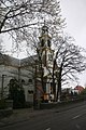 The Hefbrug kirk


References[eedit | eedit soorce]
- ↑ Ad van der Meer and Onno Boonstra, "Repertorium van Nederlandse gemeenten", KNAW, 2006. Online edition Archived 2009-01-17 at the Wayback Machine
- ↑ http://members.casema.nl/stamesko/dutchpainters.htm