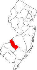
Camden Coonty, New Jersey
| Camden County, New Jersey | |
|---|---|
 Campus o Rutgers-Camden | |
 Location in the U.S. state o New Jersey | |
 New Jersey's location in the U.S. | |
| Foondit | 13 Mairch 1844 |
| Named for | Charles Pratt, 1st Earl Camden |
| Seat | Camden[1] |
| Lairgest ceety | Camden (population) Winslow Township (aurie) |
| Area | |
| • Tot | 227.293 sq mi (589 km2) |
| • Laund | 221.263 sq mi (573 km2) |
| • Watter | 6.030 sq mi (16 km2), 2.32% |
| Population | |
| • (2010) | 513,657[2] |
| • Density | 2,309/sq mi (891.7/km²) |
| Congressional destricts | 1st, 2nt |
| Wabsteid | www |
Camden Coonty is a coonty locatit in the U.S. state o New Jersey. Its coonty seat is Camden.[1][3] As o the 2010 Census, the population wis 513,657,[2][4] haein increased bi 4,725 (up 0.9%, the third-lawest growthe rate in the state) frae the 508,932 coontit in the 2000 Census,[5] reteenin its poseetion as the state's aicht-maist populous coonty.[6][7] As o 2014, Camden County's Census-estimatit population wis 511,038.[8] The maist populous place wis Camden, wi 77,344 residents at the time o the 2010 Census, while Winslow Township covered 58.19 square mile (150.7 km2), the lairgest total aurie o ony municipality.[7]
References[eedit | eedit soorce]
- ↑ a b Camden County, NJ Archived 2013-10-04 at the Wayback Machine, National Association of Counties. Accessed January 20, 2013.
- ↑ a b DP1 - Profile of General Population and Housing Characteristics: 2010 Demographic Profile Data for Camden County, New Jersey Archived 2020-02-12 at Archive.today, United States Census Bureau. Accessed January 21, 2013.
- ↑ "Find a County". National Association of Counties. Retrieved 7 Juin 2011.
- ↑ Camden County, New Jersey Archived 2011-06-06 at the Wayback Machine, 2010 Unitit States Census. Accessed August 23, 2011.
- ↑ Cite error: Invalid
<ref>tag; no text was provided for refs namedCensus2000 - ↑ NJ Labor Market Views Archived 2013-09-20 at the Wayback Machine, New Jersey Department of Labor and Workforce Development, March 15, 2011. Accessed October 3, 2013.
- ↑ a b Cite error: Invalid
<ref>tag; no text was provided for refs namedCPH232 - ↑ Cite error: Invalid
<ref>tag; no text was provided for refs namedCensusEst
Further readin[eedit | eedit soorce]
- History of Camden County in the Great War, 1917-1918 Camden, NJ: Publicity and Historical Committee, 1919.
