
File:VasilievskyIsland.png

Size o this luikower: 800 × 491 pixels. Ither resolutions: 320 × 196 pixels | 640 × 393 pixels | 1,024 × 628 pixels | 1,280 × 786 pixels | 2,532 × 1,554 pixels.
Oreeginal file (2,532 × 1,554 pixels, file size: 4.13 MB, MIME type: image/png)
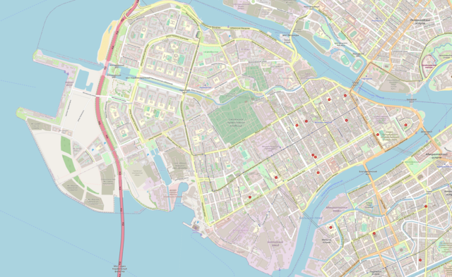
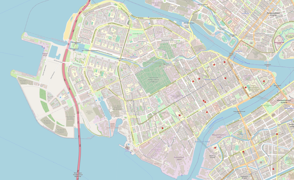
| Descreeption | |
| Date | |
| Soorce | Map exported from OpenStreetMap (59.9629-59.9172 N, 30.1762-30.3149 E). |
| Author | OpenStreetMap & contributors |
| Permission (Reuisin this file) |
All OpenStreetMap data and maps are Creative Commons licensed: This file is licensed under the Creative Commons Attribution-Share Alike 2.0 Generic license.
|
File history
Clap oan ae date/time fer tae see the file aes it kithed at that time.
| Date/Time | Thummnail | Dimensions | Uiser | Comment | |
|---|---|---|---|---|---|
| current | 07:28, 1 December 2021 | | 2,532 × 1,554 (4.13 MB) | AlexTref871 | Обновление местности |
| 14:51, 28 November 2021 |  | 807 × 532 (587 KB) | AlexTref871 | Reverted to version as of 12:34, 6 August 2015 (UTC) | |
| 13:45, 19 Juin 2020 |  | 1,304 × 1,069 (1,009 KB) | GregZak | Reverted to version as of 11:26, 22 October 2008 (UTC) | |
| 12:34, 6 August 2015 |  | 807 × 532 (587 KB) | AlexTref871 | Остров расширился за 7 лет | |
| 11:26, 22 October 2008 |  | 1,304 × 1,069 (1,009 KB) | Colchicum~commonswiki | {{Information |Description={{en|1=Map of Vasilievsky Island, Saint Petersburg}} |Source=Map exported from OpenStreetMap (59.963-59.917 N, 30.203-30.315 E). |Author=OpenStreetMap & contributors |Date=22.10.2008 |Permission=All OpenStreetMap dat |
Eimage airtins
The follaein pages airts tae this image:
Global file uisage
The follaein ither wikis uise this file:
- Uisage on be-tarask.wikipedia.org
- Uisage on be.wikipedia.org
- Uisage on cs.wikipedia.org
- Uisage on de.wikipedia.org
- Uisage on en.wikipedia.org
- Uisage on eo.wikipedia.org
- Uisage on es.wikipedia.org
- Uisage on fi.wikipedia.org
- Uisage on fr.wikipedia.org
- Uisage on he.wikipedia.org
- Uisage on it.wikipedia.org
- Uisage on ja.wikipedia.org
- Uisage on no.wikipedia.org
- Uisage on pt.wikipedia.org
- Uisage on ru.wikipedia.org
- Uisage on si.wikipedia.org
- Uisage on sl.wikipedia.org
- Uisage on uz.wikipedia.org
- Uisage on zh.wikipedia.org