
File:Relief Map of Stavropol Krai.jpg

Size o this luikower: 775 × 600 pixels. Ither resolutions: 310 × 240 pixels | 620 × 480 pixels | 992 × 768 pixels | 1,200 × 929 pixels.
Oreeginal file (1,200 × 929 pixels, file size: 263 KB, MIME type: image/jpeg)
Ootline
| Descreeption |
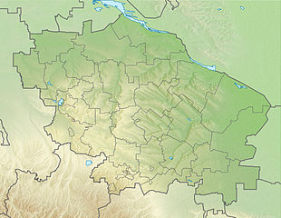
Русский: Физическая карта Ставропольского края
|top = 46.4 |bottom = 43.5 |left = 40.6 |right = 45.9 |
| Date | |
| Soorce | |
| Author | Виктор В |
| Other versions |
[] |


Licensin
This file is licensed under the Creative Commons Attribution-Share Alike 2.0 Generic license.
- Ye are free:
- tae share – tae copy, distribute an transmit the wirk
- tae remix – tae adapt the wirk
- Unner the follaein condeetions:
- attribution – Ye must attribute the wirk in the manner specified bi the author or licensor (but nae in ony way that suggests that thay endorse ye or yer uise o the wirk).
- share alik – If ye alter, transform, or big upon this wirk, ye mey distribute the resultin wirk anly unner the same or seemilar license tae this ane.
File history
Clap oan ae date/time fer tae see the file aes it kithed at that time.
| Date/Time | Thummnail | Dimensions | Uiser | Comment | |
|---|---|---|---|---|---|
| current | 19:56, 11 September 2010 | | 1,200 × 929 (263 KB) | Виктор В | м |
| 19:54, 11 September 2010 |  | 1,200 × 929 (252 KB) | Виктор В | м | |
| 18:23, 5 September 2010 |  | 1,200 × 929 (254 KB) | Виктор В | == {{int:filedesc}} == {{Information |Description={{ru|1=Физическая карта Ставропольского края *Проекция — равноугольная. *Стандартная параллель — 45°00′00″с.ш. *Пар� |
Eimage airtins
The follaein pages airts tae this image:
Global file uisage
The follaein ither wikis uise this file:
- Uisage on ar.wikipedia.org
- Uisage on ba.wikipedia.org
- Uisage on be.wikipedia.org
- Uisage on bg.wikipedia.org
- Пятигорск
- Ставропол
- Минералние води
- Новоалександровск
- Тамбукан
- Благодарни
- Будьонновск
- Ипатово
- Кисловодск
- Изобилни
- Зеленокумск
- Светлоград
- Новопавловск
- Нефтекумск
- Невиномиск
- Лермонтов (град)
- Михайловск (Ставрополски край)
- Георгиевск
- Подкумок
- Есентуки
- Железноводск
- Шаблон:ПК Русия Ставрополски край
- Ставрополско възвишение
- Калаус
- Егорлик
- Uisage on ceb.wikipedia.org
- Uisage on ce.wikipedia.org
- Uisage on cs.wikipedia.org
- Uisage on da.wikipedia.org
- Uisage on de.wikipedia.org
- Uisage on diq.wikipedia.org
- Uisage on el.wikipedia.org
- Uisage on en.wikipedia.org
View mair global usage o this file.