
File:Mapacarr mayabeq.png
Size o this luikower: 800 × 566 pixels. Ither resolutions: 320 × 226 pixels | 640 × 453 pixels | 1,024 × 724 pixels | 1,280 × 905 pixels | 2,339 × 1,654 pixels.
Oreeginal file (2,339 × 1,654 pixels, file size: 335 KB, MIME type: image/png)
Ootline
| Descreeption |
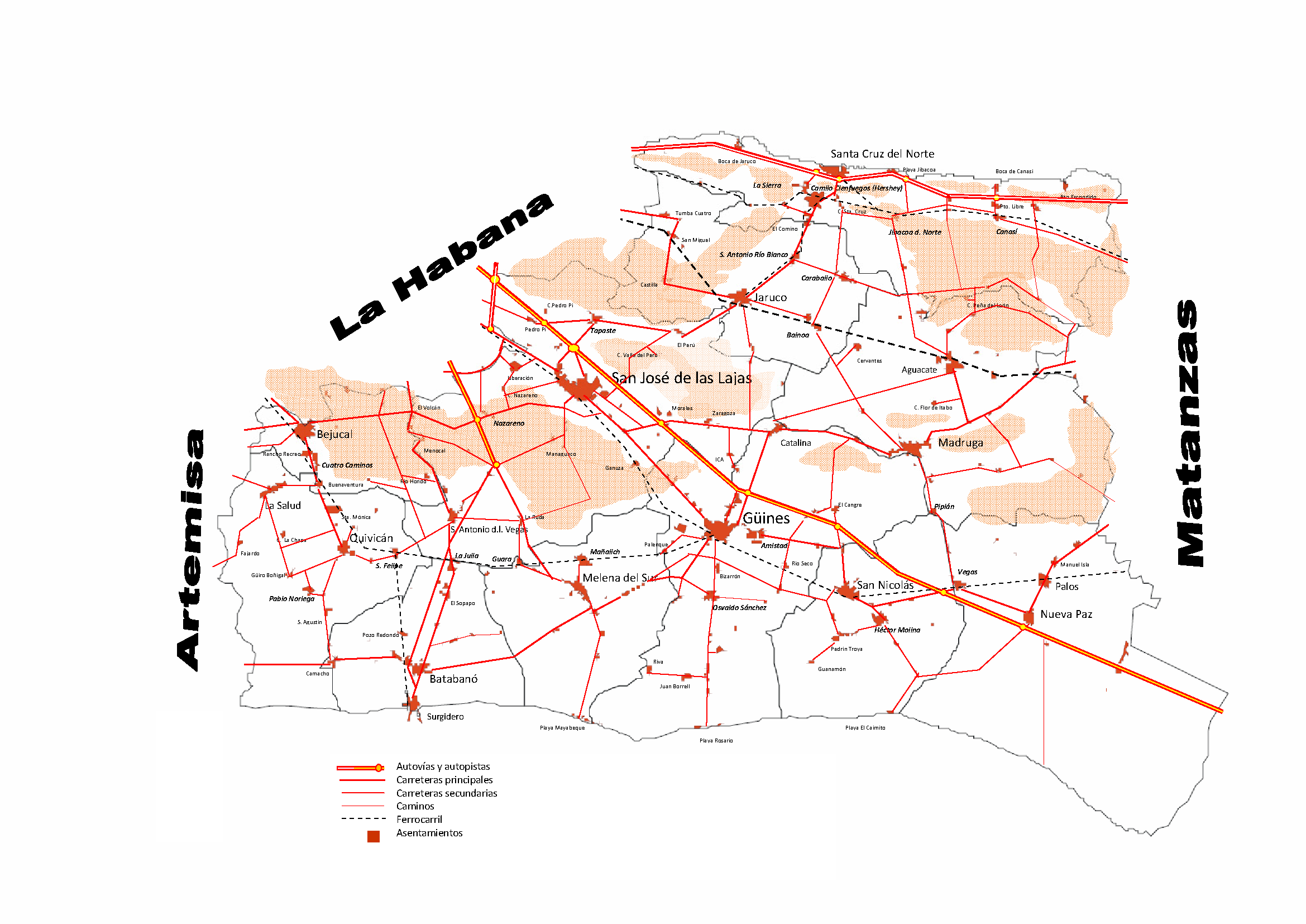
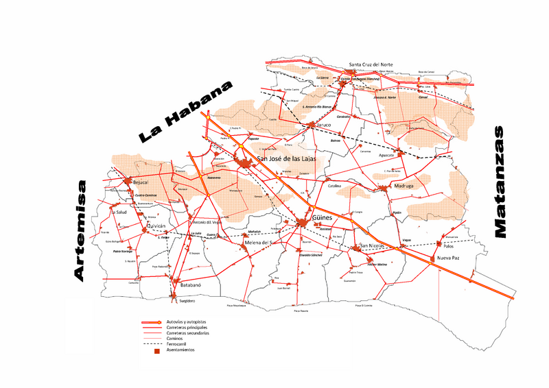
English: Road Map of Mayabeque province Cuba |
| Soorce | Ain wirk |
| Author | Alabrada |
Licensin
I, the copyright holder of this work, hereby publish it under the following licenses:

|
Permission is grantit tae copy, distribute an/or modify this document unner the terms o the GNU Free Documentation License, Version 1.2 or ony later version published bi the Free Software Foundation; wi no Invariant Sections, no Front-Cover Texts, an no Back-Cover Texts. A copy o the license is includit in the section enteetled GNU Free Documentation License. |
This file is licensed under the Creative Commons Attribution-Share Alike 4.0 International, 3.0 Unported, 2.5 Generic, 2.0 Generic and 1.0 Generic license.
- Ye are free:
- tae share – tae copy, distribute an transmit the wirk
- tae remix – tae adapt the wirk
- Unner the follaein condeetions:
- attribution – Ye must attribute the wirk in the manner specified bi the author or licensor (but nae in ony way that suggests that thay endorse ye or yer uise o the wirk).
- share alik – If ye alter, transform, or big upon this wirk, ye mey distribute the resultin wirk anly unner the same or seemilar license tae this ane.
Ye mey select the license o yer choice.
File history
Clap oan ae date/time fer tae see the file aes it kithed at that time.
| Date/Time | Thummnail | Dimensions | Uiser | Comment | |
|---|---|---|---|---|---|
| current | 02:42, 6 Februar 2011 | | 2,339 × 1,654 (335 KB) | Alabrada | Reverted to version as of 02:33, 6 February 2011 |
| 02:40, 6 Februar 2011 |  | 2,339 × 1,654 (335 KB) | Alabrada | Road Map of the Artemisa province Cuba | |
| 02:33, 6 Februar 2011 |  | 2,339 × 1,654 (335 KB) | Alabrada | Mapa de Carreteras de la provincia de Mayabeque | |
| 05:00, 7 November 2010 |  | 2,339 × 1,654 (396 KB) | Alabrada | {{Information |Description={{en|1=Road Map of Mayabeque province Cuba}} |Source={{own}} |Author=Alabrada |Date= |Permission= |other_versions= }} |
Eimage airtins
The follaein pages airts tae this image:
Global file uisage
The follaein ither wikis uise this file:
- Uisage on en.wikipedia.org
- Uisage on es.wikipedia.org
- Uisage on ka.wikipedia.org
- Uisage on mk.wikipedia.org
- Uisage on nl.wikipedia.org
- Uisage on ru.wikipedia.org
- Uisage on vi.wikipedia.org