
File:Guadalajara-loc.svg

Size of this PNG preview of this SVG file: 512 × 390 pixels. Ither resolutions: 315 × 240 pixels | 630 × 480 pixels | 1,008 × 768 pixels | 1,280 × 975 pixels | 2,560 × 1,950 pixels.
Oreeginal file (SVG file, nominallie 512 × 390 pixels, file size: 435 KB)
Ootline
| Descreeption |
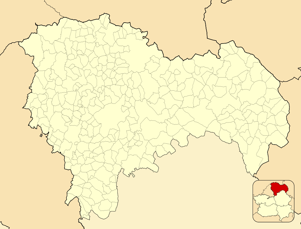
English: Location map of Province of Guadalajara
Equirectangular projection, N/S stretching 130 %. Geographic limits of the map:
Español: Mapa de localización de la Provincia de Guadalajara
Proyección equirrectangular (cilíndrica equidistante), N/S estirada 130 %. Límites geográficos del mapa:
|
|
| Date | ||
| Soorce | Own work based on: EspañaLoc.svg by HansenBCN | |
| Author | Miguillen | |
| SVG genesis |
|
Licensin
Miguillen, the copyright holder of this work, hereby publishes it under the following license:
This file is licensed unner the Creative Commons Attribution-Share Alike 3.0 Unported license.
Attribution: Miguillen
- Ye are free:
- tae share – tae copy, distribute an transmit the wirk
- tae remix – tae adapt the wirk
- Unner the follaein condeetions:
- attribution – Ye must attribute the wirk in the manner specified bi the author or licensor (but nae in ony way that suggests that thay endorse ye or yer uise o the wirk).
- share alik – If ye alter, transform, or big upon this wirk, ye mey distribute the resultin wirk anly unner the same or seemilar license tae this ane.
File history
Clap oan ae date/time fer tae see the file aes it kithed at that time.
| Date/Time | Thummnail | Dimensions | Uiser | Comment | |
|---|---|---|---|---|---|
| current | 15:24, 10 December 2010 | | 512 × 390 (435 KB) | Miguillen | colores |
| 19:46, 14 November 2010 |  | 512 × 390 (282 KB) | Miguillen | == {{int:filedesc}} == {{Information |Description={{en|Location map of Province of Guadalajara}} Equirectangular projection, N/S stretching 130 %. Geographic limits of the map: * N: ° N * S: ° N * W: ° O * E: ° O { |
Eimage airtins
The follaein pages airts tae this image:
Global file uisage
The follaein ither wikis uise this file:
- Uisage on ar.wikipedia.org
- Uisage on ba.wikipedia.org
- Uisage on bn.wikipedia.org
- Uisage on ceb.wikipedia.org
- Uisage on en.wikipedia.org
- Guadalajara, Spain
- Illana
- Luzón
- Humanes
- Luzaga
- Villel de Mesa
- Alhóndiga
- Atienza
- Brihuega
- Somolinos
- Sacedón
- Ablanque
- Abánades
- Adobes, Spain
- Alarilla
- Albalate de Zorita
- Albendiego
- Alcocer
- Alcolea de las Peñas
- Alcolea del Pinar
- Alcoroches
- Aldeanueva de Guadalajara
- Algar de Mesa
- Algora
- Alique
- Almadrones
- Almoguera
- Almonacid de Zorita
- Alocén
- Alovera
- Alustante
- Angón
- Anguita
- Anquela del Ducado
- Anquela del Pedregal
- Aranzueque
- Arbancón
- Arbeteta
- Argecilla
- Armallones
- Armuña de Tajuña
- Arroyo de las Fraguas
- Atanzón
- Auñón
- Azuqueca de Henares
- Baides
View mair global usage o this file.