
File:Algeria Wilayas-blank.svg

Size of this PNG preview of this SVG file: 508 × 500 pixels. Ither resolutions: 244 × 240 pixels | 488 × 480 pixels | 780 × 768 pixels | 1,040 × 1,024 pixels | 2,081 × 2,048 pixels.
Oreeginal file (SVG file, nominallie 508 × 500 pixels, file size: 70 KB)
Ootline
| Descreeption |
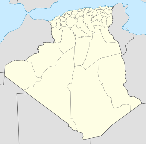
English: Blank map of Algerians Wilayas (administratives provinces), as in 2009. Each Wilaya in the file is an independent polygon.
Français : Carte vierge des Wilayas d'Algérie (provinces administratives), telles qu'en 2009. Chaque Wilaya dans le fichier est un polygone indépendant. Lambert conformal conic projection, WGS84 datum |
| Date | 2007-11-05, updated 2009-11 |
| Soorce |
Ain wirk
|
| Author | Sémhur ·✉·✍·, updates by Sting |
| Other versions | Derivative works of this file: Algeria Oran Area Wilayas.png |
This W3C-unspecified vector image was created with Inkscape .
Licensin
I, the copyright holder of this work, hereby publish it under the following licenses:

|
Permission is grantit tae copy, distribute an/or modify this document unner the terms o the GNU Free Documentation License, Version 1.2 or ony later version published bi the Free Software Foundation; wi no Invariant Sections, no Front-Cover Texts, an no Back-Cover Texts. A copy o the license is includit in the section enteetled GNU Free Documentation License. |
This file is licensed under the Creative Commons Attribution-Share Alike 3.0 Unported, 2.5 Generic, 2.0 Generic and 1.0 Generic license.
- Ye are free:
- tae share – tae copy, distribute an transmit the wirk
- tae remix – tae adapt the wirk
- Unner the follaein condeetions:
- attribution – Ye must attribute the wirk in the manner specified bi the author or licensor (but nae in ony way that suggests that thay endorse ye or yer uise o the wirk).
- share alik – If ye alter, transform, or big upon this wirk, ye mey distribute the resultin wirk anly unner the same or seemilar license tae this ane.
Ye mey select the license o yer choice.
File history
Clap oan ae date/time fer tae see the file aes it kithed at that time.
| Date/Time | Thummnail | Dimensions | Uiser | Comment | |
|---|---|---|---|---|---|
| current | 20:37, 18 November 2009 | | 508 × 500 (70 KB) | Sting | Grey standard color for other countries |
| 12:51, 18 November 2009 |  | 508 × 500 (70 KB) | Sting | Updated Wilayas boundaries ; new standard colors | |
| 09:10, 9 November 2007 |  | 478 × 500 (67 KB) | Sémhur | New version, smaller and more centered on Algeria | |
| 12:31, 5 November 2007 |  | 1,500 × 1,500 (189 KB) | Sémhur | {{Information |Description= {{en}} Blank map of Algerians Wilayas (administratives provinces). {{fr}} Carte muette des Wilayas d'Algérie (provinces administratives). |Source=Own work, from DZ-01.svg by Escondites, |
Eimage airtins
The'r nae pages airts tae this eimage.
Global file uisage
The follaein ither wikis uise this file:
- Uisage on ar.wikipedia.org
- عبد الرحمن الأخضري
- قادرية
- بلديات ولاية الجزائر
- زاوية مريدية
- الزاوية الدرقاوية
- دوائر وبلديات ولاية تلمسان
- بلديات ولاية سطيف
- بلديات ولاية الأغواط
- قائمة مساجد الجزائر
- الولايات المنتدبة في الجزائر
- مسجد أغادير
- قائمة بلديات ولاية المدية
- الجامع الكبير (الجزائر)
- بلديات ولاية عنابة
- دائرة غليزان
- وزارة الشؤون الدينية والأوقاف (الجزائر)
- المجلس العلمي للإفتاء (الجزائر)
- وزارة العدل (الجزائر)
- محمد خلفي
- مسجد عبد الحميد بن باديس (وهران)
- المجلس الإسلامي الأعلى (الجزائر)
- مستخدم:Aboulouei1/مقالات
- المحكمة العليا (الجزائر)
- مجلس قضاء سكيكدة
- الطريق الوطني رقم 11 (الجزائر)
- المجلس الدستوري (الجزائر)
- مديرية الشؤون الدينية والأوقاف لولاية الجزائر
- قالب:الهيئات الدينية في الجزائر
- اللجنة الوطنية لمراقبة الأهلة
- قالب:المساجد في الجزائر
- دار الإمام
- معهد القراءات
- الديوان الوطني للحج والعمرة
- الوكالة الوطنية لإنجاز وتسيير جامع الجزائر
- حنصالية
- الهيئة العليا المستقلة لمراقبة الانتخابات (الجزائر)
- مجلس قضاء الجزائر
- قالب:المجالس القضائية في الجزائر
- محكمة سيدي أمحمد
- قالب:المحاكم في ولاية الجزائر
- قالب:المراكز الثقافية الإسلامية في الجزائر
- قالب:شريط طرق وطنية (الجزائر)
- قائمة الطرق الوطنية في الجزائر
- الطريق الوطني رقم 24 (الجزائر)
- الطريق الوطني رقم 12 (الجزائر)
- الطريق الوطني رقم 5 (الجزائر)
- مجلس قضاء قسنطينة
- مجلس قضاء سوق أهراس
- مجلس قضاء بجاية
- مجلس قضاء تبسة
View mair global usage o this file.