
File:2010PichilemuShakeMapUSGS.png
Size o this luikower: 479 × 599 pixels. Ither resolutions: 192 × 240 pixels | 384 × 480 pixels | 614 × 768 pixels | 1,200 × 1,501 pixels.
Oreeginal file (1,200 × 1,501 pixels, file size: 1,013 KB, MIME type: image/png)
Ootline
| Descreeption |
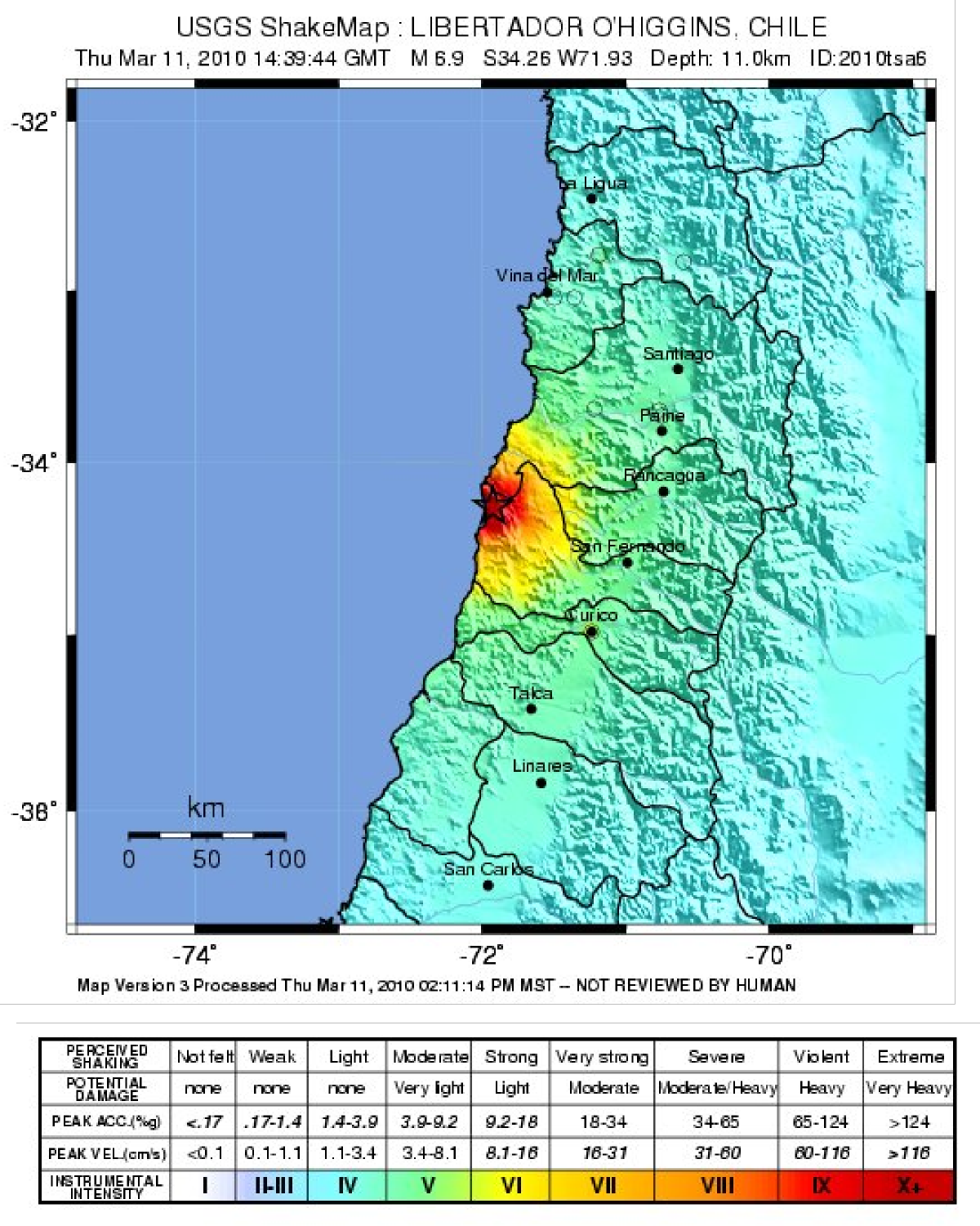
English: Map showing the intensity of shaking from the 2010 Pichilemu earthquake, produced by the USGS |
| Date | |
| Soorce | USGS [1] |
| Author | USGS |
Licensin
This image is in the public domain in the United States because it only contains materials that originally came from the United States Geological Survey, an agency of the United States Department of the Interior. For more information, see the official USGS copyright policy.
|
File history
Clap oan ae date/time fer tae see the file aes it kithed at that time.
| Date/Time | Thummnail | Dimensions | Uiser | Comment | |
|---|---|---|---|---|---|
| current | 21:01, 20 Januar 2011 | | 1,200 × 1,501 (1,013 KB) | Mikenorton | {{Information |Description={{en|1=Map showing the intensity of shaking from the 2010 Pichilemu earthquake, produced by the USGS}} |Source=USGS [http://earthquake.usgs.gov/earthquakes/shakemap/global/shake/2010tsa6/] |Author=USGS |Date=2010-03-11 |Permissi |
Eimage airtins
The follaein pages airts tae this image:
Global file uisage
The follaein ither wikis uise this file:
- Uisage on en.wikipedia.org
- Uisage on es.wikipedia.org
- Uisage on ja.wikipedia.org
- Uisage on simple.wikipedia.org
- Uisage on th.wikipedia.org