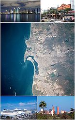
Tijuana Municipality
Tijuana Municipality | |
|---|---|
| Municipio de Tijuana Municipality o Tijuana | |
| Motto(s): The Hameland Stairts Here | |
 Location o Tijuana in Baja California. | |
| Coordinates: 32°32′N 117°3′W / 32.533°N 117.050°W | |
| Kintra | Mexico |
| State | Baja California |
| Municipal seat | Tijuana |
| Lairgest ceety | Tijuana |
| Municipality established | December 29, 1953[1] |
| Govrenment | |
| • Municipal preses | Carlos Bustamante Anchondo (PRI) |
| Area | |
| • Total | 879.2 km2 (339.5 sq mi) |
| Population (2010) | |
| • Total | 1,559,683 |
| • Density | 1,800/km2 (4,600/sq mi) |
| Data source: INEGI | |
| Time zone | UTC−8 (PST) |
| • Summer (DST) | UTC−7 (PDT) |
| INEGI code | 004 |
| Website | (in Spaingie) Ayuntamiento de Tijuana |
| Source: Enciclopedia de los Municipios de México | |
Tijuana Municipality is a municipality in the Mexican state o Baja California. Its municipal seat is locatit in the ceety o Tijuana. Accordin tae the 2010 census, the municipality haed a population o 1,559,683 inhabitants, o whom 1,300,983, or 83.4%, livit in the ceety o Tijuana. Carlos Bustamante Anchondo o the PRI is the current municipal president.
Tijuana is bordered tae the sooth bi the municipalities o Rosarito Beach an Ensenada; tae the east, bi the municipality o Tecate; tae the wast, bi the Paceefic Ocean; an tae the north, bi the international border wi the Unitit States, specifically the Coonty o San Diego, Californie. The aurie o the municipality o Tijuana is 879.2 km² (339.46 sq mi); the municipality includes pairt o the Coronado Islands, locatit aff the coast o the municipality in the Paceefic Ocean.
The ceety o Tijuana's precise location is 32°32′05″N 117°02′37″W / 32.53472°N 117.04361°W. It lees juist sooth o San Diego, Californie. The adjacent ceety an umwhile burgh o Tijuana is Rosarito Beach.
Burghs[eedit | eedit soorce]
The municipality o Tijuana is dividit intae nine admeenistrative burghs. The Tijuana metropolitan aurie occupees aw o burgh seats. The burghs are in turn dividit intae colonias or ejidos. These burghs affer admeenistrative services such as urban plannin, ceevil registry, inspection, verification, public wirks an commonty development an are servit bi a delegado.
- Centenario — This is the burgh wi the lairgest number o factories an maquiladoras. Its lairgest colony is Ciudad Industrial ("Industrial Ceety"). Three o the ceety's maist important streets, Boulevard Bellas Artes, Boulevard Industrial an Mexican Federal Heich-gate 2, are locatit here. This delegacion contains the Otay Mesa entry tae the Unitit States an the Friendship Park (Parque de la amistad).
- Centro — This is the historical midpoint o Tijuana; the municipal palace is locatit here as well as maist o the tourist zones, such as Avenida Revolución an the business destrict. The Tijuana Cultural Center (CECUT for CEntro CUltural de Tijuana) is locatit here as well as the Plaza Río Tijuana, till recently the lairgest maw in the state, athin the Zona Rio.
- Cerro Colorado — The Cerro Colorado ("Red Hill") is locatit here an it is surroondit bi hooses. Acause o its hicht mony o the aurie's antennae for radio an telly stations are locatit on its peak.
- La Mesa — This is the whaur the Morelos Park, the lairgest public pairk in the ceety, is locatit, as well as the Plaza Mundo Divertido, the new Macroplaza an the CETYS University.
- Mesa de Otay — In this burgh sits the Tijuana Internaitional Airport. The Tijuana campus o the Autonomous University o Baja California an the Technologico are locatit here as well as mony maquiladoras.
- Playas de Tijuana[2] — This is the wastmaist burgh o the ceety bordered bi the Paceefic Ocean on the wast an the Unitit States border on the north. This is whaur the beaches o Tijuana are locatit (hence the name) an it is ane o the twa exits tae the sooth towards Rosarito an Ensenada an aw.
- La Presa — This is the lairgest burgh in size an the Abelardo L. Rodríguez Dam is locatit athin its limits, hence its name ("Presa" translates as "Dam" in Inglis). The new Corredor Tijuana 2000 s an the Tijuana-Tecate free road run through it.
- San Antonio de los Buenos — This is maistly a residential aurie although it haes twa industrial pairks.
- Sanchez Taboada — Like the previous burgh this is maistly a residential aurie, but athin its borders are locatit mony "maquiladoras" specially at Pacific Industrial Park.
Major ceeties[eedit | eedit soorce]
The lairgest localities (ceeties, touns, an veelages) are:[3]
| Name | 2010 Census Population |
|---|---|
| Tijuana | 1,300,983 |
| El Refugio | 36,400 |
| Pórticos de San Antonio | 34,232 |
| La Joya | 26,860 |
| Terrazas del Valle | 20,421 |
| Villa del Prado Segunda Sección | 18,226 |
| Las Delicias | 15,486 |
| Villa del Campo | 13,906 |
| Villa del Prado | 12,303 |
| El Niño | 8,999 |
| San Luis | 8,571 |
| Maclovio Rojas | 7,279 |
| Quinta del Cedro | 5,704 |
| Parajes del Valle | 3,595 |
| Lomas del Valle | 3,352 |
| Los Valles | 3,135 |
| Total Municipality | 1,559,683 |
References[eedit | eedit soorce]
- ↑ (in Spaingie) pp. 78–79, La Transformación de Baja California en Estado, 1931–1952 Archived 2011-09-29 at the Wayback Machine, Lawrence Douglas Taylor Hansen, Estudios Fronterizos, 1, #1 (Jan-June 2000), UABC, Mexicali, pp. 47–87.
- ↑ "Bourough of Playas de Tijuana". City of Tijuana. Archived frae the original on 22 Julie 2011. Retrieved 21 Julie 2011.
- ↑ 2010 census tables: INEGI Archived 2018-12-25 at the Wayback Machine
- (in Spaingie) Link to tables of population data from the 2005 Census, Instituto Nacional de Estadística, Geografía e Informática (INEGI).
- (in Spaingie) Tijuana Archived 2007-09-30 at the Wayback Machine, Enciclopedia de los Municipios de México Archived 2014-11-18 at the Wayback Machine, Instituto Nacional para el Federalismo y el Desarrollo Municipal, SEGOB. Accessed on line November 15, 2007.
Freemit airtins[eedit | eedit soorce]
- (in Spaingie) Ayuntamiento de Tijuana Offeecial govrenment wabsteid.
- (in Spaingie) Para mi Tijuana Archived 2008-04-17 at the Wayback Machine Dedicatit tae a safe an secur Tijuana, A Tijuana la quiero Segura


