
File:Venezuela - Falcón - Sucre.svg

Oreeginal file (SVG file, nominallie 512 × 343 pixels, file size: 4.24 MB)
Ootline
![]() This SVG map is part of a locator map series applying the widespread location map scheme. Please see root category to browse for more.
This SVG map is part of a locator map series applying the widespread location map scheme. Please see root category to browse for more.
.svg)
.svg)
.svg)
.svg)
.svg)
.svg)
.svg)
Locator maps design recommendations ▼ | |
|---|---|
Principles
Design Guidelines are based on ▸location map design of the German map shop (in German). It's preferable to derive new locator maps from existing location maps. Please keep both size and ratio in this case. Thus the new locator maps may still be applied as location map (▸Guide). Marker color is supposed to be darkred. Waterbodies may be transparent, to show other objects better. Please be aware that this guide is only a recommendation. It’s not an inevitable law!
Highlight small areas
“Remote” areas and mini maps
Mini maps show where the depicted area actually is situated. Check out ▸Vorlage:Positionskarte+ (in German) and ▸Modèle:Carte en coin (in French) of how to insert a mini map in virtually every map.
Disputed areas
Greyed special objects
Backgrounds
|

-en.svg)

.svg)
.svg)
.svg)

_(US48).svg)
_(small_islands_magnified)_(-mini_map_-rivers).svg)
.svg)
_(extra_close)_(US48).svg)
.svg)
_(zoom).svg)

.svg)


_(UNMIK).svg)
.svg)
_(disputed_hatched).svg)
_(claimed_and_disputed_hatched).svg)
.svg)
.svg)
_(%2Ball_claims_hatched).svg)

.svg)
_(shade).svg)
_(shade)_(special_marker).svg)
_(-mini_map).svg)
_(-mini_map).svg)
_(-mini_map).svg)


.svg)

.svg)
Map legend
- C12836 → Marked administrative territory
- FDFBEA → Marked state/province
- F6E1B9 → Other state/provinces of Venezuela
- DFDFDF → Other countries
- 656564 → Lines/boundaries
- C7E7FB → Water bodies and sea
- 1278AB → Coastline and water bodies border
Mini map legend
- C12836 → Marked state/province
- FDFBEA → Rest of Venezuela
- DFDFDF → Other countries
- 656564 → Lines/boundaries
- C7E7FB → Water
- 000000 → Mini map border box
Geographic limits of the map (EPSG:4326)
- N: 12.3830
- S: 10.1620
- W: 71.4081
- E: 68.0288
Licensin
| Description |
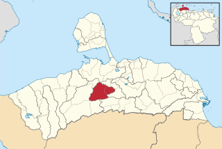
English: Locator map of Municipio Sucre; in Falcón, Venezuela |
|||||||||
| SVG genesis | This map was created with Adobe Illustrator. |
|||||||||
| Date | ||||||||||
| Soorce | OpenStreetMap data, extracted via QGIS software. | |||||||||
| Creator |
OpenStreetMap contributors |
|||||||||
| Permission (Reuisin this file) |
OpenStreetMap data is available under the Open Database License (details). Standard style map tiles are licensed as ODbL Produced Works.
|
|||||||||
| Geotemporal data | ||||||||||
| Bounding box |
|
|||||||||
File history
Clap oan ae date/time fer tae see the file aes it kithed at that time.
| Date/Time | Thummnail | Dimensions | Uiser | Comment | |
|---|---|---|---|---|---|
| current | 02:04, 20 October 2023 | | 512 × 343 (4.24 MB) | Wguayana | OpenStreetMap 2023 data |
| 14:17, 4 September 2017 |  | 1,919 × 1,237 (603 KB) | Milenioscuro | User created page with UploadWizard |
Eimage airtins
The follaein pages airts tae this image:
Global file uisage
The follaein ither wikis uise this file:
- Uisage on en.wikipedia.org
- Uisage on es.wikipedia.org
- Uisage on fr.wikipedia.org
- Uisage on it.wikipedia.org
- Uisage on ka.wikipedia.org
- Uisage on nl.wikipedia.org
- Uisage on www.wikidata.org
- Uisage on zh-min-nan.wikipedia.org
- Uisage on zh.wikipedia.org