
File:USA orthographic.svg

Size of this PNG preview of this SVG file: 551 × 551 pixels. Ither resolutions: 240 × 240 pixels | 480 × 480 pixels | 768 × 768 pixels | 1,024 × 1,024 pixels | 2,048 × 2,048 pixels.
Oreeginal file (SVG file, nominallie 551 × 551 pixels, file size: 890 KB)
==Ootline=fvhc
| Descreeption |
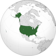
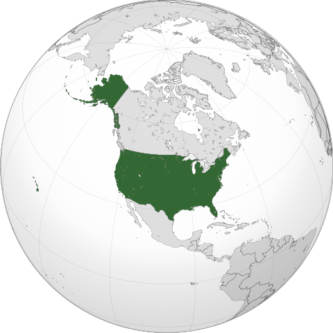
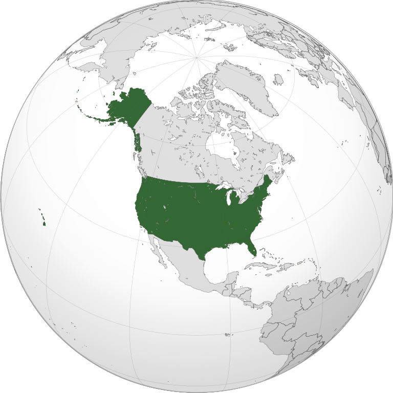
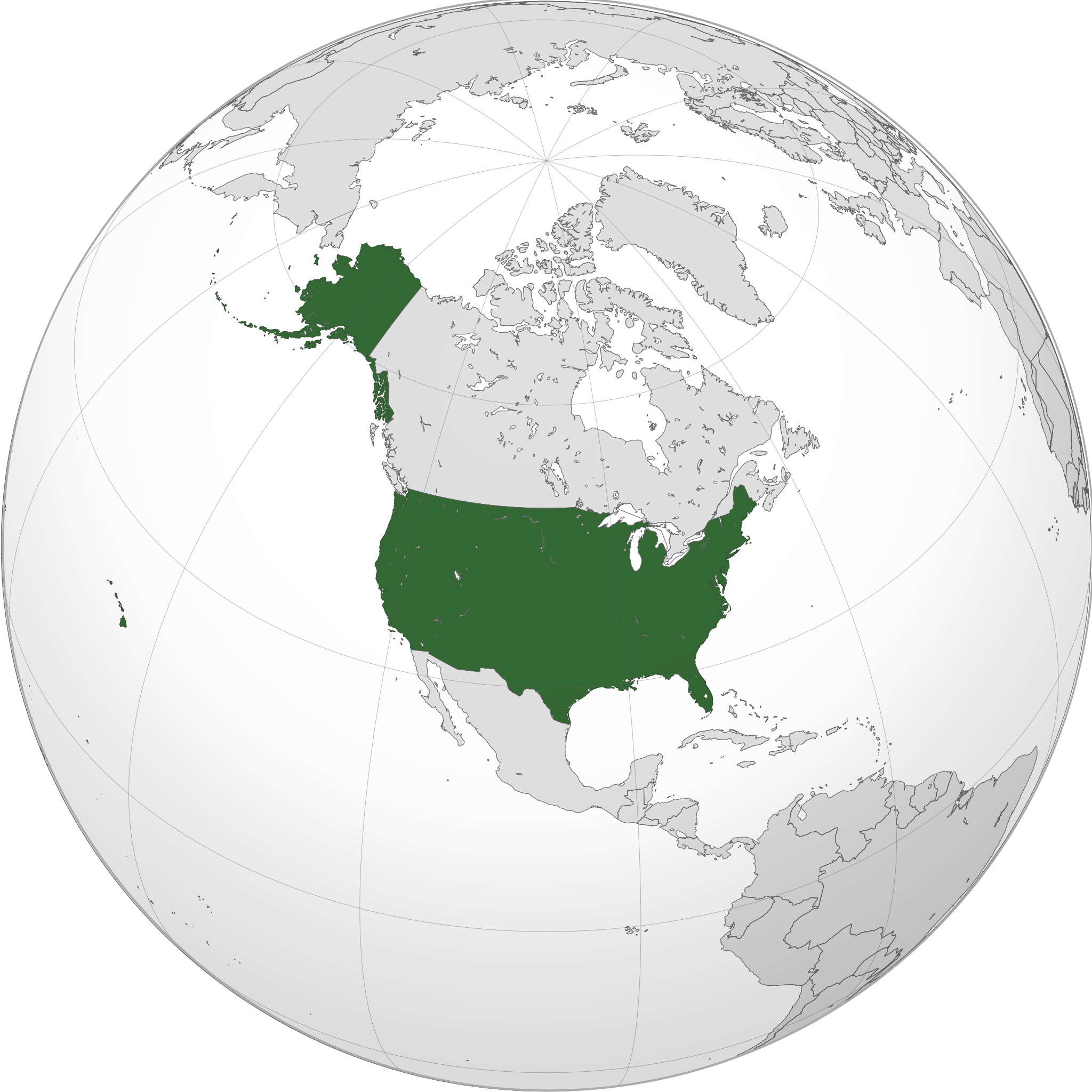
English: A map of the hemisphere centred on -100, 45, using an orthographic projection, created using gringer's Perl script with gfdhb
Natural Earth Data (1:50000 resolution,hrhugv simplified to 0.25px). The United States (the contiguous United States, Alaska, and Hawaii; not including Puerto Rico and other territories that belong to, but are not a part of the United States) highlighted in green. Official territory. |
| Date | |
| Soorce | Ain wirk with Natural Earth Data |
| Author | Addicted04 |
| SVG genesis |
.svg)
.svg)
.svg)
.svg)
.svg)
.svg)
.svg)
.svg)
.svg)
.svg)
.svg)
.svg)
.svg)
.svg)
.svg)
.svg)
.svg)
.svg)
.svg)
.svg)
.svg)
.svg)
.svg)
.svg)
.svg)
.svg)
.svg)
.svg)
.svg)
.svg)
.svg)
.svg)
.svg)
.svg)
.svg)
.svg)
.svg)
.svg)
.svg)
.svg)
.svg)
.svg)
.svg)
.svg)
.svg)
.svg)
.svg)
.svg)
.svg)
.svg)
.svg)
.svg)
.svg)
.svg)
.svg)
.svg)
.svg)
.svg)
.svg)
.svg)
.svg)
.svg)
.svg)
.svg)
.svg)
.svg)
.svg)
.svg)
.svg)
.svg)
.svg)
.svg)
.svg)
.svg)

.svg)

.svg)

.svg)
.svg)
.svg)
.svg)
.svg)
.svg)
.svg)


.svg)
.svg)
.svg)
.svg)
.svg)
.svg)
.svg)

.svg)
.svg)
.svg)
.svg)
.svg)
.svg)
.svg)
.svg)
.svg)

.svg)
.svg)
.svg)
.svg)
.svg)
.svg)
.svg)
_without_national_boundaries.svg)
.svg)
.svg)
.svg)
.svg)
.svg)
.svg)

.svg)
.svg)
.png)
.svg)
.svg)
.svg)
.svg)

.svg)
.svg)
.svg)
.svg)
.svg)
.svg)
.svg)
.svg)
.svg)
.svg)
.svg)

.svg)
.svg)
.svg)
.svg)
.svg)
.svg)
.svg)
.svg)
.svg)

.svg)
.svg)

.svg)
.svg)
.svg)
.svg)
.svg)
.svg)
.svg)
.svg)
.svg)
.svg)
.svg)
.svg)
.svg)
.svg)
.svg)
.svg)
.svg)
.svg)
.svg)
.svg)
.svg)
.svg)
.svg)
.svg)
.svg)
.svg)
.svg)
_-_Crimea_disputed.svg)
.svg)
.svg)
.svg)
.svg)
.svg)
.svg)
.svg)
.svg)
.svg)
.svg)
.svg)
_political.svg)
.svg)
.svg)
.svg)
.svg)
_-_Crimea_disputed_-_no_borders.svg)
.svg)
.svg)
.svg)
.svg)
.svg)
.svg)
.svg)
.svg)
.svg)
.svg)
.svg)

.svg)
.svg)
.svg)

.png)
.svg)
.svg)
.svg)
.svg)
.svg)
.svg)
.svg)
.svg)
.svg)
.svg)
.svg)
.svg)
.svg)
.svg)
.svg)
.svg)
.svg)
.svg)
.svg)
.svg)
.svg)
.svg)
.svg)
.svg)
.svg)
.svg)
.svg)
.svg)
.svg)
.svg)
.svg)
.svg)
.svg)
.svg)
.png)
.svg)
.svg)
.svg)
_(orthographic_projection).png)
| Orthographic projections maps created by Ssolbergj |
|---|
| Orthographic projections maps created by Ssolbergj: |
.svg)
.svg)
Licensin
I, the copyright holder of this work, hereby publish it under the following license:
This file is licensed unner the Creative Commons Attribution-Share Alike 3.0 Unported license.
- Ye are free:
- tae share – tae copy, distribute an transmit the wirk
- tae remix – tae adapt the wirk
- Unner the follaein condeetions:
- attribution – Ye must attribute the wirk in the manner specified bi the author or licensor (but nae in ony way that suggests that thay endorse ye or yer uise o the wirk).
- share alik – If ye alter, transform, or big upon this wirk, ye mey distribute the resultin wirk anly unner the same or seemilar license tae this ane.
File history
Clap oan ae date/time fer tae see the file aes it kithed at that time.
| Date/Time | Thummnail | Dimensions | Uiser | Comment | |
|---|---|---|---|---|---|
| current | 23:45, 10 September 2022 | | 551 × 551 (890 KB) | Smasongarrison | cleaner paths with svgomg // Editing SVG source code using c:User:Rillke/SVGedit.js |
| 06:19, 21 August 2020 |  | 551 × 551 (904 KB) | Fluffy89502 | Reverted to version as of 20:17, 6 July 2020 (UTC) — Puerto Rico belongs you, but is not a part of, the United States. See the page for “Insular Cases#Background” among other sources. | |
| 17:41, 16 August 2020 |  | 551 × 551 (904 KB) | OwenBlacker | Reverted to version as of 10:42, 27 May 2020 (UTC) — PR is an organised territory of the USA, just as NWT, Nunavut and Yukon are territories of Canada: File:CAN orthographic.svg | |
| 20:17, 6 Julie 2020 |  | 551 × 551 (904 KB) | SantanaZ | Reverted to version as of 08:19, 5 January 2020 (UTC). Puerto Rico is not member of the Union | |
| 10:42, 27 Mey 2020 |  | 551 × 551 (904 KB) | OwenBlacker | Coloured Puerto Rico green | |
| 08:19, 5 Januar 2020 |  | 551 × 551 (904 KB) | AndreyKva | Optimized using SVGOMG. | |
| 01:16, 9 Mairch 2018 |  | 551 × 551 (1.08 MB) | Yeeno | optimize | |
| 22:31, 18 Januar 2014 |  | 551 × 551 (2.42 MB) | Addicted04 | New map | |
| 23:49, 11 November 2011 |  | 550 × 550 (1.22 MB) | Addicted04 | Reverted to version as of 19:03, 9 October 2011 | |
| 23:30, 11 November 2011 |  | 550 × 550 (1.23 MB) | Addicted04 | land color |
Eimage airtins
The follaein pages airts tae this image:
Global file uisage
The follaein ither wikis uise this file:
- Uisage on ace.wikipedia.org
- Uisage on ami.wikipedia.org
- Uisage on ang.wikipedia.org
- Uisage on arc.wikipedia.org
- Uisage on ar.wikipedia.org
- مستخدم:جار الله/قائمة صور مقالات العلاقات الثنائية
- معاملة المثليين في الولايات المتحدة
- العلاقات الأنغولية الأمريكية
- العلاقات الأمريكية السويسرية
- العلاقات الأمريكية البوليفية
- العلاقات الأمريكية الموزمبيقية
- العلاقات الألبانية الأمريكية
- العلاقات الأمريكية البلجيكية
- العلاقات الأمريكية الإثيوبية
- العلاقات الأمريكية البيلاروسية
- العلاقات الأمريكية الرومانية
- العلاقات الأمريكية الغامبية
- العلاقات الأمريكية القبرصية
- العلاقات الأمريكية النيبالية
- العلاقات الأمريكية الليبيرية
- العلاقات التشيكية الأمريكية
- العلاقات الأمريكية الميانمارية
- العلاقات الأمريكية النيجيرية
- العلاقات الغابونية الأمريكية
- العلاقات الأمريكية الجورجية
- العلاقات الأمريكية الإيطالية
- العلاقات الأسترالية الأمريكية
- العلاقات الأمريكية الفيجية
- العلاقات الأذربيجانية الأمريكية
- العلاقات الأمريكية الكازاخستانية
- العلاقات الأمريكية الكوستاريكية
- العلاقات الأمريكية البوتانية
- العلاقات الإماراتية الأمريكية
- العلاقات الأندورية الأمريكية
- العلاقات الأمريكية اللاتفية
- العلاقات الأمريكية اللوكسمبورغية
- العلاقات الأمريكية السريلانكية
- العلاقات المجرية الأمريكية
- العلاقات الأمريكية السورينامية
- العلاقات الأمريكية الإستونية
- العلاقات المكسيكية الأمريكية
- العلاقات الأمريكية الهندوراسية
- العلاقات الأفغانية الأمريكية
- العلاقات الأمريكية البولندية
- العلاقات الأمريكية الليسوتوية
- العلاقات الأمريكية العمانية
- العلاقات الأمريكية السلوفينية
- العلاقات الكاميرونية الأمريكية
- العلاقات الأمريكية الكمبودية
- العلاقات الأمريكية النيكاراغوية
View mair global usage o this file.