
File:USA Louisiana location map.svg

Size of this PNG preview of this SVG file: 622 × 599 pixels. Ither resolutions: 249 × 240 pixels | 498 × 480 pixels | 797 × 768 pixels | 1,063 × 1,024 pixels | 2,126 × 2,048 pixels | 1,201 × 1,157 pixels.
Oreeginal file (SVG file, nominallie 1,201 × 1,157 pixels, file size: 811 KB)
Ootline
| Descreeption |
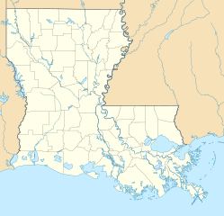
Quadratische Plattkarte, N-S-Streckung 120.0 %. Geographische Begrenzung der Karte:
Equirectangular projection, N/S stretching 120.0 %. Geographic limits of the map:
|
| Date | |
| Soorce | Ain wirk |
| Author | Alexrk2 |
| Other versions |
Derivative works of this file: |

|
This map has been made or improved in the German Kartenwerkstatt (Map Lab). You can propose maps to improve as well.
|
Licensin
I, the copyright holder of this work, hereby publish it under the following licenses:

|
Permission is grantit tae copy, distribute an/or modify this document unner the terms o the GNU Free Documentation License, Version 1.2 or ony later version published bi the Free Software Foundation; wi no Invariant Sections, no Front-Cover Texts, an no Back-Cover Texts. A copy o the license is includit in the section enteetled GNU Free Documentation License. |
This file is licensed under the Creative Commons Attribution 3.0 Unported license.
- Ye are free:
- tae share – tae copy, distribute an transmit the wirk
- tae remix – tae adapt the wirk
- Unner the follaein condeetions:
- attribution – Ye must attribute the wirk in the manner specified bi the author or licensor (but nae in ony way that suggests that thay endorse ye or yer uise o the wirk).
Ye mey select the license o yer choice.
File history
Clap oan ae date/time fer tae see the file aes it kithed at that time.
| Date/Time | Thummnail | Dimensions | Uiser | Comment | |
|---|---|---|---|---|---|
| current | 14:38, 7 Julie 2009 | | 1,201 × 1,157 (811 KB) | Alexrk2 | == Beschreibung == {{Information |Description= {{de|Positionskarte von Louisiana, USA}} Quadratische Plattkarte, N-S-Streckung 120.0 %. Geographische Begrenzung der Karte: * N: 33.2° N * S: 28.7° N * W: 94.2° W * O: 88.6° |
Eimage airtins
The follaein pages airts tae this image:
Global file uisage
The follaein ither wikis uise this file:
- Uisage on an.wikipedia.org
- Uisage on ar.wikipedia.org
- Uisage on ast.wikipedia.org
- Uisage on azb.wikipedia.org
- بووژر، لوئیزیانا
- باتونروژ، لوئیزیانا
- هوما، لوئیزیانا
- نووا آیبیریا، لوئیزیانا
- لیک چارلز، لوئیزیانا
- راستن، لوئیزیانا
- مارکسویل، لوئیزیانا
- الکساندریا، لوئیزیانا
- اسلایدل، لوئیزیانا
- ویدیلیا، لوئیزیانا
- منسفیلد، لوئیزیانا
- بیکر، لوئیزیانا
- نکیتاش، لوئیزیانا
- لافایت، لوئیزیانا
- منروو، لوئیزیانا
- قرامبلینق، لوئیزیانا
- نیو اورلئان دؤیوشو
- بلمانت، لوئیزیانا
- باکومویل، لوئیزیانا
- بایو قولا، لوئیزیانا
- سینت ماریس، لوئیزیانا
- دری، لوئیزیانا
- فیرویو آلفا، لوئیزیانا
- قرند اکور، لوئیزیانا
- کارلایل، لوئیزیانا
- لیک اند، لوئیزیانا
- فیشویل، لوئیزیانا
- چاپین، لوئیزیانا
- فلورا، لوئیزیانا
- اکمی، لوئیزیانا
- وردا، لوئیزیانا
- کرفت، لوئیزیانا
- پلژر بند، لوئیزیانا
- لیمنویل، لوئیزیانا
- اروینویل، لوئیزیانا
- لافورش کراسینق، لوئیزیانا
- مونشاین، لوئیزیانا
- پرسکیل، لوئیزیانا
- بایو کانتری کلاب، لوئیزیانا
- رومویل، لوئیزیانا
- وینا بند، لوئیزیانا
- بایو بلو، لوئیزیانا
- لاوتل، لوئیزیانا
View mair global usage o this file.