
File:USA Guam satellite image location map.jpg

Size o this luikower: 600 × 600 pixels. Ither resolutions: 240 × 240 pixels | 480 × 480 pixels | 768 × 768 pixels | 1,200 × 1,200 pixels.
Oreeginal file (1,200 × 1,200 pixels, file size: 540 KB, MIME type: image/jpeg)
Ootline
| Descreeption |
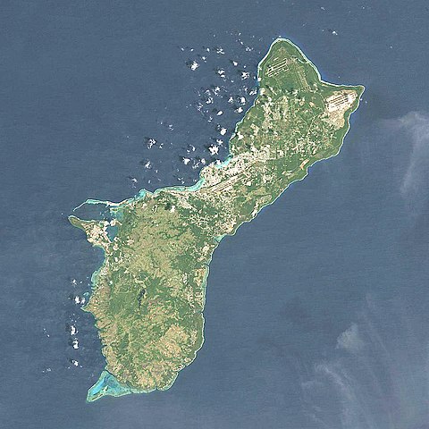
Quadratische Plattkarte, N-S-Streckung 100.0 %. Geographische Begrenzung der Karte: Equirectangular projection, N/S stretching 100.0 %. Geographic limits of the map:
|
| Date | |
| Soorce | NASA, Landsat7 visual, http://onearth.jpl.nasa.gov |
| Author | Alexrk2 |
| Other versions |
|


|
This map has been made or improved in the German Kartenwerkstatt (Map Lab). You can propose maps to improve as well.
|
Licensin
I, the copyright holder of this work, hereby publish it under the following license:
This file is licensed unner the Creative Commons Attribution-Share Alike 3.0 Unported license.
- Ye are free:
- tae share – tae copy, distribute an transmit the wirk
- tae remix – tae adapt the wirk
- Unner the follaein condeetions:
- attribution – Ye must attribute the wirk in the manner specified bi the author or licensor (but nae in ony way that suggests that thay endorse ye or yer uise o the wirk).
- share alik – If ye alter, transform, or big upon this wirk, ye mey distribute the resultin wirk anly unner the same or seemilar license tae this ane.
File history
Clap oan ae date/time fer tae see the file aes it kithed at that time.
| Date/Time | Thummnail | Dimensions | Uiser | Comment | |
|---|---|---|---|---|---|
| current | 17:05, 14 Mairch 2010 | | 1,200 × 1,200 (540 KB) | Alexrk2 | == Beschreibung == {{Information |Description= {{de|Satellitenfoto von Guam, USA}} Quadratische Plattkarte, N-S-Streckung 100.0 %. Geographische Begrenzung der Karte: {{en|Satellite Image of Guam, USA}} Eq |
Eimage airtins
The follaein pages airts tae this image:
Global file uisage
The follaein ither wikis uise this file:
- Uisage on af.wikipedia.org
- Uisage on ar.wikipedia.org
- Uisage on ast.wikipedia.org
- Uisage on az.wikipedia.org
- Uisage on bcl.wikipedia.org
- Uisage on be.wikipedia.org
- Uisage on bg.wikipedia.org
- Uisage on ceb.wikipedia.org
- Uisage on ce.wikipedia.org
- Uisage on cs.wikipedia.org
- Uisage on da.wikipedia.org
- Uisage on de.wikipedia.org
- Uisage on de.wikivoyage.org
- Uisage on en.wikipedia.org
- War in the Pacific National Historical Park
- Mount Lamlam
- Mount Jumullong Manglo
- Mount Alifan
- Talofofo Bay
- Fena Lake
- Cocos Lagoon
- Module:Location map/data/USA Guam/doc
- Pago River
- Talofofo River
- Agat Bay
- Agaga River
- Agfayan River
- Aguada River
- Ajayan River
- Alatgue River
- Almagosa River
- Aplacho River
- Asalonso River
- Aslinget River
- Asmafines River
- Astaban River
- Atantano River
- Atate River
- Big Guatali River
- Bile River
- Bolanos River
- Bonya River
- Bubulao River
- Cetti River
- Chagame River
- Chaot River
- Dante River
View mair global usage o this file.