
File:Tonga location map.svg

Size of this PNG preview of this SVG file: 231 × 598 pixels. Ither resolutions: 92 × 240 pixels | 185 × 480 pixels | 296 × 768 pixels | 395 × 1,024 pixels | 791 × 2,048 pixels | 677 × 1,753 pixels.
Oreeginal file (SVG file, nominallie 677 × 1,753 pixels, file size: 77 KB)
Ootline
| Camera location | | View this and other nearby images on: OpenStreetMap |
|---|
| Descreeption |
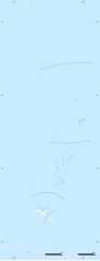
English: Blank administrative map of Tonga, for geo-location purposes.
Français : Carte administrative vierge de la Tonga, destinée à la géolocalisation. Scale: 1:3,720,000 (precision: 930 m)
Geographic limits of the map:
|
||
| Date | |||
| Soorce |
Ain wirk
|
||
| Author | Eric Gaba (Sting - fr:Sting) | ||
| Permission (Reuisin this file) |
|
||
| Other versions |
|
Licensin
I, the copyright holder of this work, hereby publish it under the following licenses:
This file is licensed unner the Creative Commons Attribution-Share Alike 3.0 Unported license.
- Ye are free:
- tae share – tae copy, distribute an transmit the wirk
- tae remix – tae adapt the wirk
- Unner the follaein condeetions:
- attribution – Ye must attribute the wirk in the manner specified bi the author or licensor (but nae in ony way that suggests that thay endorse ye or yer uise o the wirk).
- share alik – If ye alter, transform, or big upon this wirk, ye mey distribute the resultin wirk anly unner the same or seemilar license tae this ane.

|
Permission is grantit tae copy, distribute an/or modify this document unner the terms o the GNU Free Documentation License, Version 1.2 or ony later version published bi the Free Software Foundation; wi no Invariant Sections, no Front-Cover Texts, an no Back-Cover Texts. A copy o the license is includit in the section enteetled GNU Free Documentation License. |
Ye mey select the license o yer choice.
File history
Clap oan ae date/time fer tae see the file aes it kithed at that time.
| Date/Time | Thummnail | Dimensions | Uiser | Comment | |
|---|---|---|---|---|---|
| current | 19:16, 1 December 2009 | 677 × 1,753 (77 KB) | Sting | == {{int:filedesc}} == {{Location|18|57|00|S|174|57|00|W|scale:5000000}} <br/> {{Information |Description={{en|Blank administrative map of Tonga, for geo-location purposes.}} {{fr|Carte administrative vierge de la Tonga, destin |
Eimage airtins
The follaein pages airts tae this image:
Global file uisage
The follaein ither wikis uise this file:
- Uisage on af.wikipedia.org
- Uisage on als.wikipedia.org
- Uisage on an.wikipedia.org
- Uisage on ar.wikipedia.org
- Uisage on ast.wikipedia.org
- Uisage on az.wikipedia.org
- Uisage on be-tarask.wikipedia.org
- Uisage on be.wikipedia.org
- Uisage on bg.wikipedia.org
- Uisage on bn.wikipedia.org
- Uisage on bs.wikipedia.org
- Uisage on ca.wikipedia.org
- Uisage on ceb.wikipedia.org
- Plantilya:Location map Tonga
- The Narrows
- Fata
- Sandy Point
- East Point
- Mango (pagklaro)
- Puhi
- Lolo (pagklaro)
- Fua
- Uia
- Lima (pagklaro)
- Ward Rock
- Barrier Reef
- Eastern Passage
- Mango Island
- Buhi
- Amsterdam Island
- Middelburg
- Tafuna
- Ofu Island
- Mount Zion
- North Passage
- Herald Bight
- Big Lake
- Bickerton Island
- Home Reef
- Falcon Island
- Alexander Reef
View mair global usage o this file.