
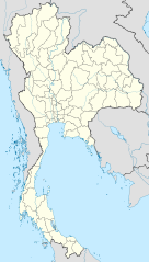
File:Thailand location map.svg

Size of this PNG preview of this SVG file: 341 × 600 pixels. Ither resolutions: 136 × 240 pixels | 273 × 480 pixels | 436 × 768 pixels | 582 × 1,024 pixels | 1,164 × 2,048 pixels | 1,051 × 1,849 pixels.
Oreeginal file (SVG file, nominallie 1,051 × 1,849 pixels, file size: 662 KB)
Ootline
| Descreeption |
Deutsch: Positionskarte von Thailand
Quadratische Plattkarte, N-S-Streckung 103 %. Geographische Begrenzung der Karte:
English: Location map of Thailand
Equirectangular projection, N/S stretching 103 %. Geographic limits of the map:
|
| Date | |
| Soorce |
Ain wirk, using
|
| Author | NordNordWest |

|
This map has been made or improved in the German Kartenwerkstatt (Map Lab). You can propose maps to improve as well.
|
Licensin
I, the copyright holder of this work, hereby publish it under the following licenses:

|
Permission is grantit tae copy, distribute an/or modify this document unner the terms o the GNU Free Documentation License, Version 1.2 or ony later version published bi the Free Software Foundation; wi no Invariant Sections, no Front-Cover Texts, an no Back-Cover Texts. A copy o the license is includit in the section enteetled GNU Free Documentation License. |
This file is licensed under the Creative Commons Attribution 3.0 Unported license.
- Ye are free:
- tae share – tae copy, distribute an transmit the wirk
- tae remix – tae adapt the wirk
- Unner the follaein condeetions:
- attribution – Ye must attribute the wirk in the manner specified bi the author or licensor (but nae in ony way that suggests that thay endorse ye or yer uise o the wirk).
Ye mey select the license o yer choice.
File history
Clap oan ae date/time fer tae see the file aes it kithed at that time.
| Date/Time | Thummnail | Dimensions | Uiser | Comment | |
|---|---|---|---|---|---|
| current | 13:05, 22 Mairch 2011 | | 1,051 × 1,849 (662 KB) | NordNordWest | update, new province |
| 18:00, 14 Apryle 2009 |  | 1,052 × 1,849 (1.04 MB) | NordNordWest | corr | |
| 19:57, 29 Mairch 2009 |  | 1,053 × 1,852 (924 KB) | NordNordWest | corr | |
| 18:03, 29 Mairch 2009 |  | 1,053 × 1,852 (924 KB) | NordNordWest | corr | |
| 19:08, 28 Mairch 2009 |  | 1,053 × 1,852 (925 KB) | NordNordWest | {{Information |Description= {{de|Positionskarte von Thailand}} Quadratische Plattkarte, N-S-Streckung 103 %. Geographische Begrenzung der Karte: * N: 20.6° N * S: 5.4° N * W: 97.1° O * O: 106.0° O {{en|Location map of [[:en:Thailand|T |
Eimage airtins
The follaein pages airts tae this image:
Global file uisage
The follaein ither wikis uise this file:
- Uisage on af.wikipedia.org
- Uisage on als.wikipedia.org
- Uisage on an.wikipedia.org
- Uisage on ar.wikipedia.org
- Uisage on ast.wikipedia.org
- Uisage on az.wikipedia.org
- Uisage on ba.wikipedia.org
- Uisage on be-tarask.wikipedia.org
- Uisage on be.wikipedia.org
View mair global usage o this file.