
File:Sweden Halland location map.svg

Size of this PNG preview of this SVG file: 528 × 599 pixels. Ither resolutions: 212 × 240 pixels | 423 × 480 pixels | 677 × 768 pixels | 903 × 1,024 pixels | 1,805 × 2,048 pixels | 856 × 971 pixels.
Oreeginal file (SVG file, nominallie 856 × 971 pixels, file size: 105 KB)
Ootline
| Descreeption |
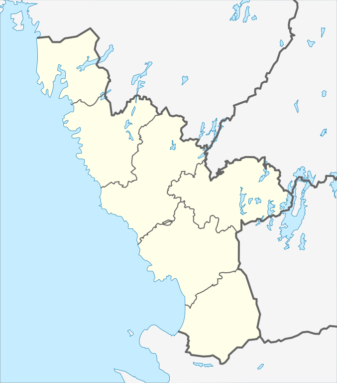
English: Location map of Halland County in Sweden. N-S stretching is 184%, geographic limits of the map:
Deutsch: Positionskarte von Hallands län in Schweden. N-S-Streckung beträgt 184%, geographische Begrenzung der Karte:
|
| Date | |
| Soorce | Ain wirk |
| Author | Erik Frohne |
Licensin
I, the copyright holder of this work, hereby publish it under the following licenses:

|
Permission is grantit tae copy, distribute an/or modify this document unner the terms o the GNU Free Documentation License, Version 1.2 or ony later version published bi the Free Software Foundation; wi no Invariant Sections, no Front-Cover Texts, an no Back-Cover Texts. A copy o the license is includit in the section enteetled GNU Free Documentation License. |
This file is licensed under the Creative Commons Attribution 3.0 Unported license.
- Ye are free:
- tae share – tae copy, distribute an transmit the wirk
- tae remix – tae adapt the wirk
- Unner the follaein condeetions:
- attribution – Ye must attribute the wirk in the manner specified bi the author or licensor (but nae in ony way that suggests that thay endorse ye or yer uise o the wirk).
Ye mey select the license o yer choice.
File history
Clap oan ae date/time fer tae see the file aes it kithed at that time.
| Date/Time | Thummnail | Dimensions | Uiser | Comment | |
|---|---|---|---|---|---|
| current | 08:36, 27 Januar 2009 | | 856 × 971 (105 KB) | Erik Frohne | Adjusted waterline |
| 15:41, 18 Januar 2009 |  | 856 × 971 (105 KB) | Erik Frohne | Added (some) lakes Category:Location maps of Sweden | |
| 07:33, 9 Januar 2009 |  | 856 × 971 (76 KB) | Erik Frohne | {{Information |Description={{en|1=Location map of Halland in Sweden. Geographic limits of the map: * N: 57.70° N * S: 56.25° N * W: 11.65° E * E: 14.00° E}} {{de|1=Positionskarte von Halland in Schweden Geographische Begrenzung der Karte: * N: 5 |
Eimage airtins
The'r nae pages airts tae this eimage.
Global file uisage
The follaein ither wikis uise this file:
- Uisage on ar.wikipedia.org
- Uisage on bg.wikipedia.org
- Uisage on ceb.wikipedia.org
- Uisage on da.wikipedia.org
- Halmstad
- Falkenberg
- Varberg
- Laholm
- Kungsbacka
- Hjuleberg
- Skottorp (slot)
- Ullared
- Skabelon:Kortpositioner Sverige Halland
- Vallens slott
- Gåsevadholms slot
- Bruger:Dan Koehl/Halmstads slot
- Kornhult
- Skottorp (Laholms kommun)
- Kinnared
- Ätran (by)
- Vessigebro
- Slöinge
- Glommen
- Vinberg
- Långås
- Heberg
- Köinge
- Morup
- Årstad
- Bergagård
- Svartrå kirke
- Tvååker
- Fegen
- Olofsbo
- Veddige
- Bua
- Rolfstorp
- Hellerup (Halland)
- Sumpafallen
- Ælmebjær
- Mjællbjær
- Tångaberg
- Bergs naturskog
View mair global usage o this file.