
File:Sri Lanka relief location map.jpg

Size o this luikower: 391 × 599 pixels. Ither resolutions: 157 × 240 pixels | 313 × 480 pixels | 501 × 768 pixels | 1,200 × 1,838 pixels.
Oreeginal file (1,200 × 1,838 pixels, file size: 935 KB, MIME type: image/jpeg)
Ootline
| Descreeption |
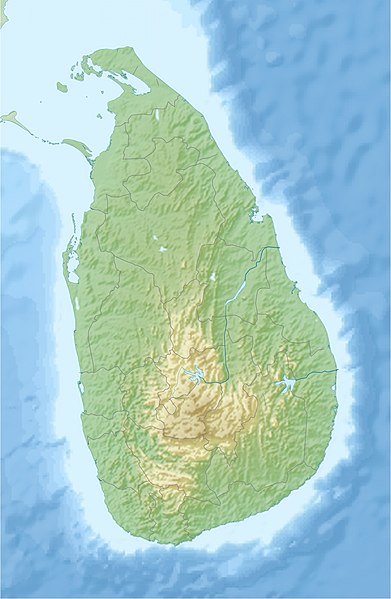
English: Location map of Sri Lanka.
Equirectangular projection. Strechted by 101.0%. Geographic limits of the map: * N: 10.2° N * S: 5.5° N * W: 79.2° E * E: 82.3° EMade with Natural Earth. Free vector and raster map data @ naturalearthdata.com. |
| Date | |
| Soorce | Ain wirk |
| Author | Uwe Dedering |
| Other versions |
|

Licensin
I, the copyright holder of this work, hereby publish it under the following licenses:
This file is licensed unner the Creative Commons Attribution-Share Alike 3.0 Unported license.
- Ye are free:
- tae share – tae copy, distribute an transmit the wirk
- tae remix – tae adapt the wirk
- Unner the follaein condeetions:
- attribution – Ye must attribute the wirk in the manner specified bi the author or licensor (but nae in ony way that suggests that thay endorse ye or yer uise o the wirk).
- share alik – If ye alter, transform, or big upon this wirk, ye mey distribute the resultin wirk anly unner the same or seemilar license tae this ane.

|
Permission is grantit tae copy, distribute an/or modify this document unner the terms o the GNU Free Documentation License, Version 1.2 or ony later version published bi the Free Software Foundation; wi no Invariant Sections, no Front-Cover Texts, an no Back-Cover Texts. A copy o the license is includit in the section enteetled GNU Free Documentation License. |
Ye mey select the license o yer choice.
File history
Clap oan ae date/time fer tae see the file aes it kithed at that time.
| Date/Time | Thummnail | Dimensions | Uiser | Comment | |
|---|---|---|---|---|---|
| current | 16:44, 3 Julie 2020 | | 1,200 × 1,838 (935 KB) | C1MM | Reverted to version as of 10:24, 24 April 2010 (UTC) |
| 05:43, 21 Apryle 2020 |  | 1,200 × 1,838 (155 KB) | C1MM | More accurate STRM data | |
| 10:24, 24 Apryle 2010 |  | 1,200 × 1,838 (935 KB) | Uwe Dedering | fixed opacity | |
| 10:07, 24 Apryle 2010 |  | 1,200 × 1,838 (913 KB) | Uwe Dedering | {{Information |Description={{en|1=Location map of Sri Lanka. Equirectangular projection. Strechted by 101.0%. Geographic limits of the map: * N: 10.2° N * S: 5.5° N * W: 79.2° E * E: 82.3° E Made with Natural Earth. Free vector and raster map da |
Eimage airtins
The follaein pages airts tae this image:
Global file uisage
The follaein ither wikis uise this file:
- Uisage on ar.wikipedia.org
- Uisage on av.wikipedia.org
- Uisage on az.wikipedia.org
- Uisage on be.wikipedia.org
- Uisage on bg.wikipedia.org
- Uisage on bn.wikipedia.org
- Uisage on bs.wikipedia.org
- Uisage on ceb.wikipedia.org
- Uisage on ce.wikipedia.org
- Uisage on ckb.wikipedia.org
- Uisage on cs.wikipedia.org
- Uisage on de.wikipedia.org
- Uisage on de.wikivoyage.org
View mair global usage o this file.