
File:Sepang.svg

Size of this PNG preview of this SVG file: 727 × 599 pixels. Ither resolutions: 291 × 240 pixels | 582 × 480 pixels | 931 × 768 pixels | 1,242 × 1,024 pixels | 2,484 × 2,048 pixels | 1,146 × 945 pixels.
Oreeginal file (SVG file, nominallie 1,146 × 945 pixels, file size: 54 KB)
Ootline
Licensin
| Descreeption |
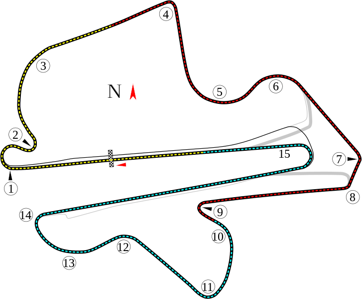
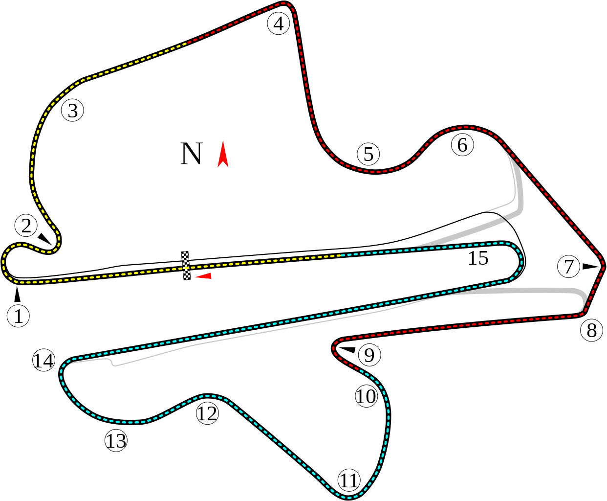
English: Track map for Sepang International Circuit.
Bahasa Melayu: Track peta untuk Litar Antarabangsa Sepang. |
| Date | |
| Soorce | Ain wirk |
| Author | Will Pittenger |
| Other versions |
|


| Camera location | | View this and other nearby images on: OpenStreetMap |
|---|
Licensin
This file is licensed unner the Creative Commons Attribution-Share Alike 3.0 Unported license.
- Ye are free:
- tae share – tae copy, distribute an transmit the wirk
- tae remix – tae adapt the wirk
- Unner the follaein condeetions:
- attribution – Ye must attribute the wirk in the manner specified bi the author or licensor (but nae in ony way that suggests that thay endorse ye or yer uise o the wirk).
- share alik – If ye alter, transform, or big upon this wirk, ye mey distribute the resultin wirk anly unner the same or seemilar license tae this ane.
File history
Clap oan ae date/time fer tae see the file aes it kithed at that time.
| Date/Time | Thummnail | Dimensions | Uiser | Comment | |
|---|---|---|---|---|---|
| current | 10:33, 31 Julie 2008 | | 1,146 × 945 (54 KB) | Will Pittenger | {{Information |Description={{en|1=Track map for w:Sepang International Circuit.}} |Source=Own work by uploader |Author=Will Pittenger |Date=7-31-2008 |Permission= |other_versions=<gallery>Image:Circuit Sepang.png|Old version - |
Eimage airtins
The follaein pages airts tae this image:
Global file uisage
The follaein ither wikis uise this file:
- Uisage on af.wikipedia.org
- Uisage on ar.wikipedia.org
- جائزة ماليزيا الكبرى
- حلبة سيبانغ الدولية
- جائزة ماليزيا الكبرى 1999
- جائزة ماليزيا الكبرى للدراجات النارية 2006
- جائزة ماليزيا الكبرى للدراجات النارية 2002
- جائزة ماليزيا الكبرى للدراجات النارية 2003
- جائزة ماليزيا الكبرى للدراجات النارية 2004
- جائزة ماليزيا الكبرى للدراجات النارية 2005
- جائزة ماليزيا الكبرى للدراجات النارية 2007
- جائزة ماليزيا الكبرى للدراجات النارية 2008
- جائزة ماليزيا الكبرى للدراجات النارية 2009
- جائزة ماليزيا الكبرى للدراجات النارية 2010
- جائزة ماليزيا الكبرى للدراجات النارية 2012
- جائزة ماليزيا الكبرى للدراجات النارية 2013
- جائزة ماليزيا الكبرى للدراجات النارية 2014
- جائزة ماليزيا الكبرى للدراجات النارية 1999
- جائزة ماليزيا الكبرى للدراجات النارية 2000
- جائزة ماليزيا الكبرى للدراجات النارية 2001
- جائزة ماليزيا الكبرى 2015
- جائزة ماليزيا الكبرى 2010
- جائزة ماليزيا الكبرى 2008
- جائزة ماليزيا الكبرى 2007
- جائزة ماليزيا الكبرى 2006
- جائزة ماليزيا الكبرى 2002
- جائزة ماليزيا الكبرى 2001
- جائزة ماليزيا الكبرى 2000
- جائزة ماليزيا الكبرى 2005
- جائزة ماليزيا الكبرى 2004
- جائزة ماليزيا الكبرى 2003
- جائزة ماليزيا الكبرى 2017
- جائزة ماليزيا الكبرى 2016
- جائزة ماليزيا الكبرى 2009
- جائزة ماليزيا الكبرى 2011
- جائزة ماليزيا الكبرى 2012
- جائزة ماليزيا الكبرى للدراجات النارية 2018
- Uisage on ast.wikipedia.org
- Uisage on be-tarask.wikipedia.org
View mair global usage o this file.