
File:ScotlandAberdeenshireBuchan.png
Nae heier resolution available.
ScotlandAberdeenshireBuchan.png (191 × 261 pixels, file size: 4 KB, MIME type: image/png)
Ootline
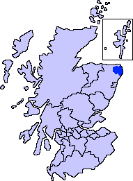
| Descreeption | Aberdeenshire unitary council - Buchan Area |
| Soorce | Slightly edited version of a map drawn by Morwen and Voyager |
| Author |
Licensin
I, the copyright holder of this work, hereby publish it under the following licenses:

|
Permission is grantit tae copy, distribute an/or modify this document unner the terms o the GNU Free Documentation License, Version 1.2 or ony later version published bi the Free Software Foundation; wi no Invariant Sections, no Front-Cover Texts, an no Back-Cover Texts. A copy o the license is includit in the section enteetled GNU Free Documentation License. |
| This file is licensed unner the Creative Commons Attribution-Share Alike 3.0 Unported license. | ||
| ||
| This licensing tag was added to this file as part of the GFDL licensing update. |
Ye mey select the license o yer choice.
File history
Clap oan ae date/time fer tae see the file aes it kithed at that time.
| Date/Time | Thummnail | Dimensions | Uiser | Comment | |
|---|---|---|---|---|---|
| current | 01:30, 8 November 2007 | | 191 × 261 (4 KB) | Harami2000 | == Summary == == Summary == {{Information |Description= Aberdeenshire unitary council - Buchan Area |Source= Slightly edited version of a map drawn by Morwen and Voyager |Date= |Author= |Permission= |other_versio |
Eimage airtins
The'r nae pages airts tae this eimage.
Global file uisage
The follaein ither wikis uise this file:
- Uisage on en.wikipedia.org
- Buchan
- New Slains Castle
- Loch of Strathbeg
- Cruden Bay
- St Fergus
- Crimond
- Peterhead
- Old Deer
- Maud, Aberdeenshire
- Whinnyfold
- Formartine and Buchan Way
- Bullers of Buchan
- Buchanhaven
- Deer Abbey
- New Deer
- Crimonmogate
- Rattray Head
- Lonmay
- Mintlaw
- Aden Country Park
- Longside
- Strichen
- Rattray, Aberdeenshire
- Fetterangus
- New Pitsligo
- Auchnagatt
- Template:Buchan, Aberdeenshire places
- Boddam, Aberdeenshire
- Hatton, Aberdeenshire
- St Combs
- Stuartfield
- Inverugie
- Clola
- Rora, Aberdeenshire
- New Leeds
- Stirling Village
- Longhaven
- Downiehills
- Kirktown of St Fergus
- Uisage on fa.wikipedia.org
- Uisage on fr.wikipedia.org