
File:Relief Map of Uzbekistan.png

Size o this luikower: 800 × 529 pixels. Ither resolutions: 320 × 211 pixels | 640 × 423 pixels | 1,024 × 677 pixels | 1,200 × 793 pixels.
Oreeginal file (1,200 × 793 pixels, file size: 1.42 MB, MIME type: image/png)
Ootline
| Descreeption |
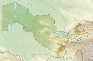
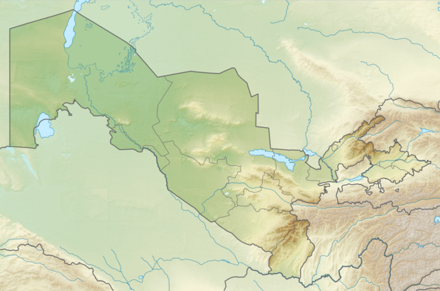
English: Relief map of Uzbekistan
Equirectangular projection, N/S stretching 130 %. Geographic limits of the map:
|
| Date | |
| Soorce | |
| Author |
|
| Permission (Reuisin this file) |
This file is licensed unner the Creative Commons Attribution-Share Alike 3.0 Unported license.
|
File history
Clap oan ae date/time fer tae see the file aes it kithed at that time.
| Date/Time | Thummnail | Dimensions | Uiser | Comment | |
|---|---|---|---|---|---|
| current | 20:01, 26 August 2010 | | 1,200 × 793 (1.42 MB) | Виктор В | =={{int:filedesc}}== {{Information |Description={{en|Relief map of Uzbekistan}} Equirectangular projection, N/S stretching 130 %. Geographic limits of the map: * N: 45.9° N * S: 36.8° N * W: 55.6° E * E: 73.5° E |Source=*[[:File:Uzb |
Eimage airtins
The follaein pages airts tae this image:
Global file uisage
The follaein ither wikis uise this file:
- Uisage on als.wikipedia.org
- Uisage on ar.wikipedia.org
- Uisage on ast.wikipedia.org
- Uisage on av.wikipedia.org
- Uisage on azb.wikipedia.org
- Uisage on az.wikipedia.org
- Uisage on ba.wikipedia.org
- Uisage on bcl.wikipedia.org
- Uisage on be.wikipedia.org
- Uisage on bg.wikipedia.org
View mair global usage o this file.