
File:Relief Map of Brazil.jpg

Size o this luikower: 607 × 600 pixels. Ither resolutions: 243 × 240 pixels | 486 × 480 pixels | 777 × 768 pixels | 1,200 × 1,186 pixels.
Oreeginal file (1,200 × 1,186 pixels, file size: 1.05 MB, MIME type: image/jpeg)
| Descreeption |
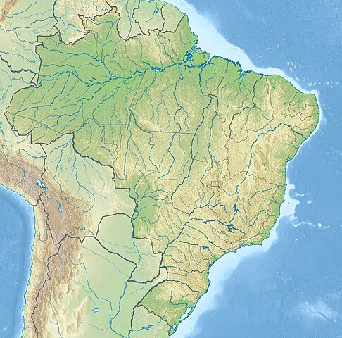
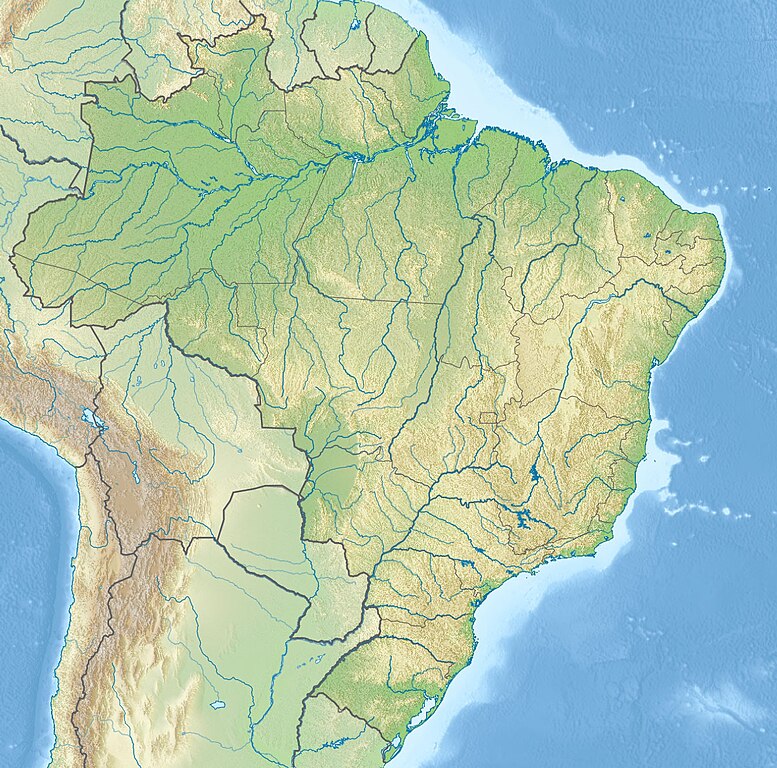
English: Location map of Brazil Equirectangular projection, N/S stretching 105 %. Geographic limits of the map:
|
|||
| Date | (UTC) | |||
| Soorce |
|
|||
| Author |
|
|||
| Other versions |
|


| This is a retouched picture, which means that it has been digitally altered from its original version. The original can be viewed here: Brazil location map.svg:
|
I, the copyright holder of this work, hereby publish it under the following license:
This file is licensed unner the Creative Commons Attribution-Share Alike 3.0 Unported license.
- Ye are free:
- tae share – tae copy, distribute an transmit the wirk
- tae remix – tae adapt the wirk
- Unner the follaein condeetions:
- attribution – Ye must attribute the wirk in the manner specified bi the author or licensor (but nae in ony way that suggests that thay endorse ye or yer uise o the wirk).
- share alik – If ye alter, transform, or big upon this wirk, ye mey distribute the resultin wirk anly unner the same or seemilar license tae this ane.
Original upload log
This image is a derivative work of the following images:
- File:Brazil_location_map.svg licensed with Cc-by-sa-3.0
- 2009-08-05T19:53:55Z NordNordWest 2008x1984 (1674058 Bytes) {{int:filedesc}} {{Information |Description= {{de|Positionskarte von [[:de:Brasilien|Brasilien]]}} Quadratische Plattkarte, N-S-Streckung 105 %. Geographische Begrenzung der Karte: * N: 6.0° N * S: 34.0° S * W: 74.5° W * O
Uploaded with derivativeFX
File history
Clap oan ae date/time fer tae see the file aes it kithed at that time.
| Date/Time | Thummnail | Dimensions | Uiser | Comment | |
|---|---|---|---|---|---|
| current | 21:46, 14 Mey 2017 | | 1,200 × 1,186 (1.05 MB) | Janitoalevic | Added Rincón de Artigas disputed territory |
| 17:55, 27 November 2010 |  | 1,200 × 1,186 (492 KB) | Виктор В | {{Information |Description={{en|Location map of Brazil}} Equirectangular projection, N/S stretching 105 %. Geographic limits of the map: * N: 6.0° N * S: 34.0° S * W: 74.5° W * E: 32.0° W |Source=*File:Brazil_location_map.svg |
Eimage airtins
The follaein pages airts tae this image:
Global file uisage
The follaein ither wikis uise this file:
- Uisage on an.wikipedia.org
- Uisage on ar.wikipedia.org
- Uisage on ban.wikipedia.org
- Uisage on bg.wikipedia.org
- Рио де Жанейро
- Итайпу
- Порто Алегри
- Сао Пауло
- Ирара
- Бауру
- Маже
- Айморес (Минаш Жерайс)
- Мост на дружбата (Парагвай - Бразилия)
- Бразилия (град)
- Петрополис
- Ресифи
- Флорианополис
- Анаполис
- Мадейра (река)
- Токантинс (река)
- Рио Негро (приток на Амазонка)
- Манаус
- Такуари
- Салвадор (Баия)
- Сантос
- Сао Бернардо до Кампо
- Розейра
- Ипатинга
- Трес Корасойнс
- Паулиста (Пернамбуко)
- Сао Висенти (Сао Пауло)
- Прадополис
- Белен (Пара)
- Бело Оризонти
- Масейо
- Форталеза
- Витория (Еспирито Санто)
- Гояния
- Кампо Гранди
- Кашоейра до Сул
- Итабуна
- Куритиба
- Арара (Параиба)
View mair global usage o this file.