
File:Parinacota.jpg

Size o this luikower: 800 × 589 pixels. Ither resolutions: 320 × 236 pixels | 640 × 471 pixels | 1,024 × 754 pixels | 1,280 × 942 pixels | 2,623 × 1,931 pixels.
Oreeginal file (2,623 × 1,931 pixels, file size: 499 KB, MIME type: image/jpeg)
Ootline
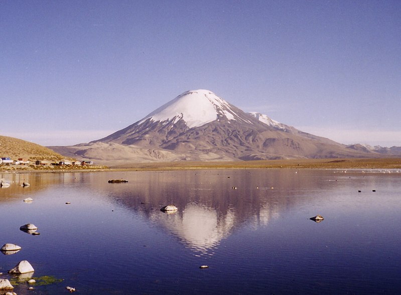
| Descreeption | Parinacota and Laguna Chungara |
| Date | |
| Soorce | Ain wirk |
| Author | Gerd Breitenbach |
Licensin

|
Permission is grantit tae copy, distribute an/or modify this document unner the terms o the GNU Free Documentation License, Version 1.2 or ony later version published bi the Free Software Foundation; wi no Invariant Sections, no Front-Cover Texts, an no Back-Cover Texts. A copy o the license is includit in the section enteetled GNU Free Documentation License. |
| This file is licensed unner the Creative Commons Attribution-Share Alike 3.0 Unported license. | ||
| ||
| This licensing tag was added to this file as part of the GFDL licensing update. |
File history
Clap oan ae date/time fer tae see the file aes it kithed at that time.
| Date/Time | Thummnail | Dimensions | Uiser | Comment | |
|---|---|---|---|---|---|
| current | 15:50, 11 Mey 2005 | | 2,623 × 1,931 (499 KB) | Gerd Breitenbach | Parinacota and Laguna Chungara, own fotography 2003 {{GFDL}} |
Eimage airtins
The follaein pages airts tae this image:
Global file uisage
The follaein ither wikis uise this file:
- Uisage on ar.wikipedia.org
- Uisage on arz.wikipedia.org
- Uisage on ay.wikipedia.org
- Uisage on az.wikipedia.org
- Uisage on be-tarask.wikipedia.org
- Uisage on be.wikipedia.org
- Uisage on br.wikipedia.org
- Uisage on ca.wikipedia.org
- Uisage on ceb.wikipedia.org
- Uisage on ckb.wikipedia.org
- Uisage on cs.wikipedia.org
- Uisage on da.wikipedia.org
- Uisage on de.wikipedia.org
- Uisage on de.wikivoyage.org
- Uisage on diq.wikipedia.org
- Uisage on en.wikipedia.org
- Arica
- Morro de Arica
- Acotango
- Pomerape
- Payachata
- Kimsa Chata (Bolivia-Chile)
- Cordillera Occidental (Central Andes)
- Visviri
- Lauca
- Salar de Surire Natural Monument
- Wikipedia:WikiProject Lakes/Galleries/4
- Las Vicuñas National Reserve
- Codpa
- Water resources
- Template:AricaParinacota-geo-stub
- Cosapilla River
- Cerro Cosapilla
- Ancuta
- Belén, Chile
View mair global usage o this file.