
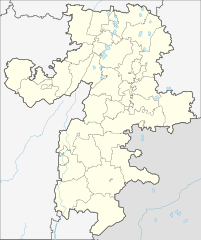
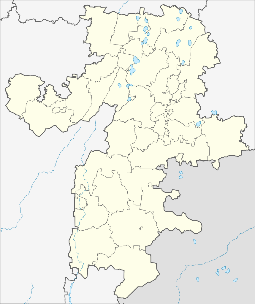
File:Outline map of Chelyabinsk Oblast OSM.svg

Size of this PNG preview of this SVG file: 503 × 600 pixels. Ither resolutions: 201 × 240 pixels | 402 × 480 pixels | 644 × 768 pixels | 859 × 1,024 pixels | 1,717 × 2,048 pixels | 738 × 880 pixels.
Oreeginal file (SVG file, nominallie 738 × 880 pixels, file size: 356 KB)
Ootline
| Descreeption |
Русский: Административная карта Челябинской области, на основе OpenStreetMap.
|
| Date | |
| Soorce |
This W3C-unspecified vector image was created with Inkscape . |
| Author | Nzeemin |
| Other versions |
|

Licensin
This file is licensed under the Creative Commons Attribution-Share Alike 2.0 Generic license.
- Ye are free:
- tae share – tae copy, distribute an transmit the wirk
- tae remix – tae adapt the wirk
- Unner the follaein condeetions:
- attribution – Ye must attribute the wirk in the manner specified bi the author or licensor (but nae in ony way that suggests that thay endorse ye or yer uise o the wirk).
- share alik – If ye alter, transform, or big upon this wirk, ye mey distribute the resultin wirk anly unner the same or seemilar license tae this ane.
File history
Clap oan ae date/time fer tae see the file aes it kithed at that time.
| Date/Time | Thummnail | Dimensions | Uiser | Comment | |
|---|---|---|---|---|---|
| current | 09:05, 17 Mairch 2012 | | 738 × 880 (356 KB) | Nzeemin |
Eimage airtins
The follaein pages airts tae this image:
Global file uisage
The follaein ither wikis uise this file:
- Uisage on af.wikipedia.org
- Uisage on ar.wikipedia.org
- Uisage on azb.wikipedia.org
- Uisage on ba.wikipedia.org
- Силәбе өлкәһе
- Яҡуп (Силәбе өлкәһе)
- Ҡалып:ПозКарта Рәсәй Силәбе өлкәһе
- Мейәс
- Силәбе
- Сыбаркүл (ҡала)
- Верхнеурал
- Арыҫлан (Наҙы-Петровск районы)
- Арыҡ
- Ҡолой (ауыл)
- Яратҡол
- Ҡуянбай
- Һәйбәт (Силәбе өлкәһе)
- Субар
- Сәйет (Арғаяш районы)
- Ураҙбай (Арғаяш районы)
- Ялтыр
- Биҡҡол (Арғаяш районы)
- Хәлит (Арғаяш районы)
- Кесе Ҡуйһары
- Көньяҡ Горняк
- Аҡбаш (Арғаяш районы)
- Көҙәш
- Миҙиәк
- Межозёрный
- Йүрүҙән (ҡала)
- Атйетәр (Силәбе өлкәһе)
- Ҡоншаҡ
- Ғәшер
- Һары (Ҡоншаҡ районы)
- Хәлит (Ҡоншаҡ районы)
- Мөслим (ауыл, Силәбе өлкәһе)
- Әлифҡол
- Мәхмүт (Силәбе өлкәһе)
- Ҡарағайкүл (ауыл, Ҡоншаҡ районы)
- Суртаныш
- Карино (Силәбе өлкәһе)
- Дружный (Ҡоншаҡ районы)
- Әмин (Ҡоншаҡ районы)
- Борисовка (Ҡоншаҡ районы)
- Яңы Бүре
- Бүре (Силәбе өлкәһе)
- Бараҡ (Рәсәй)
- Баязит (Силәбе өлкәһе)
View mair global usage o this file.