
File:Oceania laea location map.svg

Size of this PNG preview of this SVG file: 699 × 600 pixels. Ither resolutions: 280 × 240 pixels | 560 × 480 pixels | 895 × 768 pixels | 1,194 × 1,024 pixels | 2,388 × 2,048 pixels | 1,181 × 1,013 pixels.
Oreeginal file (SVG file, nominallie 1,181 × 1,013 pixels, file size: 1.55 MB)
Ootline
| Descreeption |
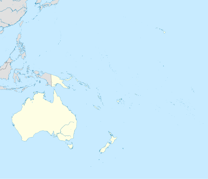
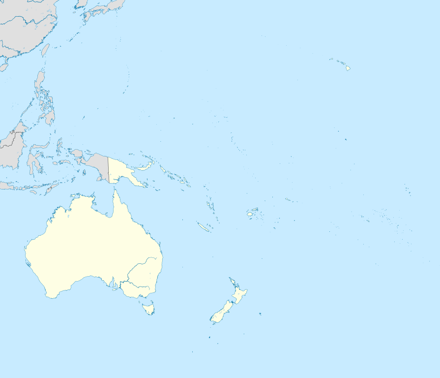
English: Location map of Oceania.
|
| Date | |
| Soorce | Ain wirk |
| Author | Uwe Dedering |
| SVG genesis | This W3C-invalid locator map was created with Inkscape. |
Licensin
I, the copyright holder of this work, hereby publish it under the following licenses:
This file is licensed unner the Creative Commons Attribution-Share Alike 3.0 Unported license.
- Ye are free:
- tae share – tae copy, distribute an transmit the wirk
- tae remix – tae adapt the wirk
- Unner the follaein condeetions:
- attribution – Ye must attribute the wirk in the manner specified bi the author or licensor (but nae in ony way that suggests that thay endorse ye or yer uise o the wirk).
- share alik – If ye alter, transform, or big upon this wirk, ye mey distribute the resultin wirk anly unner the same or seemilar license tae this ane.

|
Permission is grantit tae copy, distribute an/or modify this document unner the terms o the GNU Free Documentation License, Version 1.2 or ony later version published bi the Free Software Foundation; wi no Invariant Sections, no Front-Cover Texts, an no Back-Cover Texts. A copy o the license is includit in the section enteetled GNU Free Documentation License. |
Ye mey select the license o yer choice.
File history
Clap oan ae date/time fer tae see the file aes it kithed at that time.
| Date/Time | Thummnail | Dimensions | Uiser | Comment | |
|---|---|---|---|---|---|
| current | 22:22, 31 Mairch 2011 | | 1,181 × 1,013 (1.55 MB) | Magog the Ogre | crop data outside of viewbox |
| 14:06, 28 November 2010 |  | 1,181 × 1,013 (2.69 MB) | Uwe Dedering | {{Information |Description={{en|1= Location map of Oceania. * Projection: Lambert azimuthal equal-area projection. * Area of interest: :* N: 35.0° N :* S: -55.0° N :* W: 110.0° E :* E: 230.0° E (This is -130° E) * Projection center: :* NS: -10.0° N |
Eimage airtins
The follaein pages airts tae this image:
Global file uisage
The follaein ither wikis uise this file:
- Uisage on af.wikipedia.org
- Uisage on an.wikipedia.org
- Uisage on ar.wikipedia.org
- Uisage on ast.wikipedia.org
- Uisage on azb.wikipedia.org
- Uisage on az.wikipedia.org
- Uisage on ban.wikipedia.org
- Uisage on ba.wikipedia.org
- Uisage on be-tarask.wikipedia.org
- Uisage on be.wikipedia.org
- Uisage on bg.wikipedia.org
- Uisage on bh.wikipedia.org
- Uisage on bn.wikipedia.org
- Uisage on br.wikipedia.org
- Uisage on ca.wikipedia.org
- Uisage on ceb.wikipedia.org
- Uisage on cs.wikipedia.org
- Uisage on da.wikipedia.org
- Uisage on de.wikipedia.org
- Kaloko-Dammbruch
- Kwajalein Missile Range
- Lapita
- Wikipedia:Kartenwerkstatt/Positionskarten/Andere
- Optus
- Benutzer:Uwe Dedering
- Mahina (Französisch-Polynesien)
- Pirae
- Vorlage:Positionskarte Ozeanien
- Wikipedia:Kartenwerkstatt/Archiv/2010-11
- Benutzer:Herzi Pinki/Vorlage:PositionskarteX ISO/Test
- Benutzer Diskussion:SteveK/Archiv2012
View mair global usage o this file.