
File:Nicaragua location map.svg

Size of this PNG preview of this SVG file: 704 × 599 pixels. Ither resolutions: 282 × 240 pixels | 564 × 480 pixels | 902 × 768 pixels | 1,203 × 1,024 pixels | 2,405 × 2,048 pixels | 1,400 × 1,192 pixels.
Oreeginal file (SVG file, nominallie 1,400 × 1,192 pixels, file size: 192 KB)
Ootline
| Descreeption |
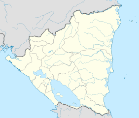
Deutsch: Positionskarte Nicaragua mit Departamentos, Quadratische Plattkarte, N-S-Streckung 100 %. Geographische Begrenzung der Karte:
English: Location map of Nicaragua with Departamentos, Equirectangular projection, N/S stretching 100 %. Geographic limits of the map:
|
| Date | |
| Soorce | Ain wirk,VMAP0,http://maplibrary.org |
| Author | Alexrk2 |
| Other versions |
Derivative works of this file:
|


|
This map has been made or improved in the German Kartenwerkstatt (Map Lab). You can propose maps to improve as well.
|
Licensin
I, the copyright holder of this work, hereby publish it under the following license:
This file is licensed unner the Creative Commons Attribution-Share Alike 3.0 Unported license.
- Ye are free:
- tae share – tae copy, distribute an transmit the wirk
- tae remix – tae adapt the wirk
- Unner the follaein condeetions:
- attribution – Ye must attribute the wirk in the manner specified bi the author or licensor (but nae in ony way that suggests that thay endorse ye or yer uise o the wirk).
- share alik – If ye alter, transform, or big upon this wirk, ye mey distribute the resultin wirk anly unner the same or seemilar license tae this ane.
File history
Clap oan ae date/time fer tae see the file aes it kithed at that time.
| Date/Time | Thummnail | Dimensions | Uiser | Comment | |
|---|---|---|---|---|---|
| current | 06:36, 25 Mey 2021 | | 1,400 × 1,192 (192 KB) | Milenioscuro | corrected some errors |
| 06:30, 25 Mey 2021 |  | 1,400 × 1,192 (192 KB) | Milenioscuro | corrected department boundaries | |
| 22:09, 17 Februar 2010 |  | 1,400 × 1,192 (416 KB) | Alexrk2 | - | |
| 20:12, 16 Februar 2010 |  | 1,400 × 1,192 (415 KB) | Alexrk2 | == Summary == {{Information |Description= {{de|Positionskarte Nicaragua mit Departamentos, Quadratische Plattkarte, N-S-Streckung 100 %. Geographische Begrenzung der Karte:}} {{en|Location map Nicaragua with Departament |
Eimage airtins
The follaein pages airts tae this image:
Global file uisage
The follaein ither wikis uise this file:
- Uisage on af.wikipedia.org
- Uisage on an.wikipedia.org
- Uisage on ar.wikipedia.org
- Uisage on ast.wikipedia.org
- Greytown (Nicaragua)
- Managua
- Matiguás
- Muy Muy
- Módulu:Mapa de llocalización/datos/Nicaragua
- Módulu:Mapa de llocalización/datos/Nicaragua/usu
- Aeropuertu Bonanza
- Aeropuertu Punta Huete
- Aeropuertu de Chinandega
- Aeropuertu de Juigalpa
- Aeropuertu de Los Brasiles
- Aeropuertu de Montelimar
- Aeropuertu de Nueva Guinea
- Aeropuertu d'Ometepe
- Aeropuertu de Rosita
- Aeropuertu de San Juan de Nicaragua
- Aeropuertu de Siuna
- Aeropuertu de Waspán
- Aeropuertu internacional Costa Esmeralda
- San Isidro (Nicaragua)
- Uisage on ba.wikipedia.org
- Uisage on be-tarask.wikipedia.org
- Uisage on be.wikipedia.org
- Uisage on bg.wikipedia.org
- Uisage on bh.wikipedia.org
- Uisage on bn.wikipedia.org
View mair global usage o this file.