
File:Namibia relief location map.jpg
Size o this luikower: 623 × 600 pixels. Ither resolutions: 249 × 240 pixels | 499 × 480 pixels | 798 × 768 pixels | 1,063 × 1,024 pixels | 1,806 × 1,739 pixels.
Oreeginal file (1,806 × 1,739 pixels, file size: 1.66 MB, MIME type: image/jpeg)
| Descreeption |
Deutsch: Physische Positionskarte von Namibia
Quadratische Plattkarte, N/S-Streckung 108 %. Geographische Begrenzung der Karte:
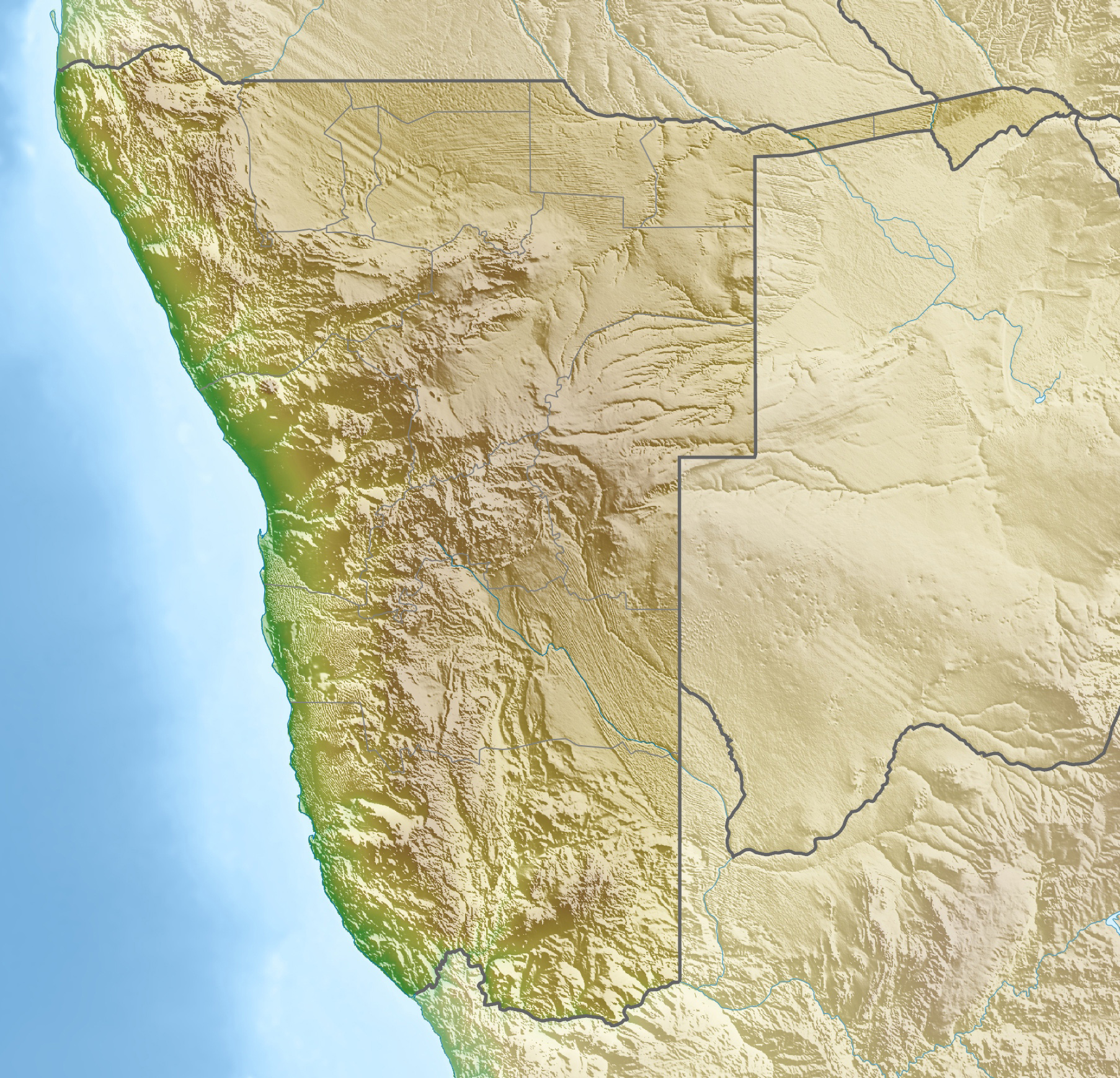
English: Physical location map of Namibia
Equirectangular projection, N/S streching 108 %. Geographic limits of the map:
|
||
| Date | |||
| Soorce | Ain wirk, using map data from administrative map by Uwe Dedering. The relief was created from SRTM-30 relief data | ||
| Author | Carport | ||
| Permission (Reuisin this file) |
This file is licensed unner the Creative Commons Attribution-Share Alike 3.0 Unported license.
This file is licensed under the Creative Commons Attribution-Share Alike 3.0 Germany license.

|
||
| Other versions |
|


File history
Clap oan ae date/time fer tae see the file aes it kithed at that time.
| Date/Time | Thummnail | Dimensions | Uiser | Comment | |
|---|---|---|---|---|---|
| current | 18:59, 12 October 2013 | | 1,806 × 1,739 (1.66 MB) | NordNordWest | upd |
| 14:12, 23 Apryle 2010 |  | 1,806 × 1,739 (1.46 MB) | Carport | c | |
| 14:07, 23 Apryle 2010 |  | 1,806 × 1,739 (1.46 MB) | Carport | {{Information |Description={{de|Physische Positionskarte von {{w|Namibia|3=de}}}} Quadratische Plattkarte, N/S-Streckung 108 %. Geographische Begrenzung der Karte: * N: 16.4° S * S: 29.6° S * W: 11.0° O * O: 25.8° O {{en|Physical location map of {{w|N |
Eimage airtins
The follaein pages airts tae this image:
Global file uisage
The follaein ither wikis uise this file:
- Uisage on ar.wikipedia.org
- Uisage on ast.wikipedia.org
- Uisage on az.wikipedia.org
- Uisage on ban.wikipedia.org
- Uisage on ba.wikipedia.org
- Uisage on be.wikipedia.org
- Uisage on bg.wikipedia.org
- Виндхук
- Хардап (язовир)
- Мариентал
- Рихобот
- Катима Мулило
- Рунду
- Опуво
- Кетмансхоп
- Утапи
- Очиваронго
- Енхана
- Людериц
- Ондангва
- Ошиканго
- Малтахьое
- Гобабис
- Ониипа
- Шаблон:ПК Намибия
- Окакарара
- Карасбург
- Свакопмунд
- Ошакати
- Цумеб
- Уолфиш Бей
- Грутфонтейн
- Окаханджа
- Каманжаб
- Мамили
- Свакоп
- Колманскоп
- Каоко
- Дамара (планинска земя)
- Етоша (солончак)
View mair global usage o this file.