
File:Mapa Mexico 2010.PNG
Size o this luikower: 800 × 506 pixels. Ither resolutions: 320 × 202 pixels | 640 × 405 pixels | 1,024 × 647 pixels | 1,319 × 834 pixels.
Oreeginal file (1,319 × 834 pixels, file size: 65 KB, MIME type: image/png)
Ootline
| Descreeption |
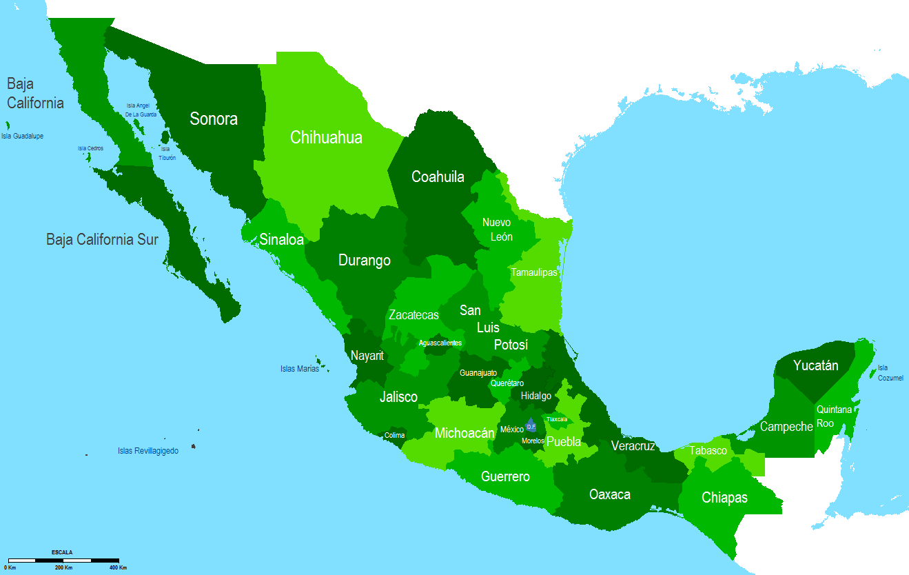
Español: Mapa de Mexico 2010 |
| Date | |
| Soorce | Ain wirk |
| Author | Hpav7 |
Licensin
| I, the copyright holder of this work, release this work into the public domain. This applies worldwide. In some countries this may not be legally possible; if so: I grant anyone the right to use this work for any purpose, without any conditions, unless such conditions are required by law. |
File history
Clap oan ae date/time fer tae see the file aes it kithed at that time.
| Date/Time | Thummnail | Dimensions | Uiser | Comment | |
|---|---|---|---|---|---|
| current | 05:42, 14 Januar 2010 | | 1,319 × 834 (65 KB) | Hpav7 | {{Information |Description={{es|1=Mapa de Mexico 2010}} |Source={{own}} |Author=Hpav7 |Date=23 de noviembre 2009 |Permission= |other_versions= }} Category:Maps of Mexico Category:Mexico |
Eimage airtins
The follaein pages airts tae this image:
Global file uisage
The follaein ither wikis uise this file:
- Uisage on ang.wikipedia.org
- Uisage on ast.wikipedia.org
- Uisage on cs.wikipedia.org
- Uisage on el.wikipedia.org
- Uisage on en.wikipedia.org
- Uisage on es.wikipedia.org
- Uisage on fa.wikipedia.org
- یوکاتان
- مکزیک
- مکزیکوسیتی
- ایالت سونورا
- کولیما
- تلاسکالا
- وراکروز
- اوآخاکا
- ساکاتکاس
- الگو:ایالتهای مکزیک
- آگوئاسکالینتس
- باخا کالیفرنیا
- باخا کالیفرنیا سور
- کامپچه
- چیاپاس
- ایالت چیواوا
- کواویلا
- دورانگو
- گواناهواتو
- گررو
- تامائولیپاس
- ایالت تاباسکو
- ایالت ایدالگو
- خالیسکو
- میچوآکان
- سینالوآ
- سن لوئیس پوتوسی
- کینتانا رو
- کرتارو
- پوئبلا
- ایالت مورلوس
- نوئوو لئون
- ایالت مخیکو
- نایاریت
- تقسیمات اداری مکزیک
- فهرست ایالتهای مکزیک
- Uisage on fo.wikipedia.org
- Uisage on he.wikipedia.org
View mair global usage o this file.