
File:Map of Ukraine political simple Oblast Donezk.png

Size o this luikower: 800 × 533 pixels. Ither resolutions: 320 × 213 pixels | 640 × 426 pixels | 1,024 × 682 pixels | 1,200 × 799 pixels.
Oreeginal file (1,200 × 799 pixels, file size: 140 KB, MIME type: image/png)
Ootline
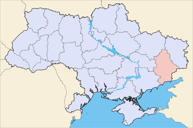
| Descreeption | Political map of Ukraine, highlighting Donetsk Oblast | ||||||
| Date | |||||||
| Soorce | Image (Map) made by Sven Teschke, Germany --Steschke 18:49, 6 Nov 2004 (UTC) | ||||||
| Author | Sven Teschke | ||||||
| Other versions |
[]
|


Licensin

|
Permission is grantit tae copy, distribute an/or modify this document unner the terms o the GNU Free Documentation License, Version 1.2 or ony later version published bi the Free Software Foundation; wi no Invariant Sections, no Front-Cover Texts, an no Back-Cover Texts. A copy o the license is includit in the section enteetled GNU Free Documentation License. |
| This file is licensed unner the Creative Commons Attribution-Share Alike 3.0 Unported license. | ||
| ||
| This licensing tag was added to this file as part of the GFDL licensing update. |
This file is licensed under the Creative Commons Attribution-Share Alike 1.0 Generic license.
- Ye are free:
- tae share – tae copy, distribute an transmit the wirk
- tae remix – tae adapt the wirk
- Unner the follaein condeetions:
- attribution – Ye must attribute the wirk in the manner specified bi the author or licensor (but nae in ony way that suggests that thay endorse ye or yer uise o the wirk).
- share alik – If you alter, transform, or build upon this work, you must distribute the resulting work under the same license as the original.
File history
Clap oan ae date/time fer tae see the file aes it kithed at that time.
| Date/Time | Thummnail | Dimensions | Uiser | Comment | |
|---|---|---|---|---|---|
| current | 13:45, 13 Mey 2014 | | 1,200 × 799 (140 KB) | Aotearoa | Reverted to version as of 21:45, 4 May 2014 - if you need map without Crimea then upload it as another file |
| 09:13, 11 Mey 2014 |  | 1,200 × 799 (67 KB) | DeJaDenis | Reverted to version as of 23:27, 3 May 2014 | |
| 21:45, 4 Mey 2014 |  | 1,200 × 799 (140 KB) | Musp | Reverted to version as of 09:12, 16 August 2012 | |
| 00:55, 4 Mey 2014 |  | 1,971 × 1,309 (365 KB) | Knyaz-1988 | New version | |
| 23:27, 3 Mey 2014 |  | 1,200 × 799 (67 KB) | Knyaz-1988 | New version | |
| 09:12, 16 August 2012 |  | 1,200 × 799 (140 KB) | Whiteroll | Correct map uploaded: Krasnyi Lyman Raion returned to Donetsk Oblast, it has never been a part of Kharkiv Oblast | |
| 00:32, 6 Mey 2012 |  | 2,466 × 1,749 (283 KB) | An678ko | redesigned by Aplusc Studio | |
| 14:42, 30 November 2004 |  | 1,181 × 825 (16 KB) | Ed g2s | Simplified, compressed. | |
| 18:47, 6 November 2004 |  | 709 × 495 (195 KB) | Steschke | ukrainian oblast |
Eimage airtins
The follaein pages airts tae this image:
Global file uisage
The follaein ither wikis uise this file:
- Uisage on avk.wikipedia.org
- Uisage on be.wikipedia.org
- Uisage on cs.wikipedia.org
- Uisage on de.wikipedia.org
- Flaggen und Wappen der ukrainischen Oblaste
- Rajon Nowoasowsk
- Rajon Telmanowe
- Rajon Starobeschewe
- Rajon Wolnowacha
- Rajon Amwrossijiwka
- Rajon Schachtarsk
- Rajon Nikolske
- Rajon Manhusch
- Rajon Bachmut
- Rajon Lyman (Donezk)
- Rajon Pokrowsk
- Rajon Marjinka
- Rajon Welyka Nowosilka
- Rajon Dobropillja
- Rajon Oleksandriwka (Donezk)
- Rajon Slowjansk
- Rajon Kostjantyniwka
- Rajon Jassynuwata
- Rajon Mariupol
- Rajon Kramatorsk
- Rajon Horliwka
- Rajon Donezk
- Rajon Kalmiuske
- Uisage on eo.wikipedia.org
- Uisage on es.wikipedia.org
- Raión de Amvrosivka
- Raión de Velyka Novosilka
- Raión de Volnovaja
- Raión de Nikolske
- Raión de Dobropilia
- Raión de Kostantínovka
- Raión de Pokrovsk
- Raión de Limán (óblast de Donetsk)
- Raión de Márinka
- Raión de Novoazovsk
- Raión de Oleksandrivka (Donetsk)
- Raión de Mánjush
- Raión de Sloviansk
- Raión de Starobesheve
- Raión de Boikivske
- Raión de Shajtarsk
- Raión de Yasinuvata
- Uisage on eu.wikipedia.org
- Uisage on fi.wikipedia.org
- Uisage on hr.wikipedia.org
- Uisage on hu.wikipedia.org
- Uisage on hy.wikipedia.org
View mair global usage o this file.