
File:Locator map Iran Alborz Province.png
Nae heier resolution available.
Locator_map_Iran_Alborz_Province.png (672 × 600 pixels, file size: 143 KB, MIME type: image/png)
| Descreeption |
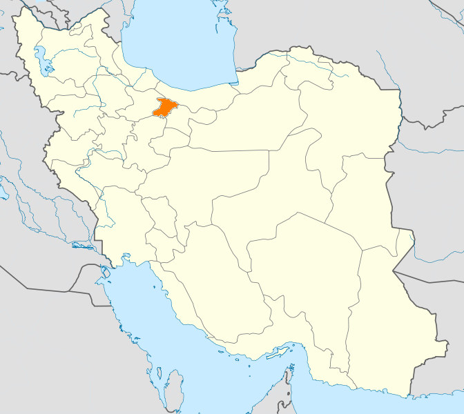
English: Location map of Iran. Equirectangular projection. Strechted by 118.0%. Geographic limits of the map: * N: 40.0° N * S: 24.5° N * W: 43.5° E * E: 64.0° E Made with Natural Earth. Free vector and raster map data @ naturalearthdata.com. |
| Date | (UTC) |
| Soorce | |
| Author |
|
| This is a retouched picture, which means that it has been digitally altered from its original version. Modifications: New map with Alborz province highlighted.. The original can be viewed here: Iran location map.svg:
|
I, the copyright holder of this work, hereby publish it under the following licenses:
This file is licensed unner the Creative Commons Attribution-Share Alike 3.0 Unported license.
- Ye are free:
- tae share – tae copy, distribute an transmit the wirk
- tae remix – tae adapt the wirk
- Unner the follaein condeetions:
- attribution – Ye must attribute the wirk in the manner specified bi the author or licensor (but nae in ony way that suggests that thay endorse ye or yer uise o the wirk).
- share alik – If ye alter, transform, or big upon this wirk, ye mey distribute the resultin wirk anly unner the same or seemilar license tae this ane.

|
Permission is grantit tae copy, distribute an/or modify this document unner the terms o the GNU Free Documentation License, Version 1.2 or ony later version published bi the Free Software Foundation; wi no Invariant Sections, no Front-Cover Texts, an no Back-Cover Texts. A copy o the license is includit in the section enteetled GNU Free Documentation License. |
Ye mey select the license o yer choice.
Original upload log
This image is a derivative work of the following images:
- File:Iran_location_map.svg licensed with Cc-by-sa-3.0, GFDL
- 2010-07-11T20:08:23Z Uwe Dedering 1200x1071 (655114 Bytes) 31. province Alborz
- 2010-02-18T17:44:29Z Uwe Dedering 1200x1071 (721726 Bytes) Bahrain above water, no disputed countries
- 2010-02-18T13:00:48Z Uwe Dedering 1200x1071 (725716 Bytes) {{Information |Description={{en|1=Location map of Iran. Equirectangular projection. Strechted by 118.0%. Geographic limits of the map: * N: 40.0° N * S: 24.5° N * W: 43.5° E * E: 64.0° E Made with Natural Earth. Fre
Uploaded with derivativeFX
File history
Clap oan ae date/time fer tae see the file aes it kithed at that time.
| Date/Time | Thummnail | Dimensions | Uiser | Comment | |
|---|---|---|---|---|---|
| current | 20:48, 24 Januar 2011 | | 672 × 600 (143 KB) | WikiDaisy | {{Information |Description={{en|1=Location map of Iran. Equirectangular projection. Strechted by 118.0%. Geographic limits of the map: * N: 40.0° N * S: 24.5° N * W: 43.5° E * E: 64.0° E Made with Natural Earth. Free vector and raster map data @ |
Eimage airtins
The follaein pages airts tae this image:
Global file uisage
The follaein ither wikis uise this file:
- Uisage on ceb.wikipedia.org
- Uisage on hak.wikipedia.org
- Uisage on hi.wikipedia.org
- Uisage on hr.wikipedia.org
- Uisage on mk.wikipedia.org
- Uisage on mr.wikipedia.org
- Uisage on no.wikipedia.org
- Uisage on pa.wikipedia.org
- Uisage on pl.wikipedia.org
- Uisage on pl.wikivoyage.org
- Uisage on ps.wikipedia.org
- Uisage on sh.wikipedia.org
- Uisage on sv.wikipedia.org
- Uisage on tr.wikipedia.org
- Kerec
- İran'daki yerleşim birimleri listesi
- Elburz (eyalet)
- Kerec şehristanı
- Nezerabad şehristanı
- Savucbulag şehristanı
- Şablon:Elburz Eyaleti
- Nezerabad
- Heştgerd
- Kerec merkezî bahşı
- İştihard şehristanı
- Asara bahşı
- Nezerabad merkezî bahşı
- Tankaman bahşı
- Savucbulag merkezî bahşı
- Çendar bahşı
- Çeharbağ bahşı
- Taligan merkezî bahşı
- Asara
- İştihard
- Taligan
- Germdere
- Kemalşehr
- Mahdeşt
- Meşkindeşt
- Muhammedşehr
- Çeharbağ
- Gülsar
- Kuhsar
- Yeni Heştgerd
- Uisage on ug.wikipedia.org
- Uisage on war.wikipedia.org
- Uisage on zh-min-nan.wikipedia.org
- Uisage on zh.wikipedia.org