
File:Lesotho location map.svg

Size of this PNG preview of this SVG file: 613 × 599 pixels. Ither resolutions: 246 × 240 pixels | 491 × 480 pixels | 786 × 768 pixels | 1,048 × 1,024 pixels | 2,095 × 2,048 pixels | 1,023 × 1,000 pixels.
Oreeginal file (SVG file, nominallie 1,023 × 1,000 pixels, file size: 104 KB)
| Descreeption |
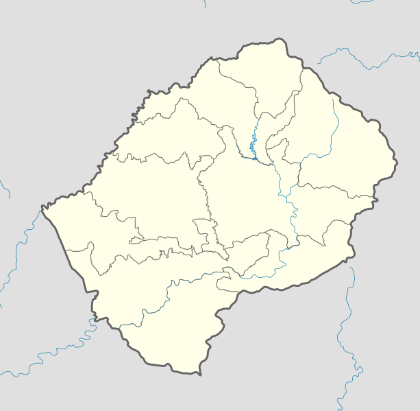
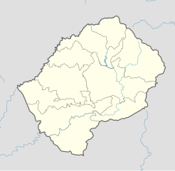
Deutsch: Positionskarte von Lesotho Quadratische Plattkarte.
English: Location map of Lesotho Equirectangular projection.
Geographic limits of the map:
|
| Date | (UTC) |
| Soorce | |
| Author |
|
| Other versions |
Derivative work: |

|
Permission is grantit tae copy, distribute an/or modify this document unner the terms o the GNU Free Documentation License, Version 1.2 or ony later version published bi the Free Software Foundation; wi no Invariant Sections, no Front-Cover Texts, an no Back-Cover Texts. A copy o the license is includit in the section enteetled GNU Free Documentation License. |
This file is licensed unner the Creative Commons Attribution-Share Alike 3.0 Unported license.
- Ye are free:
- tae share – tae copy, distribute an transmit the wirk
- tae remix – tae adapt the wirk
- Unner the follaein condeetions:
- attribution – Ye must attribute the wirk in the manner specified bi the author or licensor (but nae in ony way that suggests that thay endorse ye or yer uise o the wirk).
- share alik – If ye alter, transform, or big upon this wirk, ye mey distribute the resultin wirk anly unner the same or seemilar license tae this ane.
Original upload log
This image is a derivative work of the following images:
- File:South_Africa_location_map.svg licensed with Cc-by-3.0, Cc-by-3.0/de, GFDL, GFDL/de
- 2009-02-25T20:39:30Z NordNordWest 2032x1742 (670054 Bytes) {{Information |Description= {{de|Positionskarte von [[:de:Südafrika|Südafrika]]}} Quadratische Plattkarte, N-S-Streckung 110 %. Geographische Begrenzung der Karte: * N: 21.8° S * S: 35.2° S * W: 16.0° O * O: 33.2° O {{e
- File:Lesotho_Locator.png licensed with Cc-by-sa-3.0,2.5,2.0,1.0, GFDL
- 2008-03-06T18:16:28Z Sadalmelik 1403x1381 (47930 Bytes) {{Information |Description=Location map for Lesotho. Left:26.8, bottom:-31, right:29.75, top-28.1 |Source=self-made |Date= |Author= [[User:Sadalmelik|Sadalmelik]] |Permission= |other_versions= }} [[Category:Maps of Lesotho]]
Uploaded with derivativeFX
File history
Clap oan ae date/time fer tae see the file aes it kithed at that time.
| Date/Time | Thummnail | Dimensions | Uiser | Comment | |
|---|---|---|---|---|---|
| current | 18:04, 21 October 2013 | | 1,023 × 1,000 (104 KB) | NordNordWest | corr, see file description |
| 07:02, 7 Mairch 2010 |  | 1,023 × 1,000 (146 KB) | Spischot | Default size inceased | |
| 20:31, 28 October 2009 |  | 340 × 332 (193 KB) | Spischot | {{Information |Description={{de|Positionskarte von Lesotho}} Quadratische Plattkarte. {{en|Location map of Lesotho}} Equirectangular projection. Geographic limits of the map: * N: 28.33° S * S: 30.89° S * W: 26.74° |
Eimage airtins
The follaein pages airts tae this image:
Global file uisage
The follaein ither wikis uise this file:
- Uisage on ar.wikipedia.org
- Uisage on bg.wikipedia.org
- Uisage on bn.wikipedia.org
- Uisage on bs.wikipedia.org
- Uisage on ce.wikipedia.org
- Uisage on cs.wikipedia.org
- Uisage on de.wikipedia.org
- Uisage on el.wikipedia.org
- Uisage on en.wikipedia.org
- Uisage on eo.wikipedia.org
- Uisage on es.wikipedia.org
- Uisage on et.wikipedia.org
- Uisage on fa.wikipedia.org
- Uisage on fi.wikipedia.org
- Uisage on he.wikivoyage.org
- Uisage on kaa.wikipedia.org
- Uisage on ka.wikipedia.org
- Uisage on kn.wikipedia.org
- Uisage on ko.wikipedia.org
- Uisage on lt.wikipedia.org
- Uisage on lv.wikipedia.org
- Uisage on mk.wikipedia.org
View mair global usage o this file.