
File:Lands of the Crown of Saint Stephen in 1914.png

Size o this luikower: 592 × 600 pixels. Ither resolutions: 237 × 240 pixels | 474 × 480 pixels | 758 × 768 pixels | 1,010 × 1,024 pixels | 2,000 × 2,027 pixels.
Oreeginal file (2,000 × 2,027 pixels, file size: 433 KB, MIME type: image/png)
Ootline
| Descreeption |
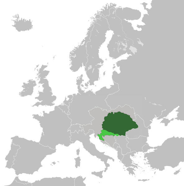
English: Lands of the Crown of Saint Stephen (Kingdom of Hungary and Kingdom of Croatia-Slavonia) in 1914 within Austria-Hungary |
| Date | |
| Soorce | Ain wirk |
| Author | Tezwoo |
Licensin
I, the copyright holder of this work, hereby publish it under the following license:
This file is licensed unner the Creative Commons Attribution-Share Alike 3.0 Unported license.
- Ye are free:
- tae share – tae copy, distribute an transmit the wirk
- tae remix – tae adapt the wirk
- Unner the follaein condeetions:
- attribution – Ye must attribute the wirk in the manner specified bi the author or licensor (but nae in ony way that suggests that thay endorse ye or yer uise o the wirk).
- share alik – If ye alter, transform, or big upon this wirk, ye mey distribute the resultin wirk anly unner the same or seemilar license tae this ane.
File history
Clap oan ae date/time fer tae see the file aes it kithed at that time.
| Date/Time | Thummnail | Dimensions | Uiser | Comment | |
|---|---|---|---|---|---|
| current | 18:14, 18 Mey 2021 | | 2,000 × 2,027 (433 KB) | DonutEater13 | Actually fixed a small spot that was in the middle of the Adriatic sea since the first alteration. (uploaded wrong version first time) |
| 18:09, 18 Mey 2021 |  | 2,000 × 2,027 (439 KB) | DonutEater13 | Reverted to version as of 12:57, 24 May 2019 (UTC) | |
| 18:00, 18 Mey 2021 |  | 2,000 × 2,027 (433 KB) | DonutEater13 | Fixed a small spot that was in the middle of the Adriatic sea since the first alteration. | |
| 12:57, 24 Mey 2019 |  | 2,000 × 2,027 (439 KB) | Koreanovsky | Since this map shows us the situation 1914 and Bosnia-Herzegovina was occupied by both Austria and Hungary, we would have to put a border over there. Otherwise it would look like an Cisleithanian crownland. | |
| 05:15, 17 Apryle 2019 |  | 2,000 × 2,027 (553 KB) | Fakirbakir | Medimurje was Hungarian | |
| 00:11, 13 Mey 2014 |  | 2,000 × 2,027 (551 KB) | Tezwoo | User created page with UploadWizard |
Eimage airtins
The follaein pages airts tae this image:
Global file uisage
The follaein ither wikis uise this file:
- Uisage on ar.wikipedia.org
- Uisage on azb.wikipedia.org
- Uisage on az.wikipedia.org
- Uisage on bg.wikipedia.org
- Uisage on bn.wikipedia.org
- Uisage on cs.wikipedia.org
- Uisage on de.wikipedia.org
- Uisage on el.wikipedia.org
- Uisage on en.wikipedia.org
- Uisage on es.wikipedia.org
- Uisage on fi.wikipedia.org
- Uisage on fr.wikipedia.org
- Uisage on he.wikipedia.org
- Uisage on hr.wikipedia.org
- Uisage on hu.wikipedia.org
- Uisage on hy.wikipedia.org
- Uisage on id.wikipedia.org
- Uisage on io.wikipedia.org
- Uisage on ko.wikipedia.org
- Uisage on lv.wikipedia.org
- Uisage on nl.wikipedia.org
- Uisage on pl.wikipedia.org
- Uisage on pl.wiktionary.org
- Uisage on pt.wikipedia.org
- Uisage on ro.wikipedia.org
- Uisage on rue.wikipedia.org
- Uisage on ru.wikipedia.org
- Uisage on simple.wikipedia.org
- Uisage on si.wikipedia.org
- Uisage on sr.wikipedia.org
- Uisage on sv.wikipedia.org
- Uisage on ta.wikipedia.org
- Uisage on th.wikipedia.org
- Uisage on tr.wikipedia.org
- Uisage on tt.wikipedia.org
- Uisage on uk.wikipedia.org
- Uisage on uz.wikipedia.org
- Uisage on vi.wikipedia.org
- Uisage on zh.wikipedia.org