
File:LA2-Bering-Sea-UTM-zones.png

Size o this luikower: 800 × 430 pixels. Ither resolutions: 320 × 172 pixels | 640 × 344 pixels | 960 × 516 pixels.
Oreeginal file (960 × 516 pixels, file size: 103 KB, MIME type: image/png)
Ootline
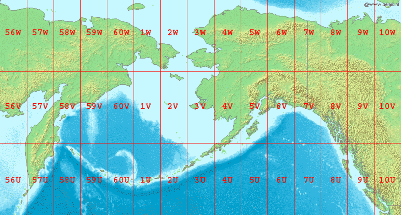
English: Map of en:Bering Sea, showing the latitude and longitude zones of the en:Universal Transverse Mercator coordinate system, from 56U to 10W.
National borders between Alaska, Canada, and the continental United States are also shown.
Bounding box West 150°, South 48°, East -120°, North 72°.
Center at 60°00′00″N 165°00′00″W / 60.00000°N 165.00000°W.
Licensin
This image is in the public domain because it came from the site https://www.demis.nl/products/web-map-server/examples/ and was released by the copyright holder. Permission is granted to copy, distribute and/or modify this map since it is based on free of copyright images from: www.demis.nl. See also approval email on de.wp and its clarification.
|
| This work has been released into the public domain by its copyright holder, www.demis.nl. This applies worldwide. In some countries this may not be legally possible; if so: www.demis.nl grants anyone the right to use this work for any purpose, without any conditions, unless such conditions are required by law.
|
File history
Clap oan ae date/time fer tae see the file aes it kithed at that time.
| Date/Time | Thummnail | Dimensions | Uiser | Comment | |
|---|---|---|---|---|---|
| current | 07:04, 3 September 2006 | | 960 × 516 (103 KB) | LA2 | Map of en:Bering Sea, showing the latitude and longitude zones of the en:Universal Transverse Mercator coordinate system, from 56U to 10W. National borders between Alaska, Canada, and the continental United States are also shown. Bounding box W |
Eimage airtins
The'r nae pages airts tae this eimage.
Global file uisage
The follaein ither wikis uise this file:
- Uisage on ar.wikipedia.org
- Uisage on ast.wikipedia.org
- Uisage on da.wikipedia.org
- Uisage on el.wikipedia.org
- Uisage on en.wikipedia.org
- Uisage on es.wikipedia.org
- Uisage on fa.wikipedia.org
- Uisage on gv.wikipedia.org
- Uisage on hr.wikipedia.org
- Uisage on hu.wikipedia.org
- Uisage on id.wikipedia.org
- Uisage on it.wikipedia.org
- Uisage on kk.wikipedia.org
- Uisage on la.wikipedia.org
- Uisage on ml.wikipedia.org
- Uisage on my.wikipedia.org
- Uisage on nl.wikipedia.org
- Uisage on nn.wikipedia.org
- Uisage on pa.wikipedia.org
- Uisage on pl.wikipedia.org
- Uisage on sr.wikipedia.org
- Uisage on ta.wikipedia.org
- Uisage on th.wikipedia.org
- Uisage on tr.wikipedia.org
- Uisage on ur.wikipedia.org
- Uisage on yi.wikipedia.org