
File:Israel relief location map.jpg

Size o this luikower: 322 × 598 pixels. Ither resolutions: 129 × 240 pixels | 614 × 1,141 pixels.
Oreeginal file (614 × 1,141 pixels, file size: 179 KB, MIME type: image/jpeg)

|
The boundaries on this map show the de facto situation. This is just one of several different views on the subject (see COM:NPOV). |
Ootline
| Camera location | | View this and other nearby images on: OpenStreetMap |
|---|
| Descreeption |
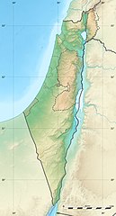
Deutsch: Positionskarte von Israel. De-facto-Situation.
Quadratische Plattkarte, N-S-Streckung 115 %. Geographische Begrenzung der Karte: English: Location map of Israel. De facto situation.
Français : Carte physique vierge d'Israël, destinée à la géolocalisation.
Equirectangular projection, N/S stretching 115 %.
Geographic limits of the map:
|
||
| Date | |||
| Soorce |
Topographic background map: Own work
|
||
| Author | Eric Gaba (Sting - fr:Sting) and NordNordWest | ||
| Permission (Reuisin this file) |
|
||
| Other versions |
|
||
| JPG genesis |
|


Licensin
I, the copyright holder of this work, hereby publish it under the following licenses:

|
Permission is grantit tae copy, distribute an/or modify this document unner the terms o the GNU Free Documentation License, Version 1.2 or ony later version published bi the Free Software Foundation; wi no Invariant Sections, no Front-Cover Texts, an no Back-Cover Texts. A copy o the license is includit in the section enteetled GNU Free Documentation License. |
This file is licensed unner the Creative Commons Attribution-Share Alike 3.0 Unported license.
- Ye are free:
- tae share – tae copy, distribute an transmit the wirk
- tae remix – tae adapt the wirk
- Unner the follaein condeetions:
- attribution – Ye must attribute the wirk in the manner specified bi the author or licensor (but nae in ony way that suggests that thay endorse ye or yer uise o the wirk).
- share alik – If ye alter, transform, or big upon this wirk, ye mey distribute the resultin wirk anly unner the same or seemilar license tae this ane.
Ye mey select the license o yer choice.
File history
Clap oan ae date/time fer tae see the file aes it kithed at that time.
| Date/Time | Thummnail | Dimensions | Uiser | Comment | |
|---|---|---|---|---|---|
| current | 22:49, 3 August 2011 | | 614 × 1,141 (179 KB) | Sting | == {{int:filedesc}} == {{Location|31|24|00|N|35|00|00|E|scale:2000000}} {{Information |Description= {{de|Positionskarte von Israel. De-facto-Situation.}} Quadratische Plattkarte, N-S-Streckung 115 %. Geographische Begrenzung der Karte: {{en |
Eimage airtins
The follaein pages airts tae this image:
Global file uisage
The follaein ither wikis uise this file:
- Uisage on als.wikipedia.org
- Uisage on am.wikipedia.org
- Uisage on ar.wikipedia.org
- Uisage on ary.wikipedia.org
- Uisage on arz.wikipedia.org
- Uisage on ast.wikipedia.org
- Uisage on av.wikipedia.org
- Uisage on azb.wikipedia.org
- Uisage on az.wikipedia.org
- Uisage on ba.wikipedia.org
- Uisage on be.wikipedia.org
View mair global usage o this file.