
File:Iron Curtain map.svg

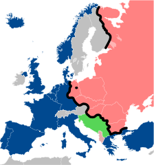
Size of this PNG preview of this SVG file: 560 × 599 pixels. Ither resolutions: 224 × 240 pixels | 449 × 480 pixels | 718 × 768 pixels | 957 × 1,024 pixels | 1,914 × 2,048 pixels | 645 × 690 pixels.
Oreeginal file (SVG file, nominallie 645 × 690 pixels, file size: 322 KB)
Ootline
| Descreeption |
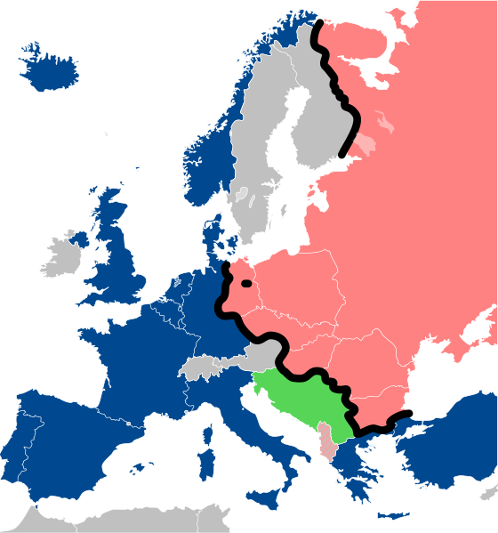
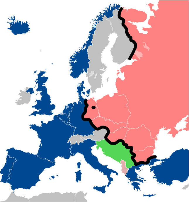
Lëtzebuergesch: Kaart vum Westen an dem Ostblock an Europa während dem Kale Krich.
"Eise Rido"
Neutral Länner
|
||
| Date | |||
| Soorce |
Travail personnel (own work). Sources:
|
||
| Author | Sémhur | ||
| Other versions |
File:Iron Curtain map alternative.svg (Same, but with Yugoslavia on the Eastern side of the Iron Curtain.) | ||
| Attribution (required by the license) | © Sémhur / Wikimedia Commons / | ||
| SVG | W3C-validity not checked.
|
||
| Graphic Lab |

| Camera location | | View this and other nearby images on: OpenStreetMap |
|---|
Licensin
I, the copyright holder of this work, hereby publish it under the following licenses:
| Copyleft: This wairk o airt is free; ye can redistreebute it n/or modifie it accordin til the terms o the Free Art License. Ye'll fynd ae specimen o this license oan the Copyleft Attitude steid aes weel aes oan ither steids. |
This file is licensed under the Creative Commons Attribution-Share Alike 4.0 International, 3.0 Unported, 2.5 Generic, 2.0 Generic and 1.0 Generic license.
- Ye are free:
- tae share – tae copy, distribute an transmit the wirk
- tae remix – tae adapt the wirk
- Unner the follaein condeetions:
- attribution – Ye must attribute the wirk in the manner specified bi the author or licensor (but nae in ony way that suggests that thay endorse ye or yer uise o the wirk).
- share alik – If ye alter, transform, or big upon this wirk, ye mey distribute the resultin wirk anly unner the same or seemilar license tae this ane.
Ye mey select the license o yer choice.
File history
Clap oan ae date/time fer tae see the file aes it kithed at that time.
| Date/Time | Thummnail | Dimensions | Uiser | Comment | |
|---|---|---|---|---|---|
| current | 13:26, 15 December 2022 | | 645 × 690 (322 KB) | PhotographyEdits | Extend the Iron Curtain eastwards of Yugoslavia. Even though Yugoslavia was not really considered part of the West, the currenet map gives the false impression that there was a huge gap in the Iron Curtain, which wasn't the case. |
| 00:56, 23 Julie 2022 |  | 645 × 690 (321 KB) | Kwamikagami | NATO blue, #004990 | |
| 20:30, 30 Mairch 2019 |  | 645 × 690 (321 KB) | Sémhur | Reverted to version as of 07:07, 27 May 2014 (UTC). Albania leaves the Waras Pack in middle of cold war; this is why it's shown wtih stripes. | |
| 09:18, 24 Mairch 2019 |  | 512 × 548 (123 KB) | Hakuli | Albania leaves the Waras Pack in middle of cold war | |
| 07:07, 27 Mey 2014 |  | 645 × 690 (321 KB) | Sémhur | Valid SVG | |
| 13:51, 16 November 2010 |  | 645 × 690 (321 KB) | Sémhur | Added Iron Curtain between Bulgaria and Greece & Turkey. | |
| 16:57, 27 September 2008 |  | 645 × 690 (321 KB) | Sémhur | Correcting mistake : Austria wasn't in NATO. | |
| 10:51, 31 Mey 2008 |  | 645 × 690 (330 KB) | Sémhur | {{Information |Description={{en|1=Map of the Iron Curtain in Europe.}} {{fr|1=Carte du rideau de fer en Europe.}} {{es|1=Mapa del Telón de Acero en Europa.}} |Source=Travail personnel (ow |
Eimage airtins
The'r nae pages airts tae this eimage.
Global file uisage
The follaein ither wikis uise this file:
- Uisage on af.wikipedia.org
- Uisage on als.wikipedia.org
- Uisage on ar.wikipedia.org
- Uisage on ast.wikipedia.org
- Uisage on azb.wikipedia.org
- Uisage on az.wikipedia.org
- Uisage on ba.wikipedia.org
- Uisage on be-tarask.wikipedia.org
- Uisage on be.wikipedia.org
- Uisage on bg.wikipedia.org
- Uisage on br.wikipedia.org
- Uisage on bs.wikipedia.org
- Uisage on ca.wikipedia.org
- Uisage on cs.wikipedia.org
- Uisage on cy.wikipedia.org
- Uisage on da.wikipedia.org
- Uisage on de.wikipedia.org
- Uisage on el.wikipedia.org
- Uisage on el.wiktionary.org
- Uisage on en.wikipedia.org
- Uisage on en.wikibooks.org
- Uisage on en.wikiquote.org
- Uisage on en.wiktionary.org
View mair global usage o this file.