
File:India Tamil Nadu location map.svg

Size of this PNG preview of this SVG file: 483 × 600 pixels. Ither resolutions: 193 × 240 pixels | 387 × 480 pixels | 619 × 768 pixels | 825 × 1,024 pixels | 1,650 × 2,048 pixels | 1,591 × 1,975 pixels.
Oreeginal file (SVG file, nominallie 1,591 × 1,975 pixels, file size: 840 KB)
Ootline
| Descreeption |
Deutsch: Postionskarte von Tamil Nadu
Quadratische Plattkarte. Geographische Begrenzung der Karte:
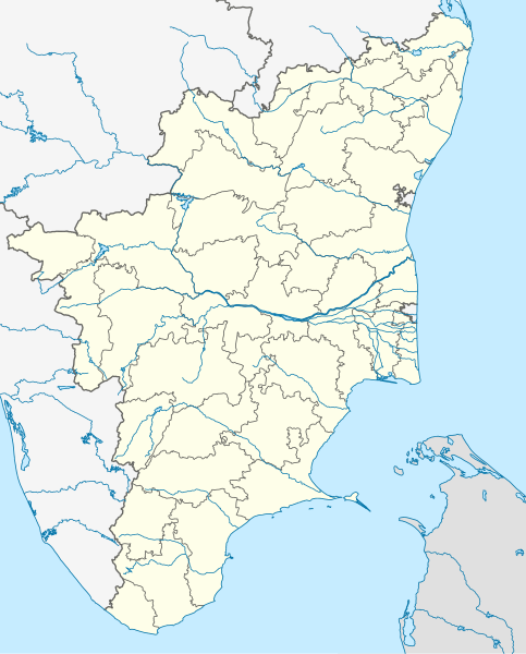
English: Location map of Tamil Nadu
Equirectangular projection. Geographic limits of the map:
|
| Date | |
| Soorce | own work, using this file by Planemad |
| Author | Maximilian Dörrbecker (Chumwa) |
| Other versions |
|


|
This map has been made or improved in the German Kartenwerkstatt (Map Lab). You can propose maps to improve as well.
|
Licensin
I, the copyright holder of this work, hereby publish it under the following licenses:

|
Permission is grantit tae copy, distribute an/or modify this document unner the terms o the GNU Free Documentation License, Version 1.2 or ony later version published bi the Free Software Foundation; wi no Invariant Sections, no Front-Cover Texts, an no Back-Cover Texts. A copy o the license is includit in the section enteetled GNU Free Documentation License. |
This file is licensed unner the Creative Commons Attribution-Share Alike 3.0 Unported license.
- Ye are free:
- tae share – tae copy, distribute an transmit the wirk
- tae remix – tae adapt the wirk
- Unner the follaein condeetions:
- attribution – Ye must attribute the wirk in the manner specified bi the author or licensor (but nae in ony way that suggests that thay endorse ye or yer uise o the wirk).
- share alik – If ye alter, transform, or big upon this wirk, ye mey distribute the resultin wirk anly unner the same or seemilar license tae this ane.
Ye mey select the license o yer choice.
File history
Clap oan ae date/time fer tae see the file aes it kithed at that time.
| Date/Time | Thummnail | Dimensions | Uiser | Comment | |
|---|---|---|---|---|---|
| current | 00:54, 6 September 2021 | | 1,591 × 1,975 (840 KB) | C1MM | Corrected Tirunelveli/Tenkasi dist boundary |
| 16:43, 4 September 2021 |  | 1,591 × 1,975 (840 KB) | C1MM | Resized file | |
| 06:09, 4 September 2021 |  | 907 × 1,123 (880 KB) | C1MM | Removed extra river piece | |
| 04:35, 4 September 2021 |  | 907 × 1,123 (880 KB) | C1MM | Corrected rivers and dist boundaries | |
| 16:44, 20 Februar 2021 |  | 512 × 636 (727 KB) | C1MM | Corrected coastline | |
| 00:35, 18 December 2020 |  | 512 × 636 (257 KB) | C1MM | Relayered | |
| 22:06, 22 Apryle 2020 |  | 512 × 636 (373 KB) | C1MM | Restore colors | |
| 20:03, 22 Apryle 2020 |  | 512 × 636 (373 KB) | C1MM | Fixed colors and colored Pondicherry | |
| 14:18, 17 Mairch 2020 |  | 512 × 636 (250 KB) | C1MM | Reverted to version as of 14:17, 17 March 2020 (UTC) | |
| 14:18, 17 Mairch 2020 |  | 512 × 636 (249 KB) | C1MM | Reverted to version as of 03:04, 17 March 2020 (UTC) |
Eimage airtins
The follaein pages airts tae this image:
Global file uisage
The follaein ither wikis uise this file:
- Uisage on ar.wikipedia.org
- Uisage on as.wikipedia.org
- Uisage on azb.wikipedia.org
- چنای
- باتی پاراسری
- باتی پینایور
- باتی کالاتور
- وینانجنی
- ویراوانور
- پیانویلای
- پتای, ویلوپورام
- پتای, کارایکال
- پتای, کودالور
- ویرامودایاناتام
- ویراسولاپورام
- ویراپانچاترام
- پرونقودی, تیروچیراپالی
- پرونقودی, پودوکوتای
- وانامادوی
- ساتانور
- ساتیوایال
- ساتیراکوندان
- ساتانور, پرامبالور
- ساراسواتی ناقار
- سانتیپالایام
- سانتاناقوپالاپورام
- سانانالور
- سانکاراپورام
- سانکاراپاندیاپورام
- کالاکودی
- کالییور
- کالینجییام
- ماتییامپاتی
- کالایور
- کالاتور ت
- دوغو کالاتور
- کالاتیمادام
- کالانقانی
- ماروقالپاتی
- مارودور, کویمباتور
- مارتاندانتورای
- کالاییور
- ساماناتام
- سامالپاتی
- سالوپاپاتی
- ونتریلینقاپورام
- سالیپری
- کاکیوادانپاتی
- ومباکام
View mair global usage o this file.