
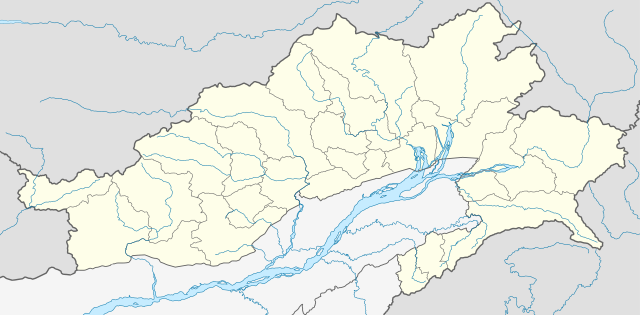
File:India Arunachal Pradesh location map.svg

Size of this PNG preview of this SVG file: 800 × 394 pixels. Ither resolutions: 320 × 158 pixels | 640 × 315 pixels | 1,024 × 504 pixels | 1,280 × 631 pixels | 2,560 × 1,261 pixels | 1,685 × 830 pixels.
Oreeginal file (SVG file, nominallie 1,685 × 830 pixels, file size: 531 KB)
| Descreeption |
Location map of Arunachal Pradesh Geographic limits of the map:
|
| Date | (UTC) |
| Soorce | |
| Author |
|
| Other versions | Derivative works of this file: India Arunachal Pradesh districts Assamese.svg |
I, the copyright holder of this work, hereby publish it under the following license:
This file is licensed unner the Creative Commons Attribution-Share Alike 3.0 Unported license.
- Ye are free:
- tae share – tae copy, distribute an transmit the wirk
- tae remix – tae adapt the wirk
- Unner the follaein condeetions:
- attribution – Ye must attribute the wirk in the manner specified bi the author or licensor (but nae in ony way that suggests that thay endorse ye or yer uise o the wirk).
- share alik – If ye alter, transform, or big upon this wirk, ye mey distribute the resultin wirk anly unner the same or seemilar license tae this ane.
Original upload log
This image is a derivative work of the following images:
- File:Arunachal_Pradesh_locator_map.svg licensed with Cc-by-sa-3.0
Uploaded with derivativeFX
File history
Clap oan ae date/time fer tae see the file aes it kithed at that time.
| Date/Time | Thummnail | Dimensions | Uiser | Comment | |
|---|---|---|---|---|---|
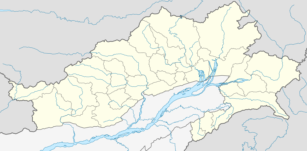
| current | 04:52, 13 Juin 2021 | | 1,685 × 830 (531 KB) | C1MM | Decreased size, added better dist boudnaries |
| 07:56, 13 Mairch 2021 |  | 1,845 × 1,046 (824 KB) | C1MM | Added river | |
| 07:52, 13 Mairch 2021 |  | 1,845 × 1,046 (820 KB) | C1MM | Corrected rivers and district boundaries | |
| 18:14, 18 Januar 2021 |  | 1,845 × 1,046 (360 KB) | C1MM | Changed weight of district boundaries | |
| 08:12, 18 Januar 2021 |  | 1,845 × 1,046 (358 KB) | C1MM | Fixed borders and corrected new district boundaries | |
| 18:37, 2 August 2020 |  | 1,456 × 800 (274 KB) | C1MM | Relayered | |
| 04:04, 16 Apryle 2020 |  | 1,456 × 800 (309 KB) | C1MM | Updated borders | |
| 04:03, 16 Apryle 2020 |  | 1,456 × 800 (309 KB) | C1MM | Corrected border sizing | |
| 03:58, 16 Apryle 2020 |  | 1,456 × 800 (309 KB) | C1MM | Extended to include new lat/longitude | |
| 22:32, 12 Apryle 2020 |  | 1,455 × 746 (276 KB) | C1MM | Corrected borders and added new districts |
Eimage airtins
The follaein pages airts tae this image:
Global file uisage
The follaein ither wikis uise this file:
- Uisage on anp.wikipedia.org
- Uisage on ar.wikipedia.org
- Uisage on as.wikipedia.org
- Uisage on azb.wikipedia.org
- Uisage on bh.wikipedia.org
- Uisage on bn.wikipedia.org
- ইটানগর
- অরুণাচল প্রদেশ
- জিরো
- আলং
- বাসার
- বোমডিলা
- চ্যাংলাং
- দপোরিজো
- দেওমালি
- জয়রামপুর
- খোনসা
- নাহারলাগুন
- নামসাই
- পাসিঘাট
- রইং
- সেপ্পা
- তওয়াং
- তেজু
- টেমপ্লেট:অবস্থান মানচিত্র ভারত অরুণাচল প্রদেশ
- ভালুকপুং
- জিরো বিমানবন্দর
- তেজু বিমানবন্দর
- পাসিঘাট বিমানবন্দর
- ইংকিয়ং
- অনিনি
- পালিন
- মিয়াও
- মেছুকা
- মডিউল:অবস্থান মানচিত্র/উপাত্ত/ভারত অরুণাচল প্রদেশ
View mair global usage o this file.