
File:Historic centre of Agrigento seen from the Valle dei Templi - Italy 2015 (2).JPG
Size o this luikower: 800 × 536 pixels. Ither resolutions: 320 × 215 pixels | 640 × 429 pixels | 1,024 × 687 pixels | 1,280 × 858 pixels | 2,560 × 1,717 pixels | 3,054 × 2,048 pixels.
Oreeginal file (3,054 × 2,048 pixels, file size: 4.55 MB, MIME type: image/jpeg)
Ootline
| Descreeption |
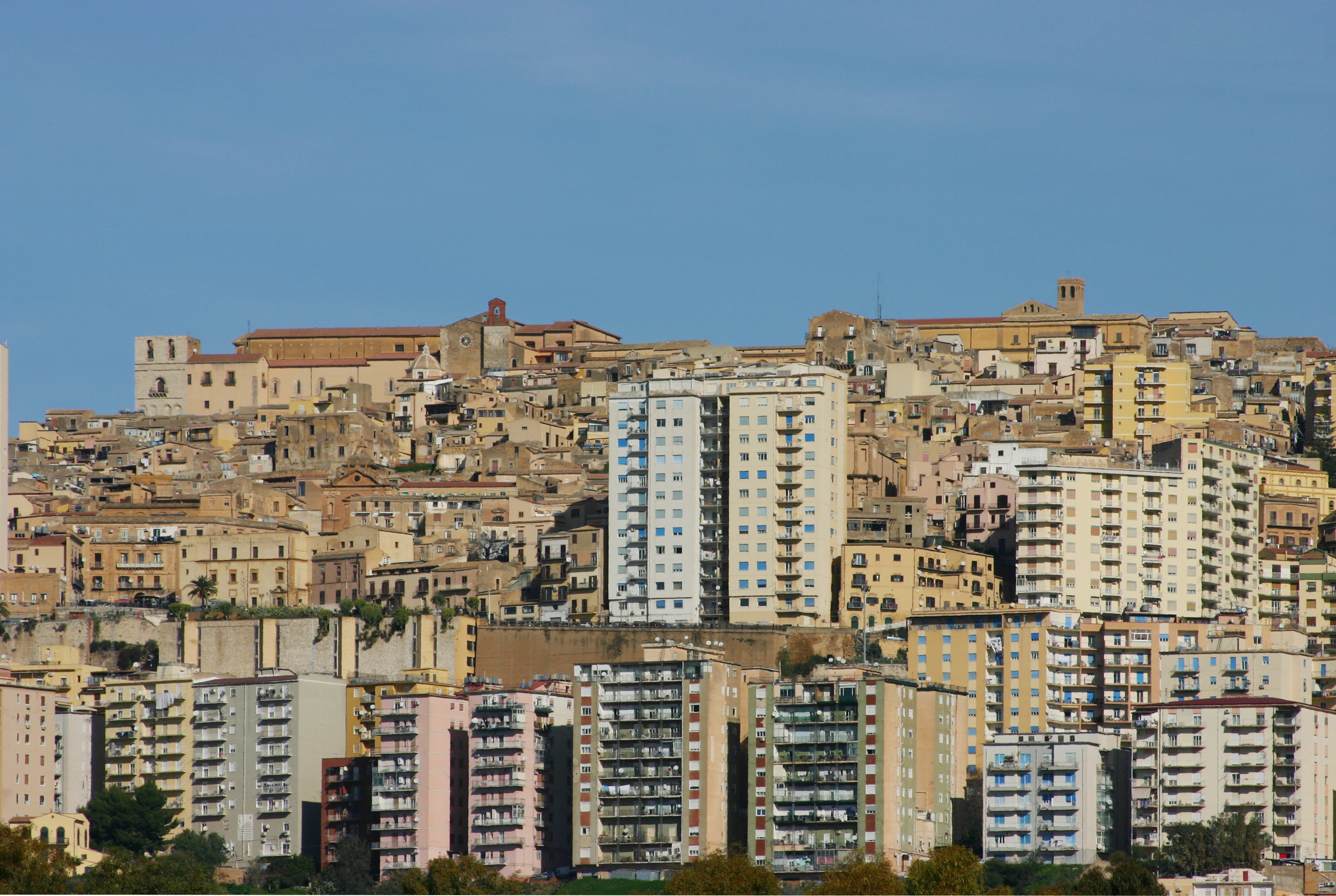
Português: Views of Agrigento. Alla destra della cattedrale si staglia il campanile della chiesa di Sant'Alfonso, poco più in basso la cappella di San Gerlando si riconosce la chiesa di San Domenico. |
||||||||||||||||||||
| Date | |||||||||||||||||||||
| Soorce | Ain wirk | ||||||||||||||||||||
| Author |
|
||||||||||||||||||||
| Attribution (required by the license) | © José Luiz Bernardes Ribeiro / | ||||||||||||||||||||
_-_Ephesus_Museum.JPG)
.JPG)
| Camera location | | View this and other nearby images on: OpenStreetMap |
|---|
.JPG¶ms=037.291442_N_0013.585249_E_globe:Earth_type:camera__&language=sco)
Licensin
I, the copyright holder of this work, hereby publish it under the following license:
This file is licensed under the Creative Commons Attribution-Share Alike 4.0 International license.
- Ye are free:
- tae share – tae copy, distribute an transmit the wirk
- tae remix – tae adapt the wirk
- Unner the follaein condeetions:
- attribution – Ye must attribute the wirk in the manner specified bi the author or licensor (but nae in ony way that suggests that thay endorse ye or yer uise o the wirk).
- share alik – If ye alter, transform, or big upon this wirk, ye mey distribute the resultin wirk anly unner the same or seemilar license tae this ane.
This image has been assessed using the Quality image guidelines and is considered a Quality image.
|
File history
Clap oan ae date/time fer tae see the file aes it kithed at that time.
| Date/Time | Thummnail | Dimensions | Uiser | Comment | |
|---|---|---|---|---|---|
| current | 21:04, 8 Mairch 2015 | | 3,054 × 2,048 (4.55 MB) | Jbribeiro1 | Remove dust spot |
| 21:25, 6 Mairch 2015 |  | 3,054 × 2,048 (4.49 MB) | Jbribeiro1 | Perspective correctin | |
| 00:08, 28 Februar 2015 |  | 3,072 × 2,048 (4.11 MB) | Jbribeiro1 | User created page with UploadWizard |
Eimage airtins
The'r nae pages airts tae this eimage.
Global file uisage
The follaein ither wikis uise this file:
- Uisage on el.wikipedia.org
- Uisage on en.wikipedia.org
- Uisage on fi.wikipedia.org
- Uisage on mk.wikipedia.org
- Uisage on pl.wiktionary.org
- Uisage on sa.wikipedia.org
- Uisage on sh.wikipedia.org
- Uisage on simple.wikipedia.org
- Uisage on sl.wikipedia.org
- Uisage on sw.wikipedia.org
- Uisage on ur.wikipedia.org
- Uisage on vep.wikipedia.org
- Uisage on zh-yue.wikipedia.org
- Uisage on zh.wikipedia.org
.JPG)