
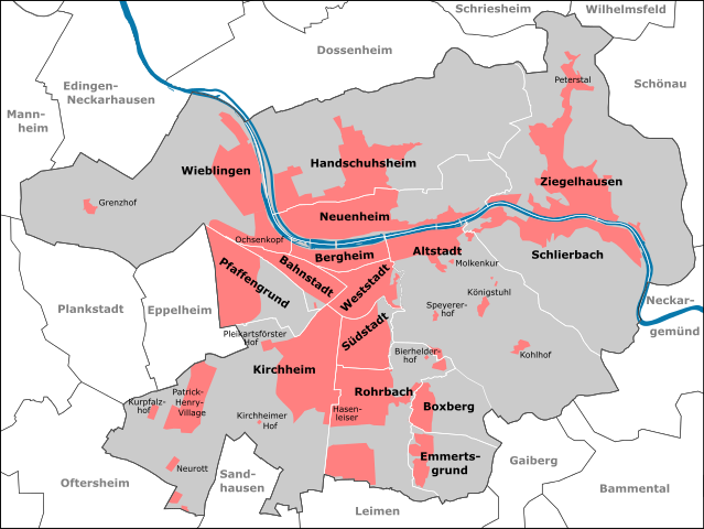
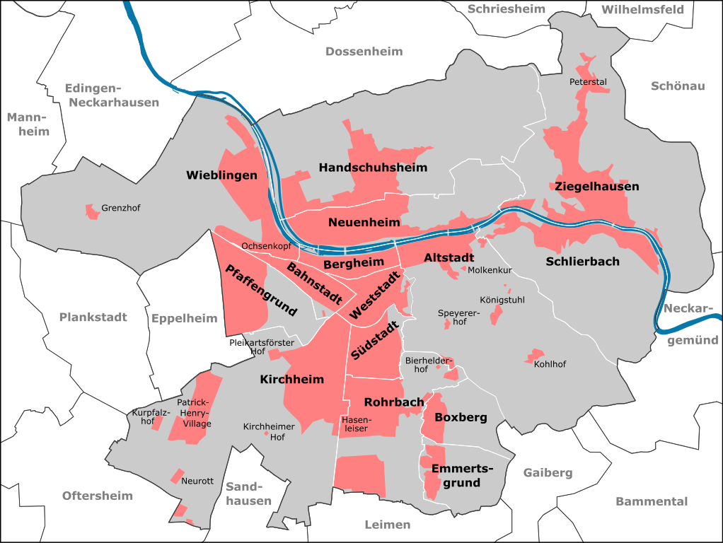
File:Heidelberg Stadtteile 2012.svg

Size of this PNG preview of this SVG file: 798 × 599 pixels. Ither resolutions: 320 × 240 pixels | 639 × 480 pixels | 1,022 × 768 pixels | 1,280 × 962 pixels | 2,560 × 1,923 pixels | 2,034 × 1,528 pixels.
Oreeginal file (SVG file, nominallie 2,034 × 1,528 pixels, file size: 1.03 MB)
| Descreeption | Stadtteile Heidelbergs ab 2012 | ||||||||||||||||||||||||||||
| Date | |||||||||||||||||||||||||||||
| Soorce |
|
||||||||||||||||||||||||||||
| Author | Pitichinaccio (talk) | ||||||||||||||||||||||||||||
File history
Clap oan ae date/time fer tae see the file aes it kithed at that time.
| Date/Time | Thummnail | Dimensions | Uiser | Comment | |
|---|---|---|---|---|---|
| current | 10:41, 4 Januar 2013 | | 2,034 × 1,528 (1.03 MB) | Pitichinaccio | erg. Edingen |
| 19:05, 1 Januar 2013 |  | 2,034 × 1,528 (1.02 MB) | Pitichinaccio | {{Information |Description=Stadtteile Heidelbergs ab 2012 |Source={{OpenStreetMap | name = Heidelberg | location = Heidelberg | description = Map of Heidelberg, Germany | top = 49.4620 | bottom = 49.3510 | left ... |
Eimage airtins
The follaein pages airts tae this image:
Global file uisage
The follaein ither wikis uise this file:
- Uisage on ast.wikipedia.org
- Uisage on azb.wikipedia.org
- Uisage on bg.wikipedia.org
- Uisage on bn.wikipedia.org
- Uisage on bs.wikipedia.org
- Uisage on da.wikipedia.org
- Uisage on de.wikipedia.org
- Uisage on de.wikivoyage.org
- Uisage on el.wikipedia.org
- Uisage on en.wikipedia.org
- Uisage on eo.wikipedia.org
- Uisage on es.wikipedia.org
- Uisage on fi.wikipedia.org
- Uisage on fr.wikipedia.org
- Uisage on he.wikipedia.org
- Uisage on hr.wikipedia.org
- Uisage on it.wikipedia.org
- Uisage on it.wikivoyage.org
- Uisage on ja.wikipedia.org
- Uisage on mk.wikipedia.org
- Uisage on no.wikipedia.org
- Uisage on pl.wikipedia.org
- Uisage on ro.wikipedia.org
- Uisage on sl.wikipedia.org
- Uisage on sr.wikipedia.org
- Uisage on vi.wikipedia.org